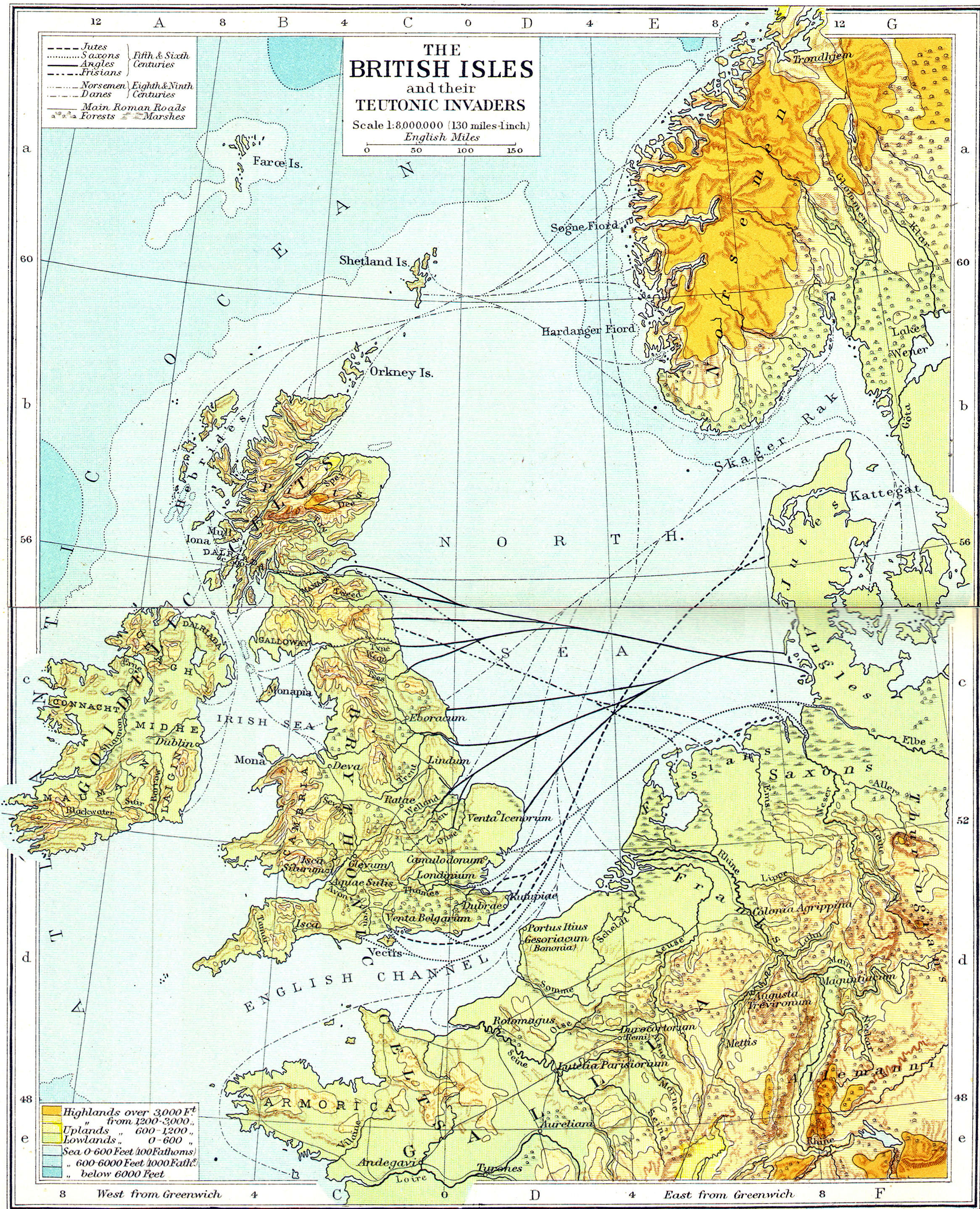
British Isles
Regions:—England, Scotland, Wales, Ireland
Islands:—Great Britain, Ireland, Isle of Write, Isle of Mann, Anglesey
Water Bodies:—English Channel, Strait of Dover, Irish Sea, Bristol Channel, St. Georges Channel, The Wash
Rivers:—Thames, Tyne, Trent, Ouse, Great Ouse, Severn, Avon, Clyde, Tweed
Roman Terms:—Brittania, Hibernia, Caledonia, Scotia
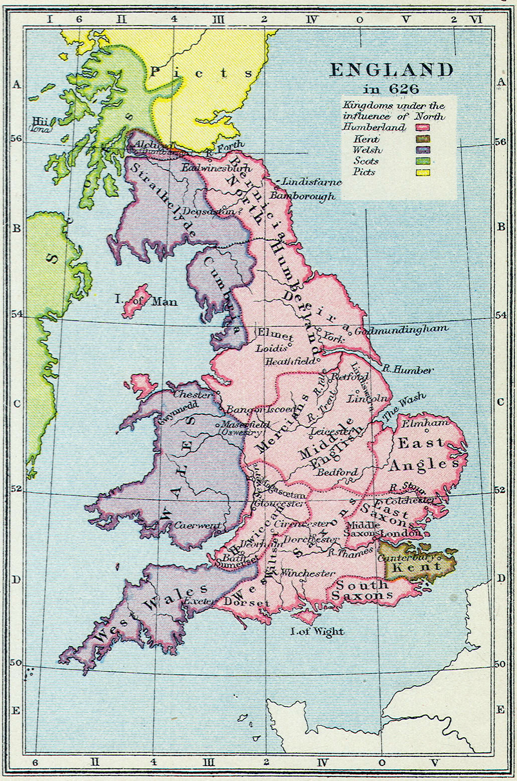
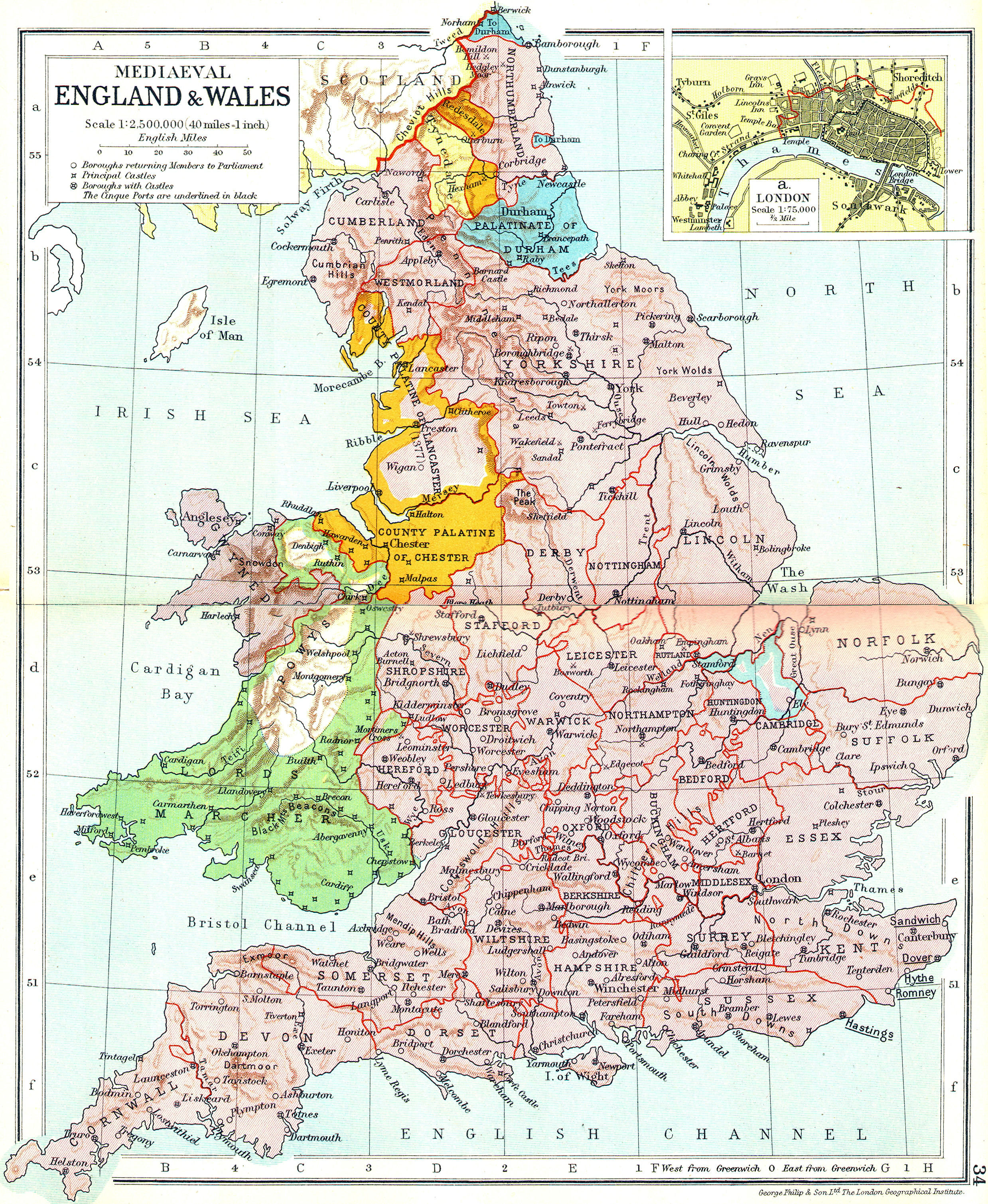
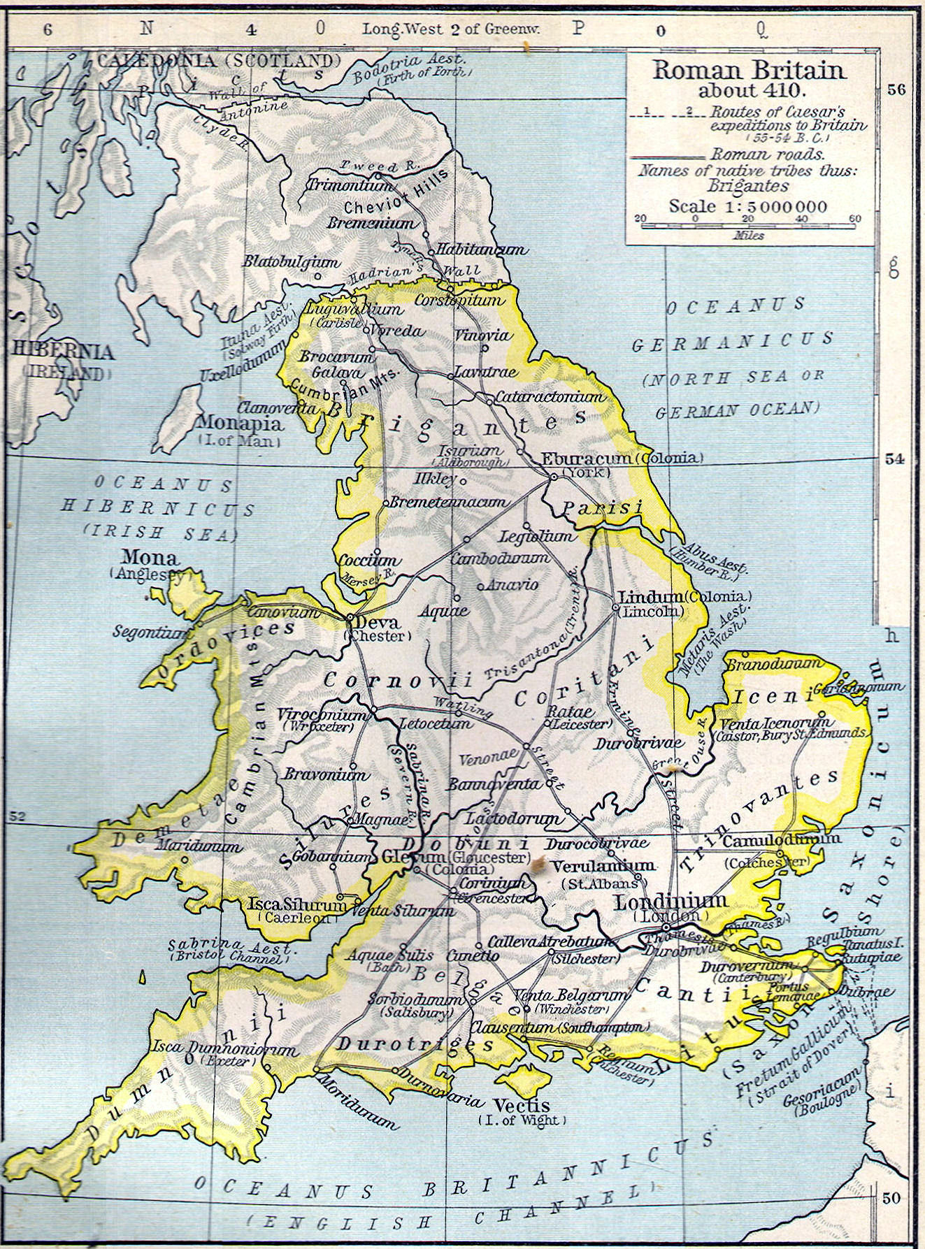
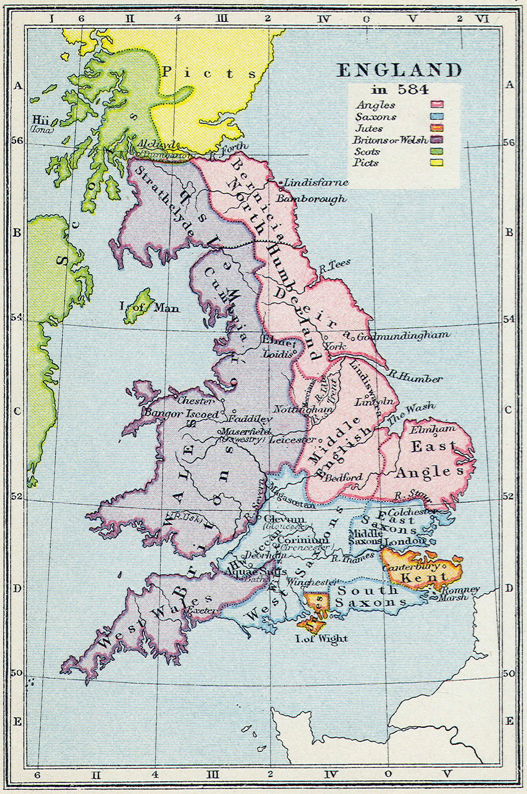
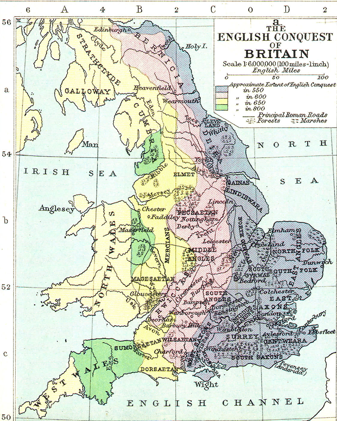
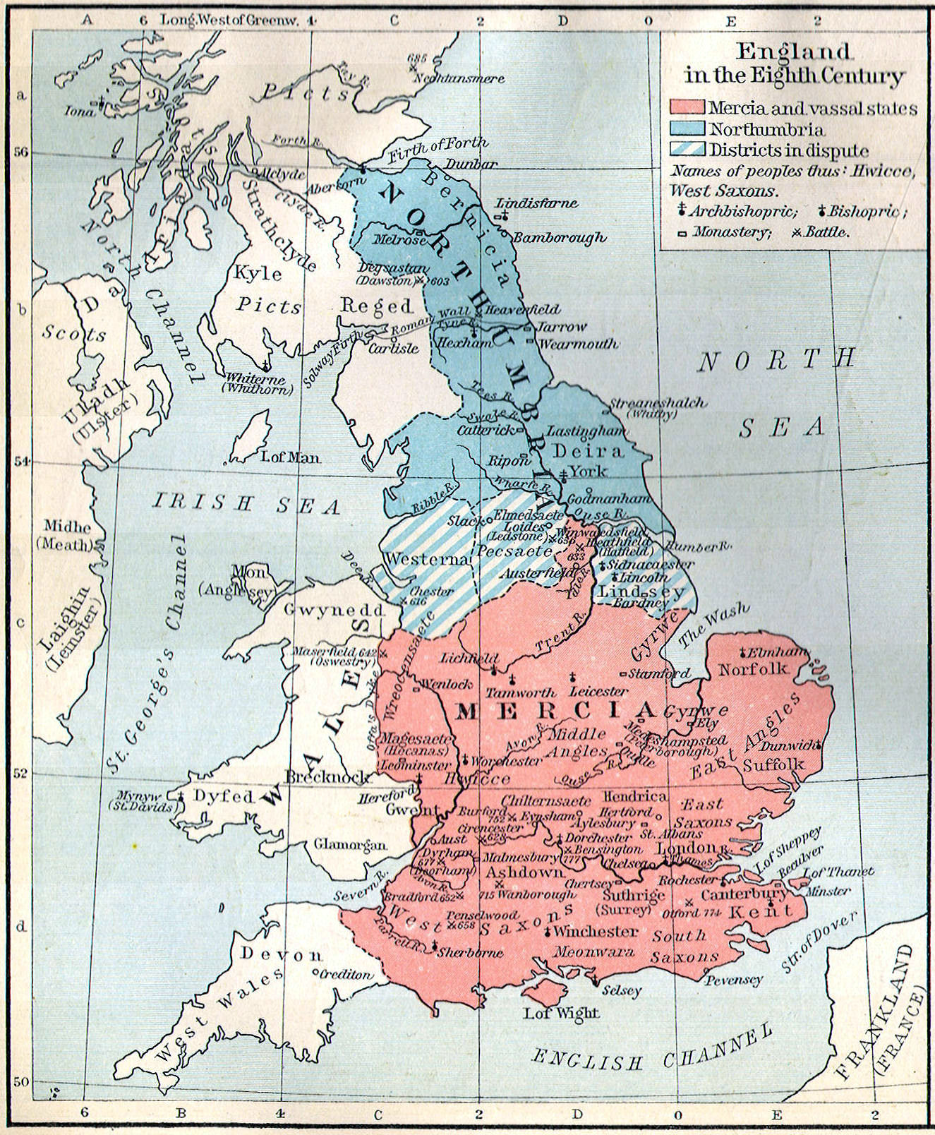
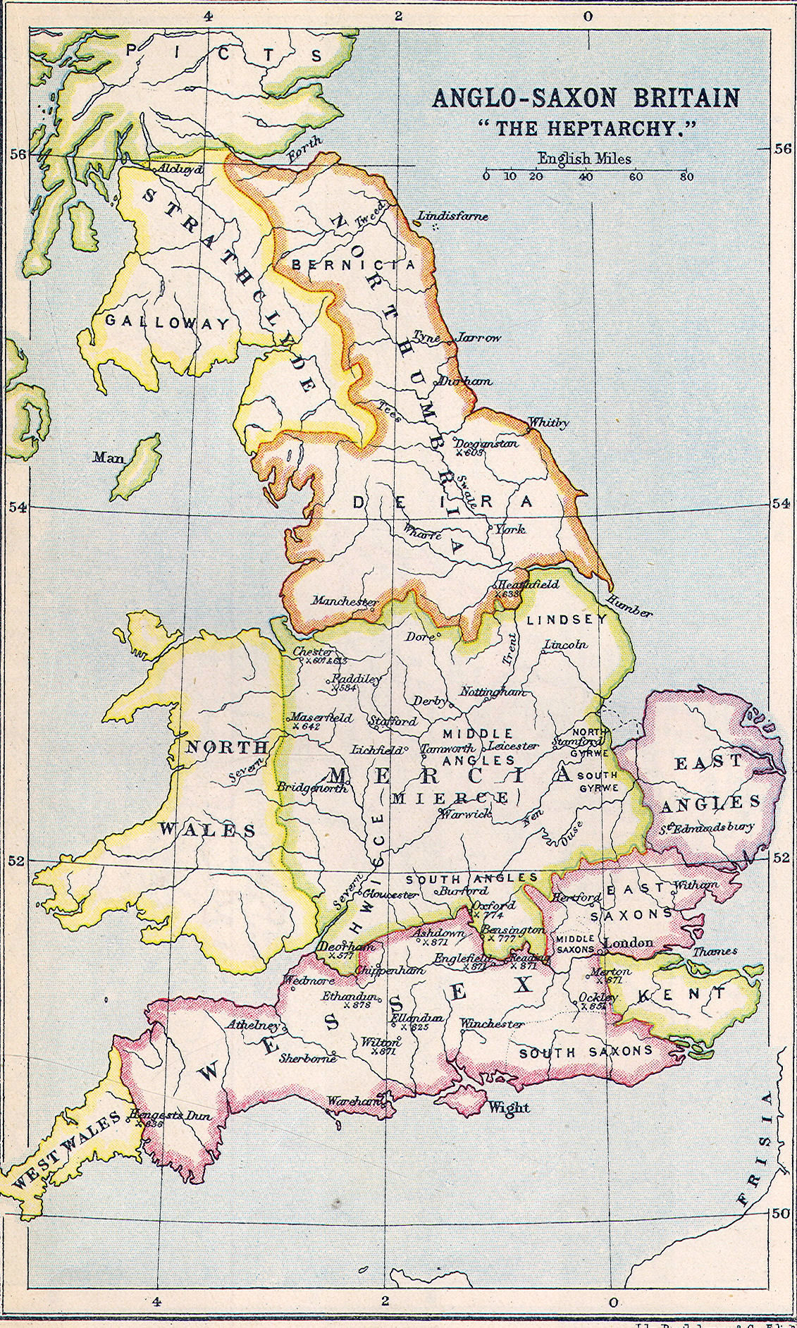
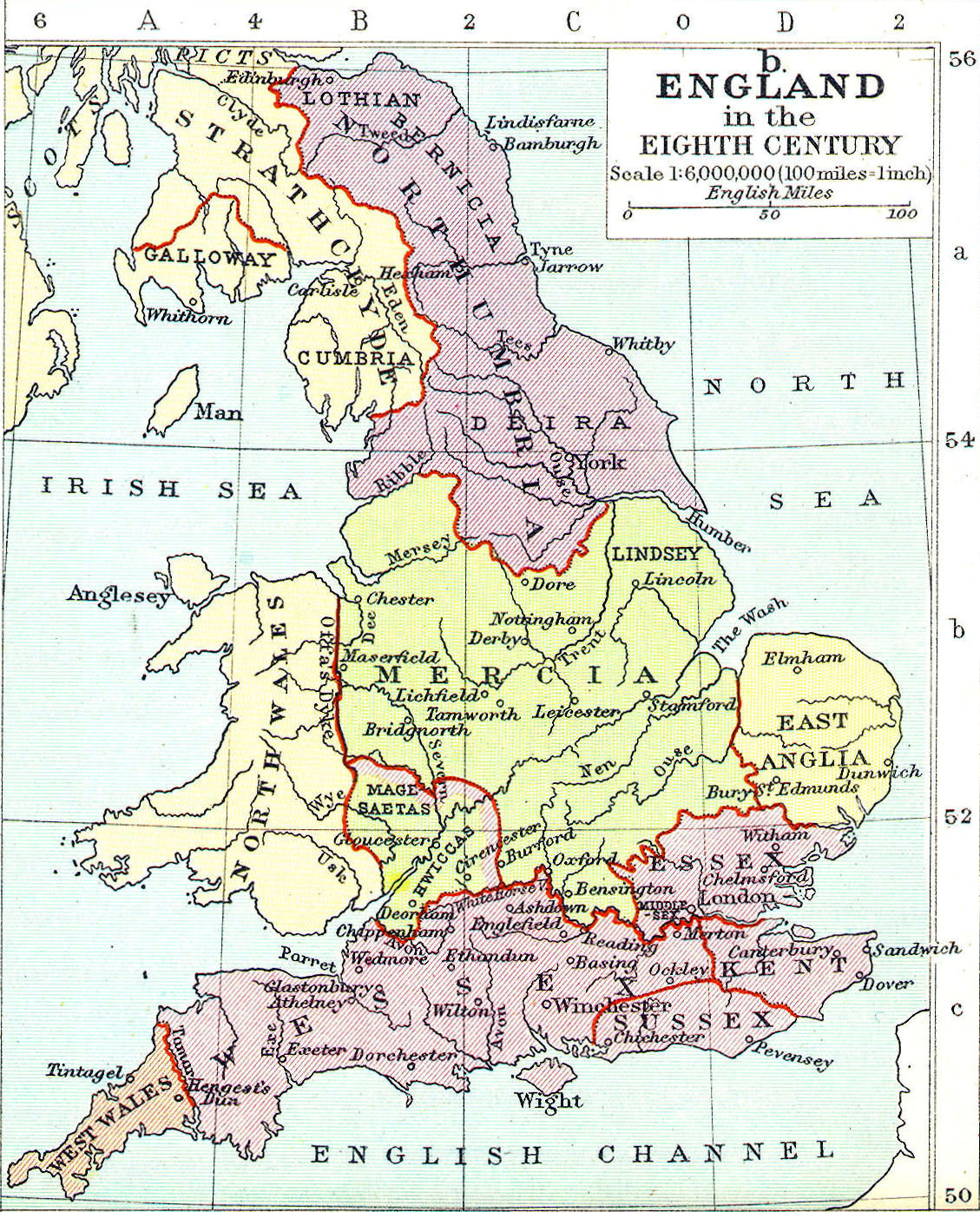
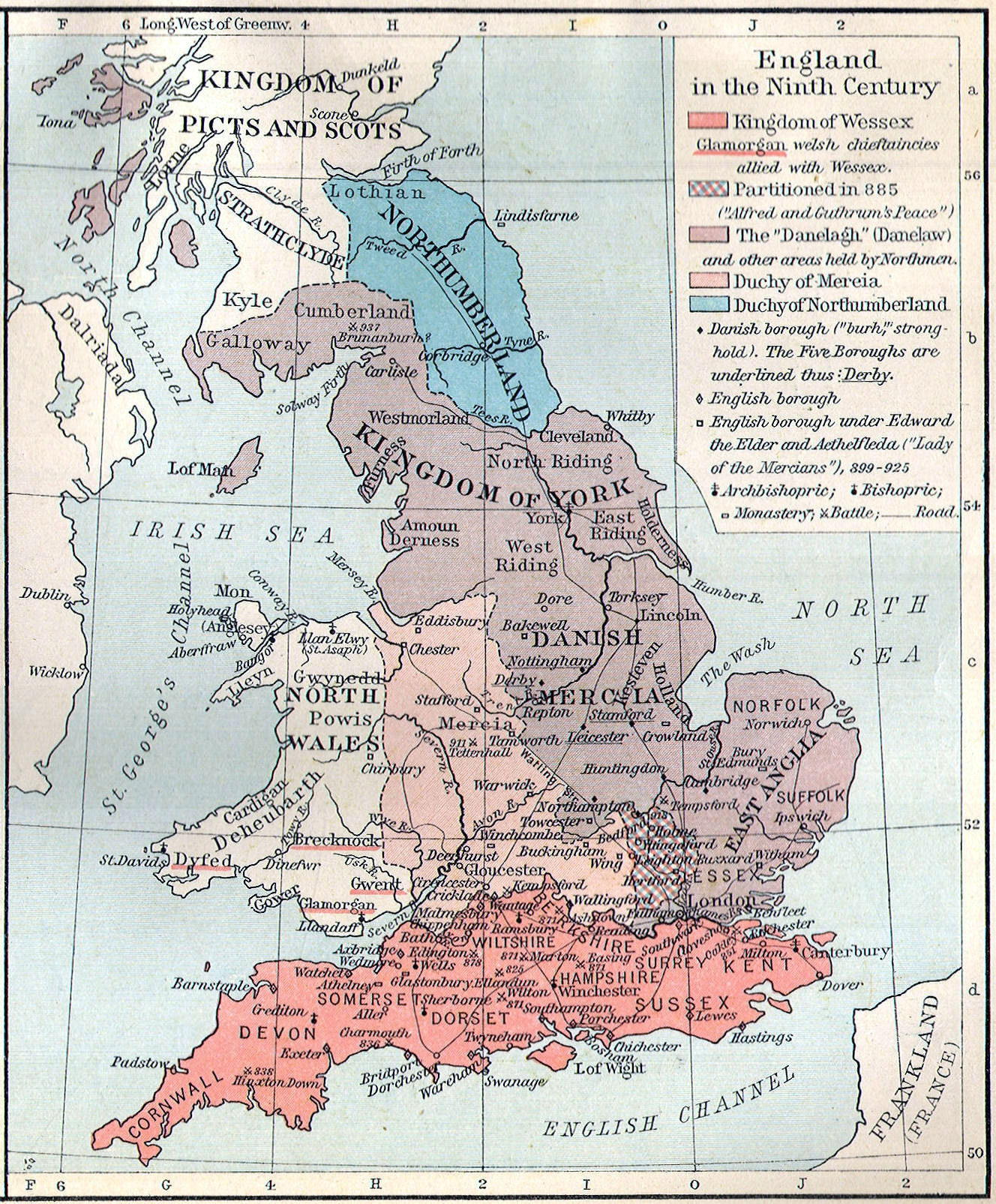
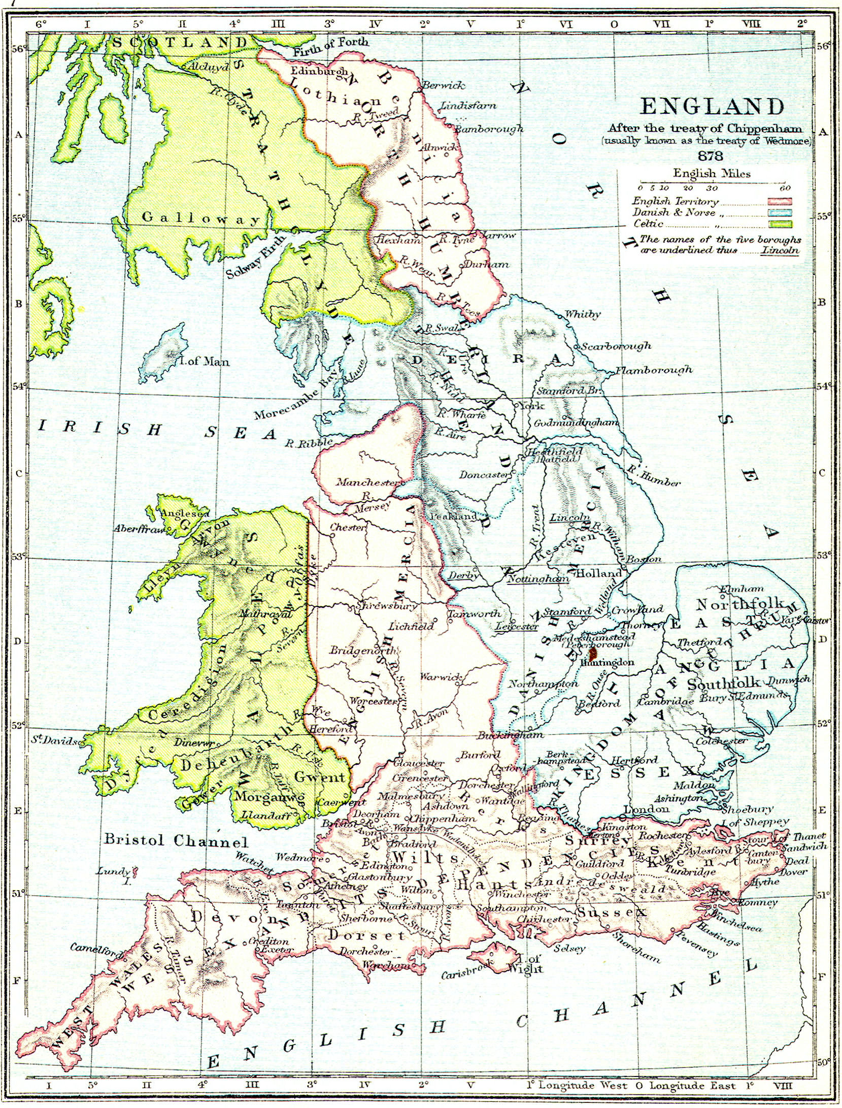
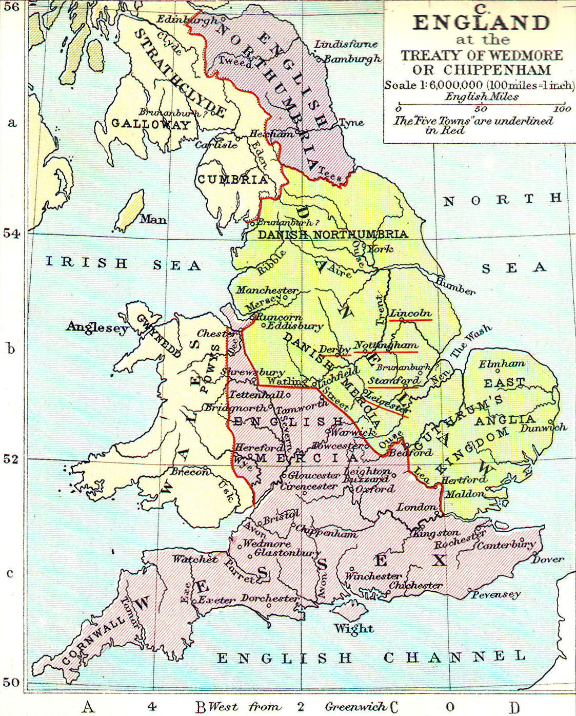
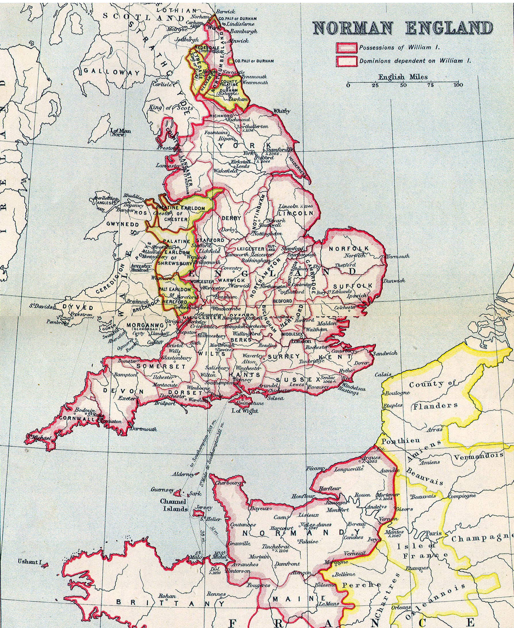
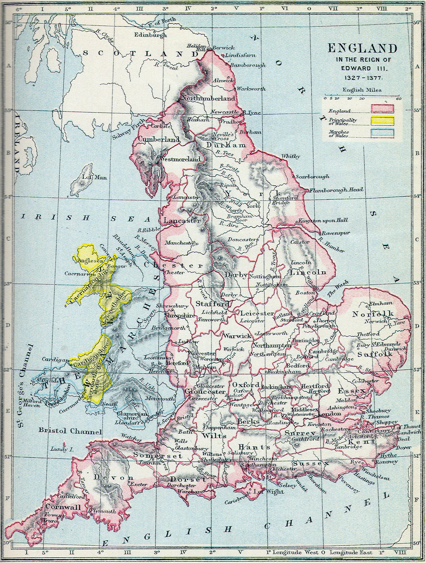
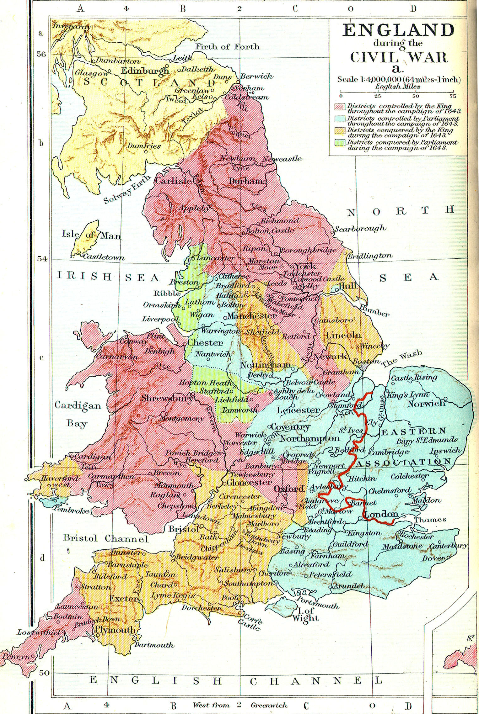
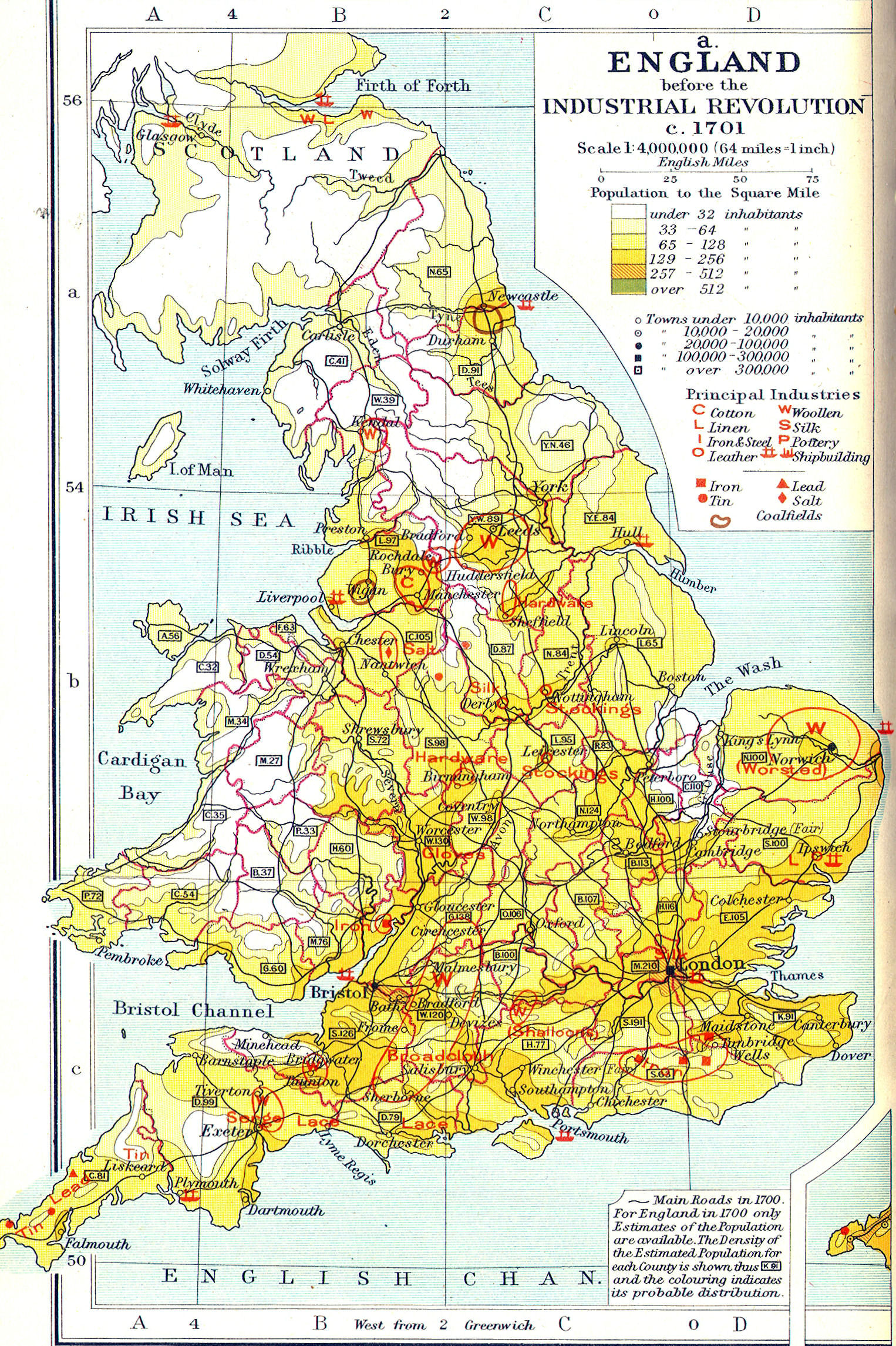
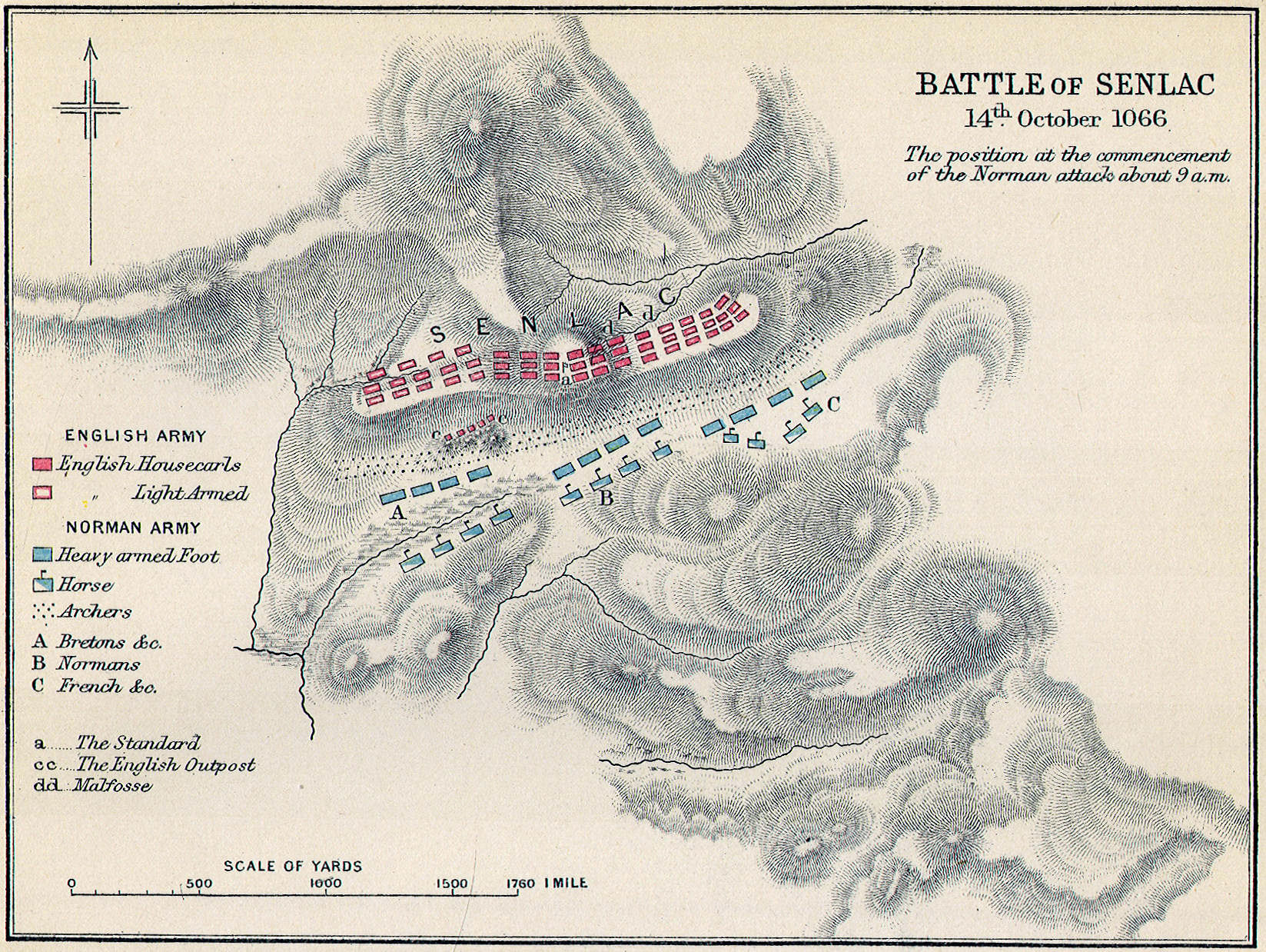
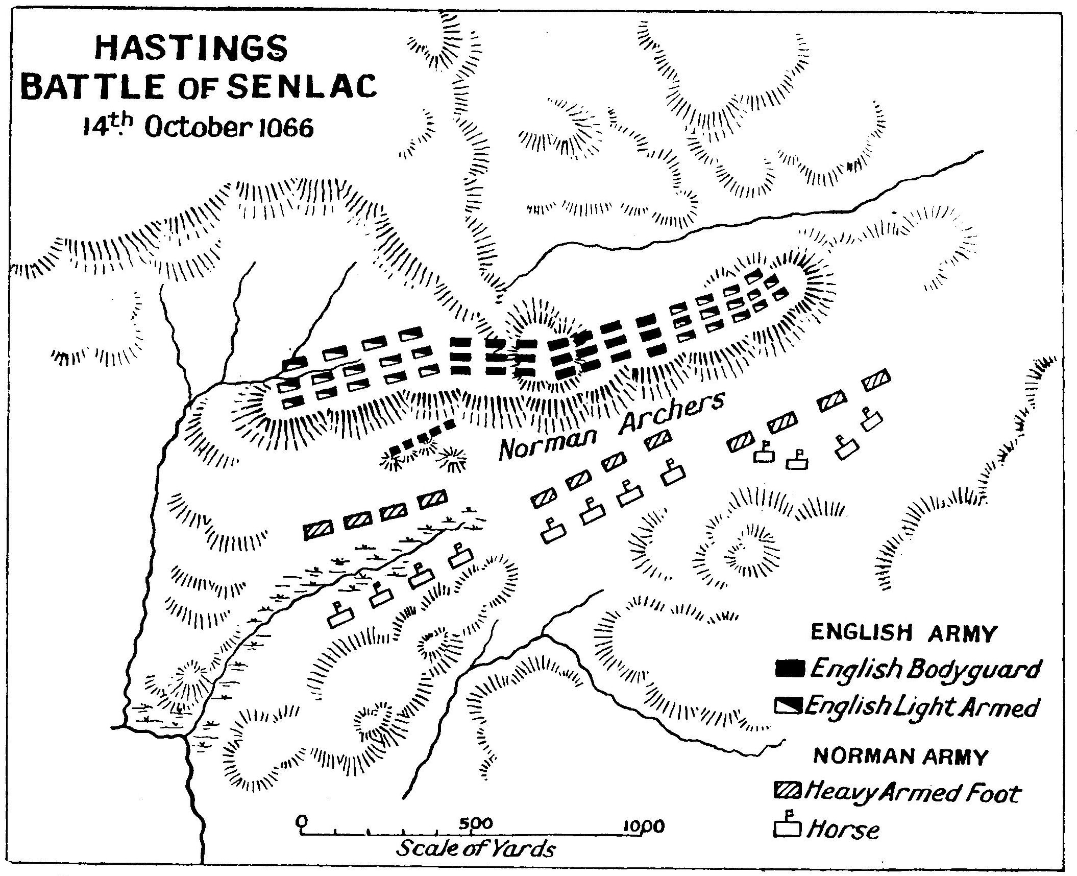
England
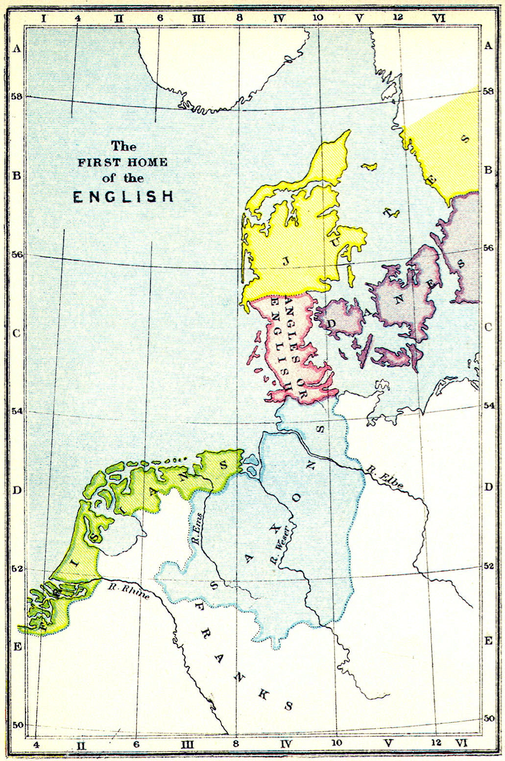
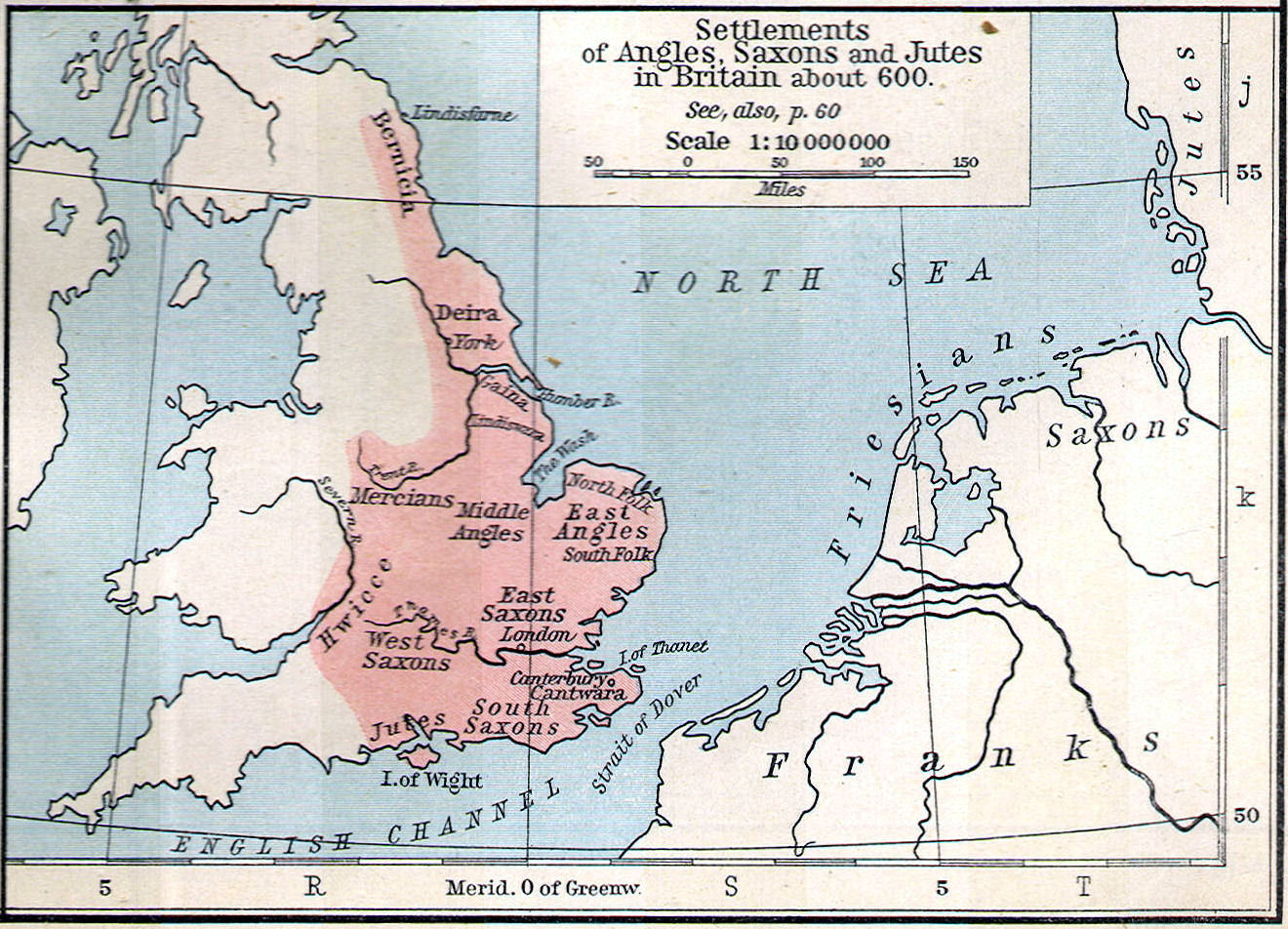
Saxon Kingdoms:—Northumbria, Mercia, East Anglia, Kent, Essex, Sussex, Middlesex
Cities:—London, Winchester, Exeter, Lincoln, York, Oxford, Canterbury,
Gloucester, Worcester, Nottingham, Hastings, Reading,
Norwich, Bristol, Chester
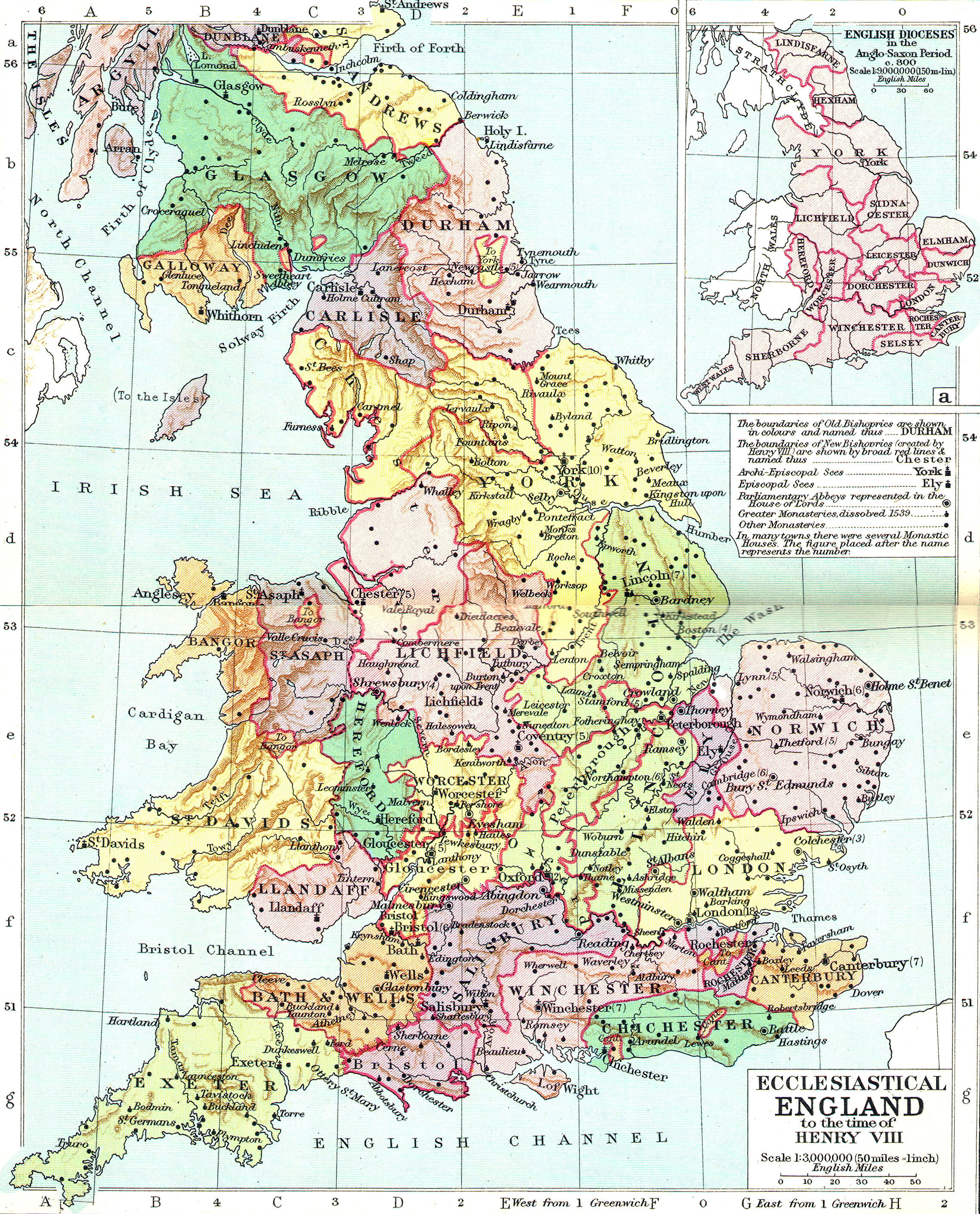
Monasteries, Abbeys:—Jarrow, Lindesfarne, Crowland, Canterbury, Westminster
Forests, Marshes:—New Forest, Sherwood Forest, Forest of Arden, The Fens
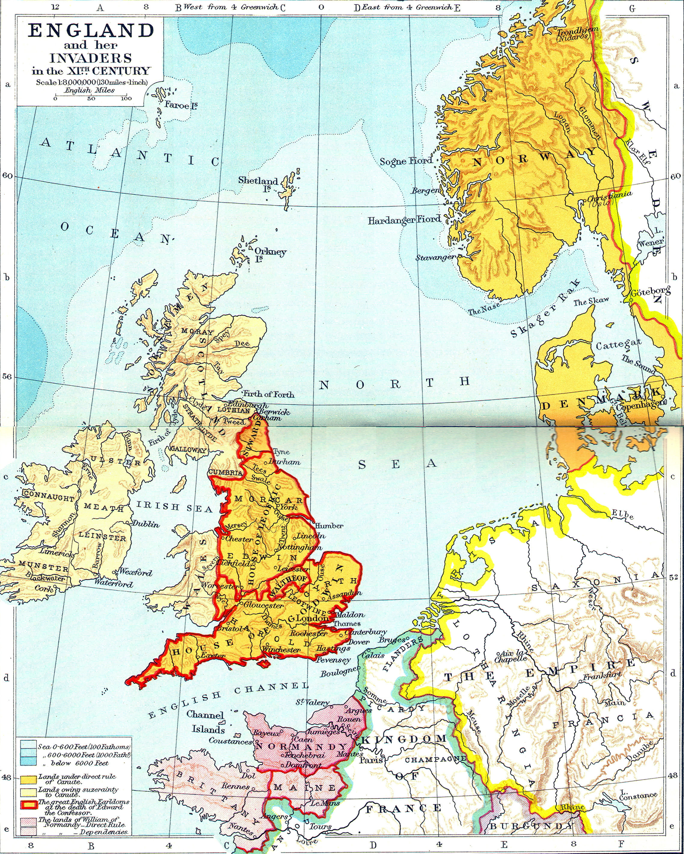
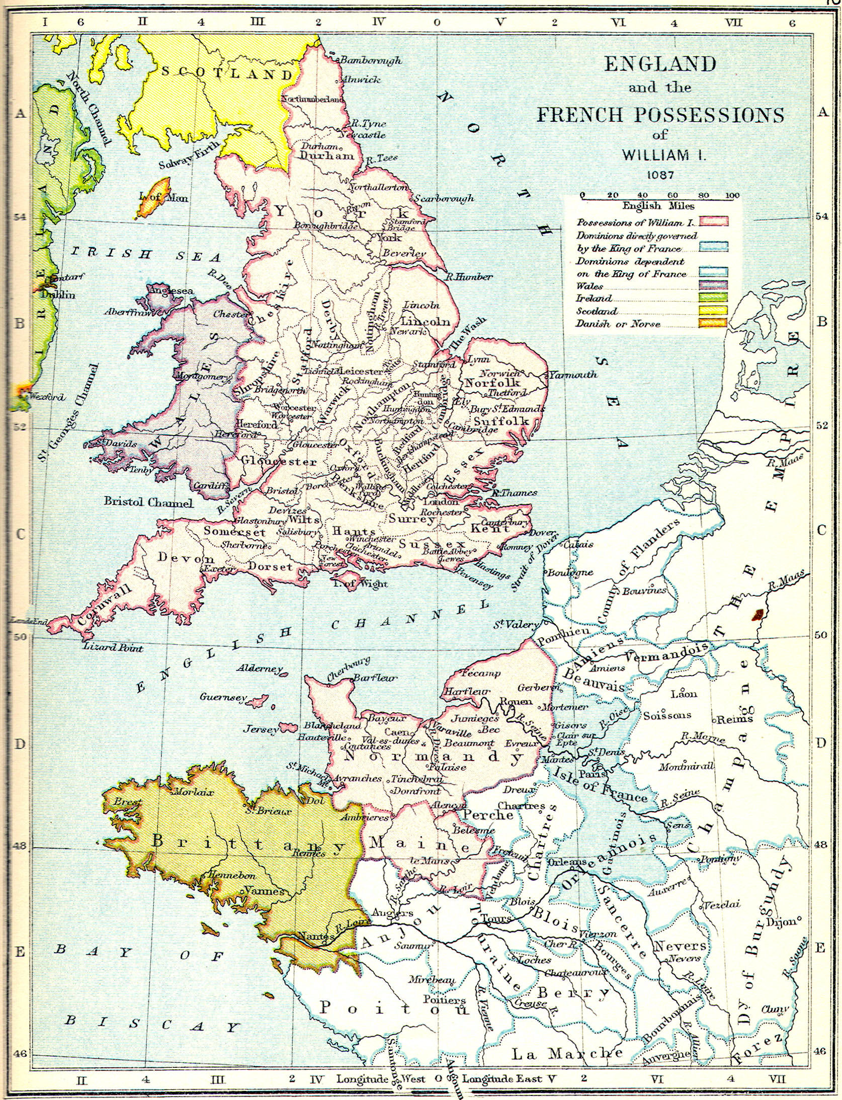
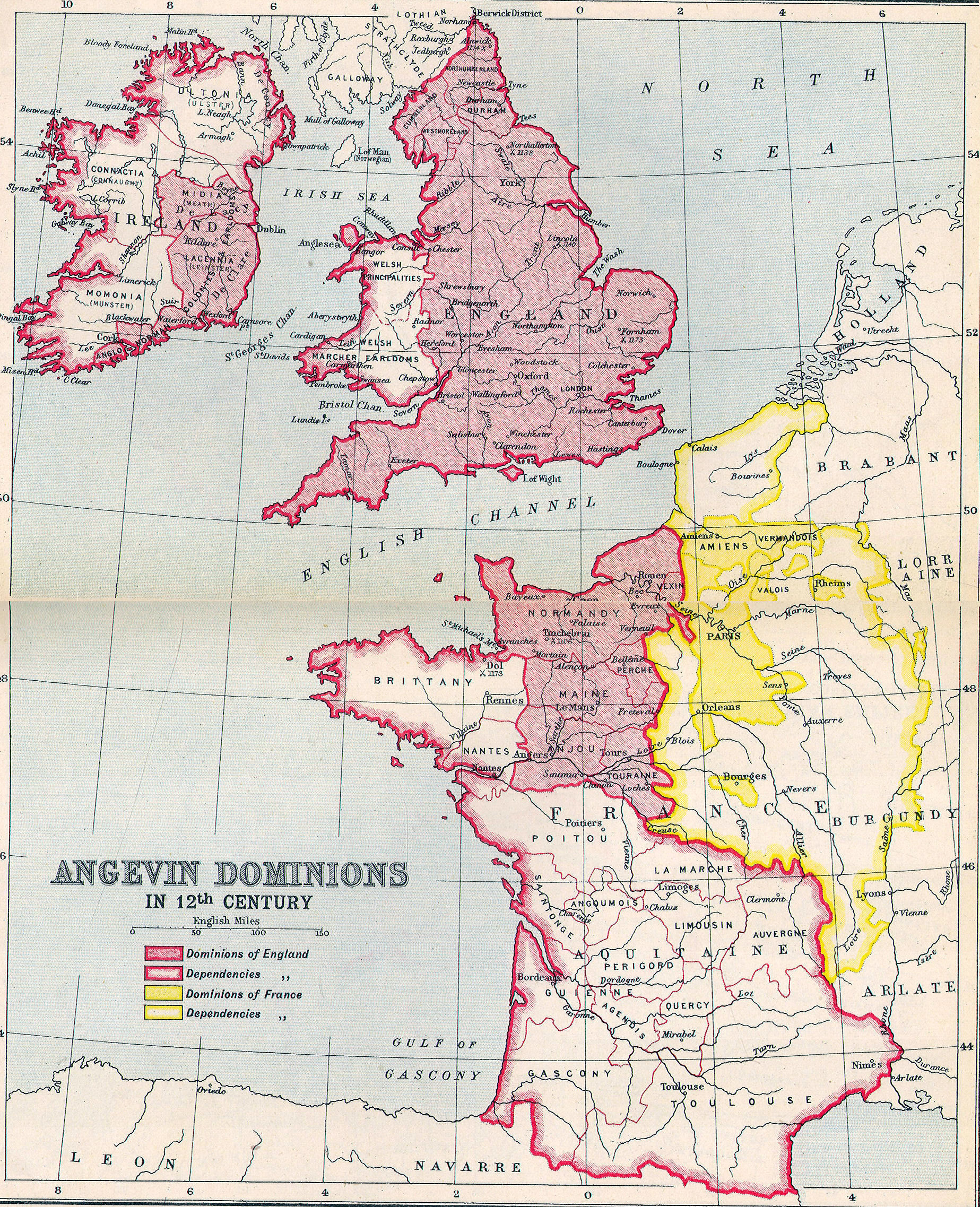
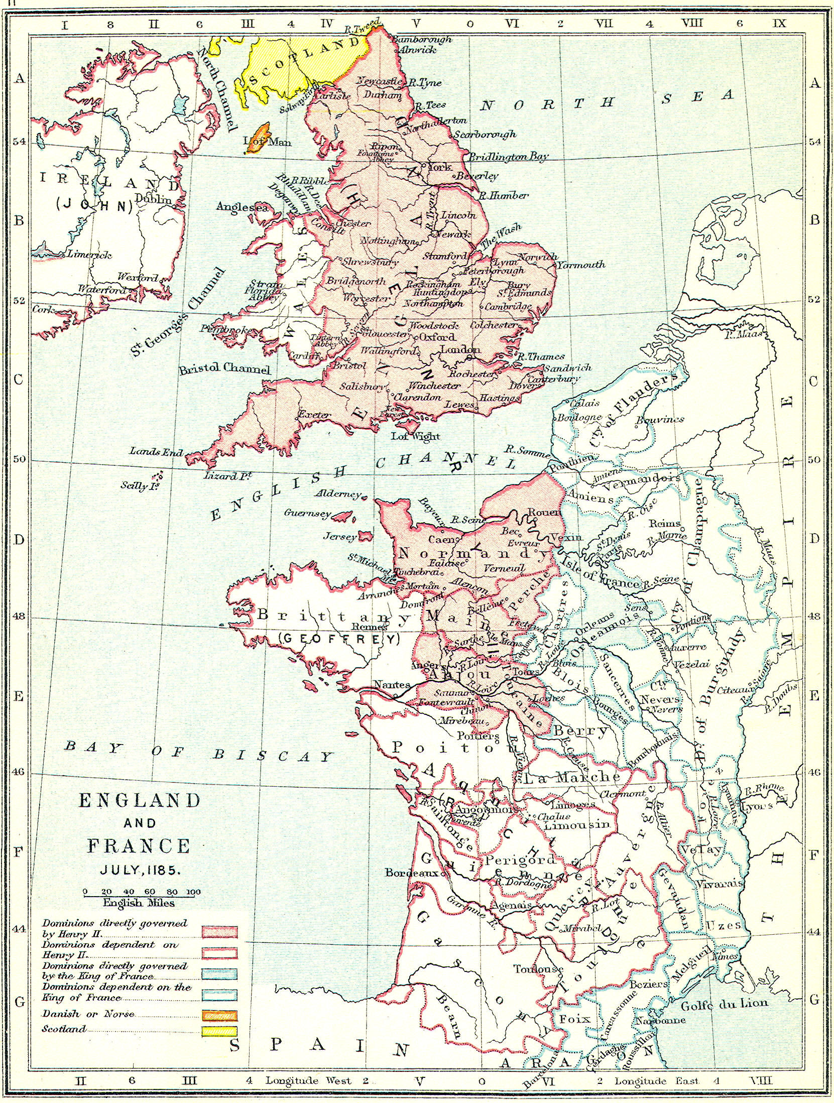
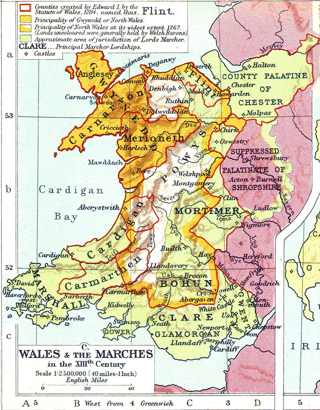
Plantagent Empire
Provinces of France:—Normandy, Anjou, Maine, Flanders, Aquitaine, Gascony
French Rivers:— Loire, Seine
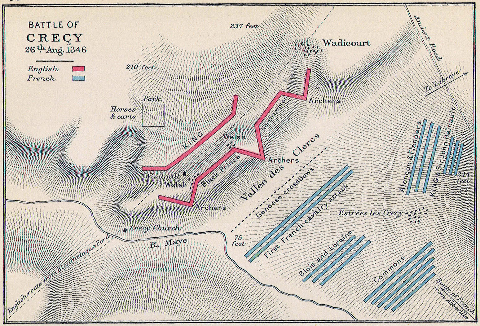
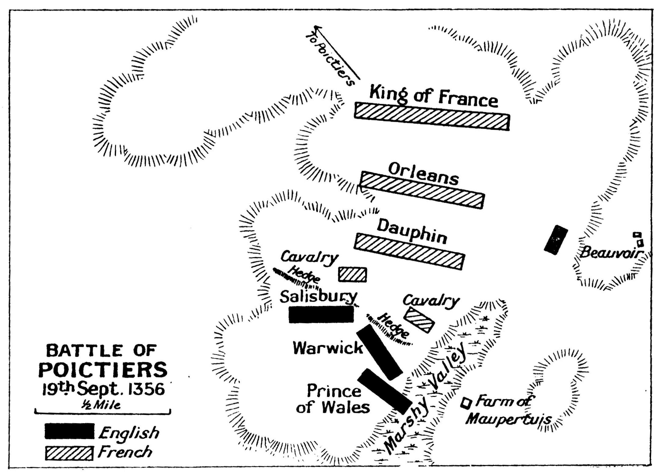
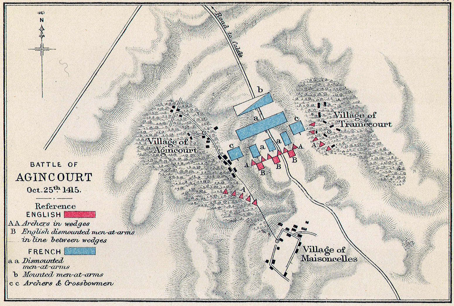
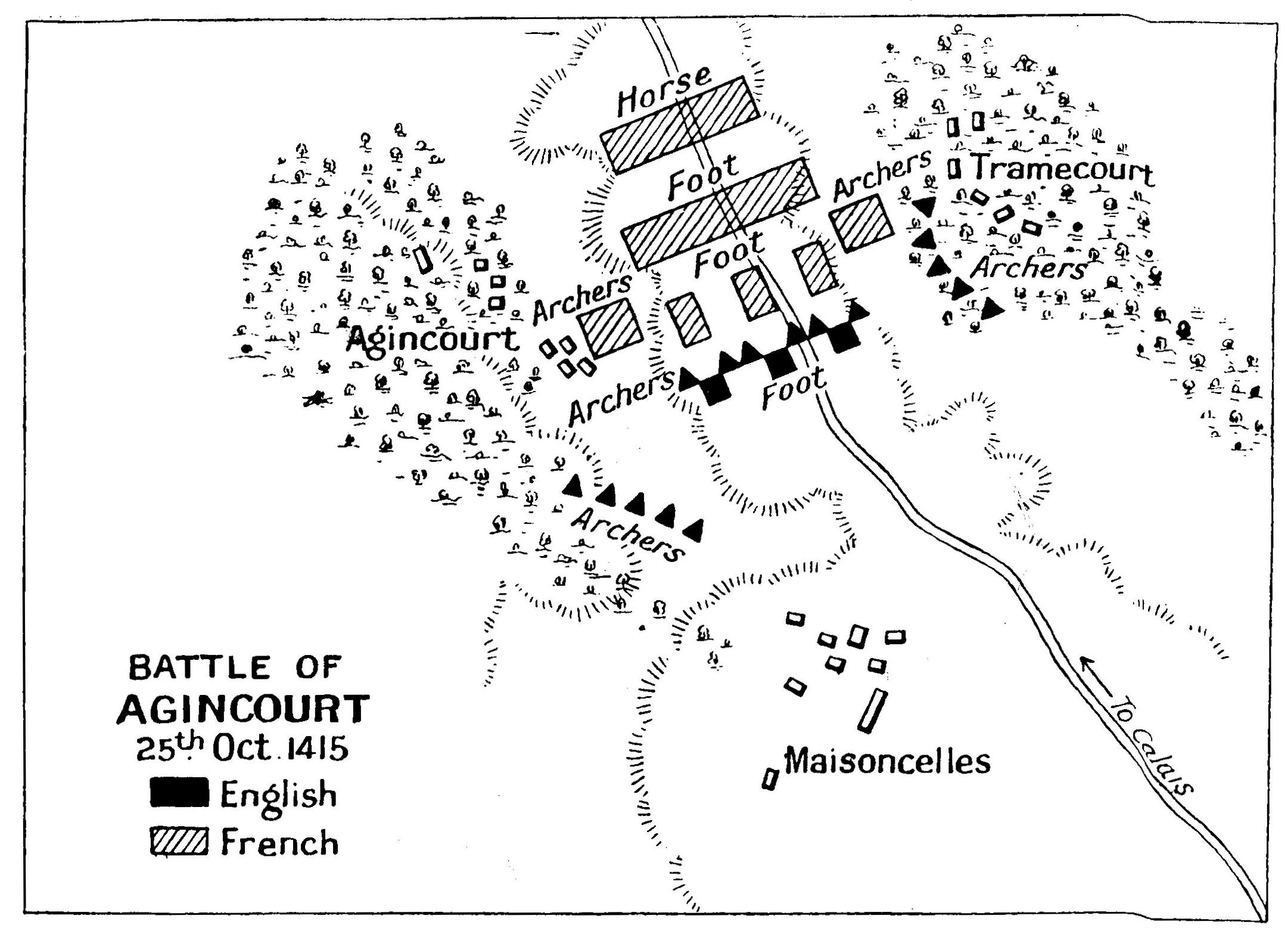
Hundred Years' War:—Sluys, Crecy, Calais, Poitiers, Agincourt, Orleans
French Cities:—Bayeux, Rouen, Paris
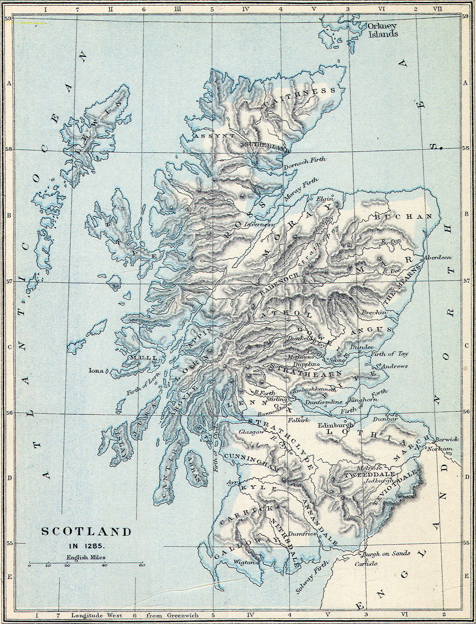
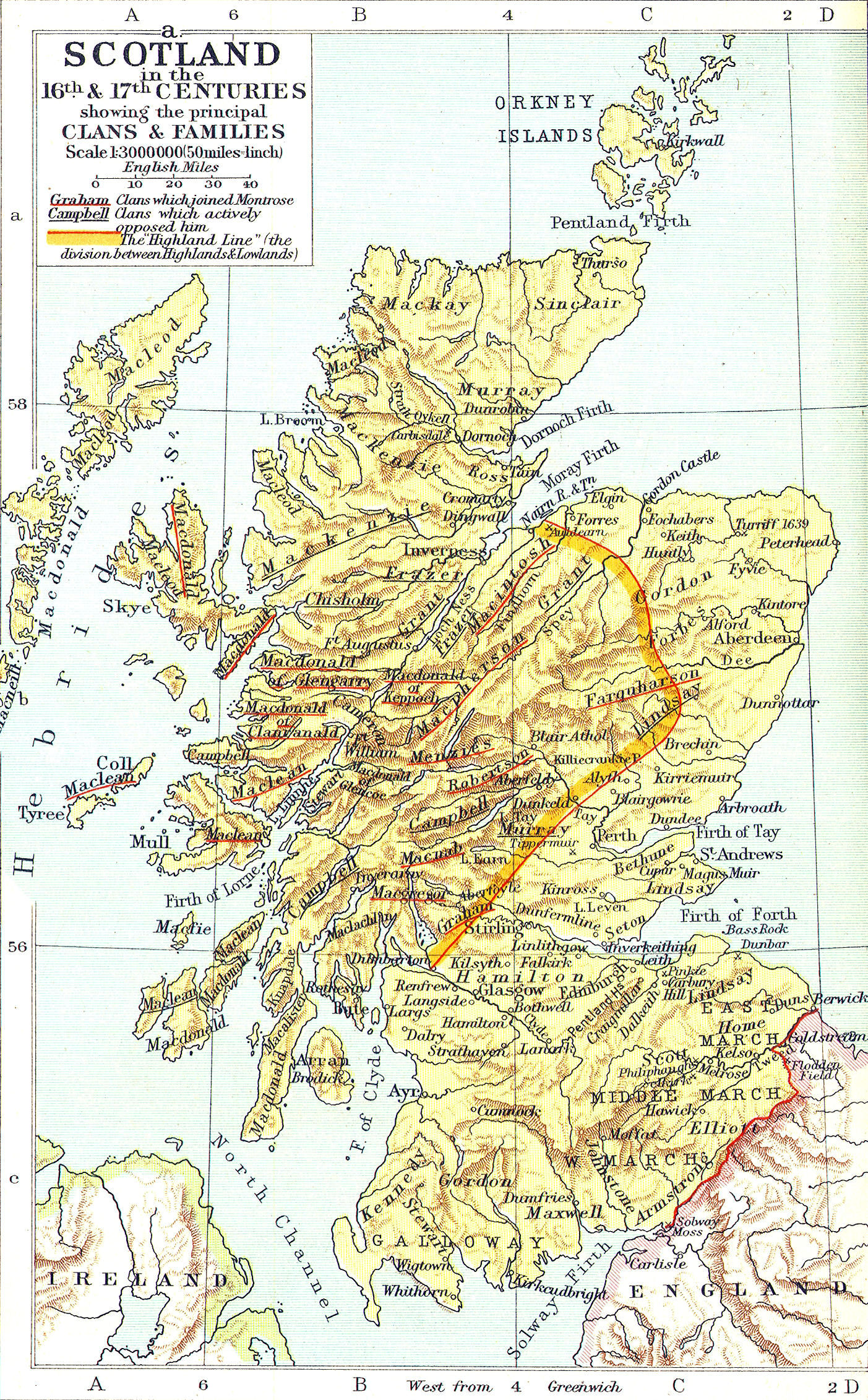
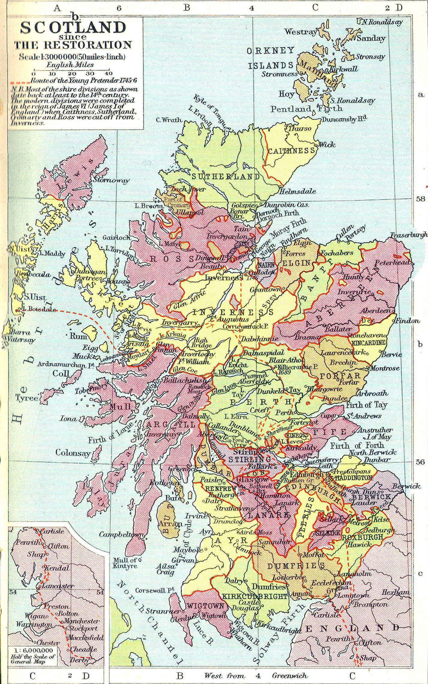
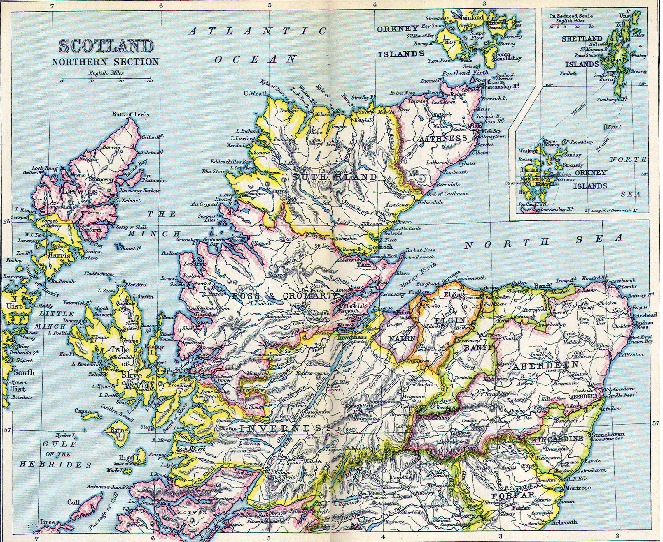
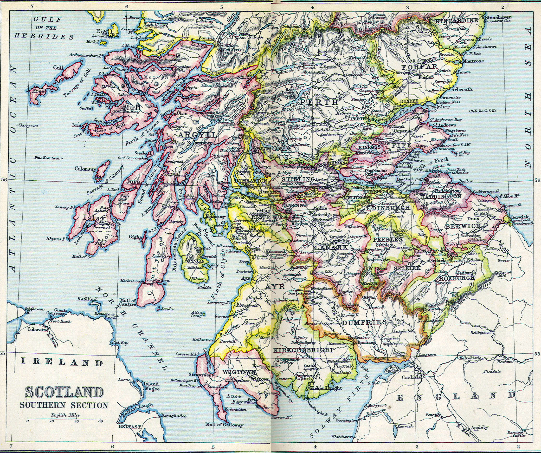
Scotland
Cities:—Edinburgh, Glasgow, Scone, Inverness, Perth, Scone, St. Andrews, Melrose
Regions:—Highlands, Lowlands, Great Glen
Mountains:—Grampian Mountains, Cheviot Hills
Monasteries:—Iona, Lindesfarne
Islands:—The Hebrides, Orkney, Islay, Iona
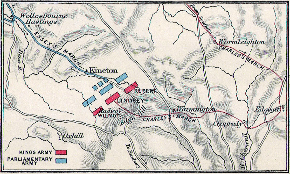
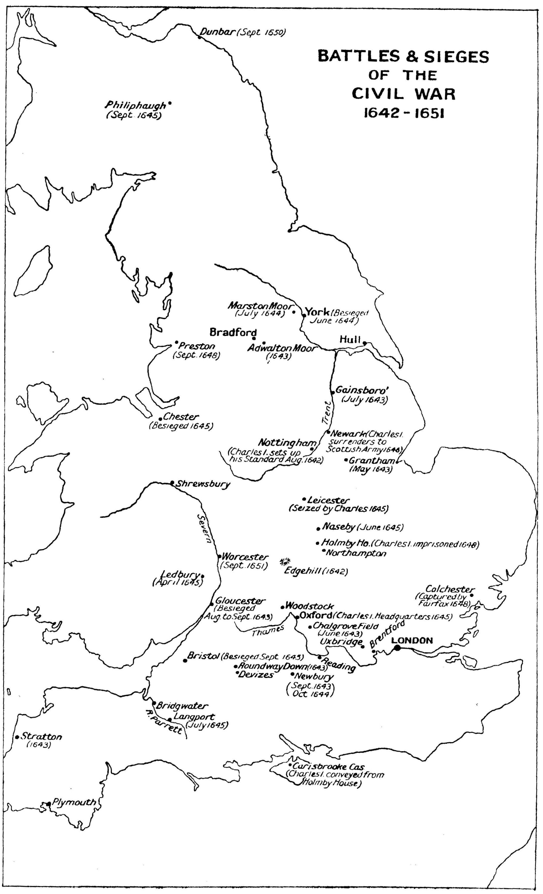
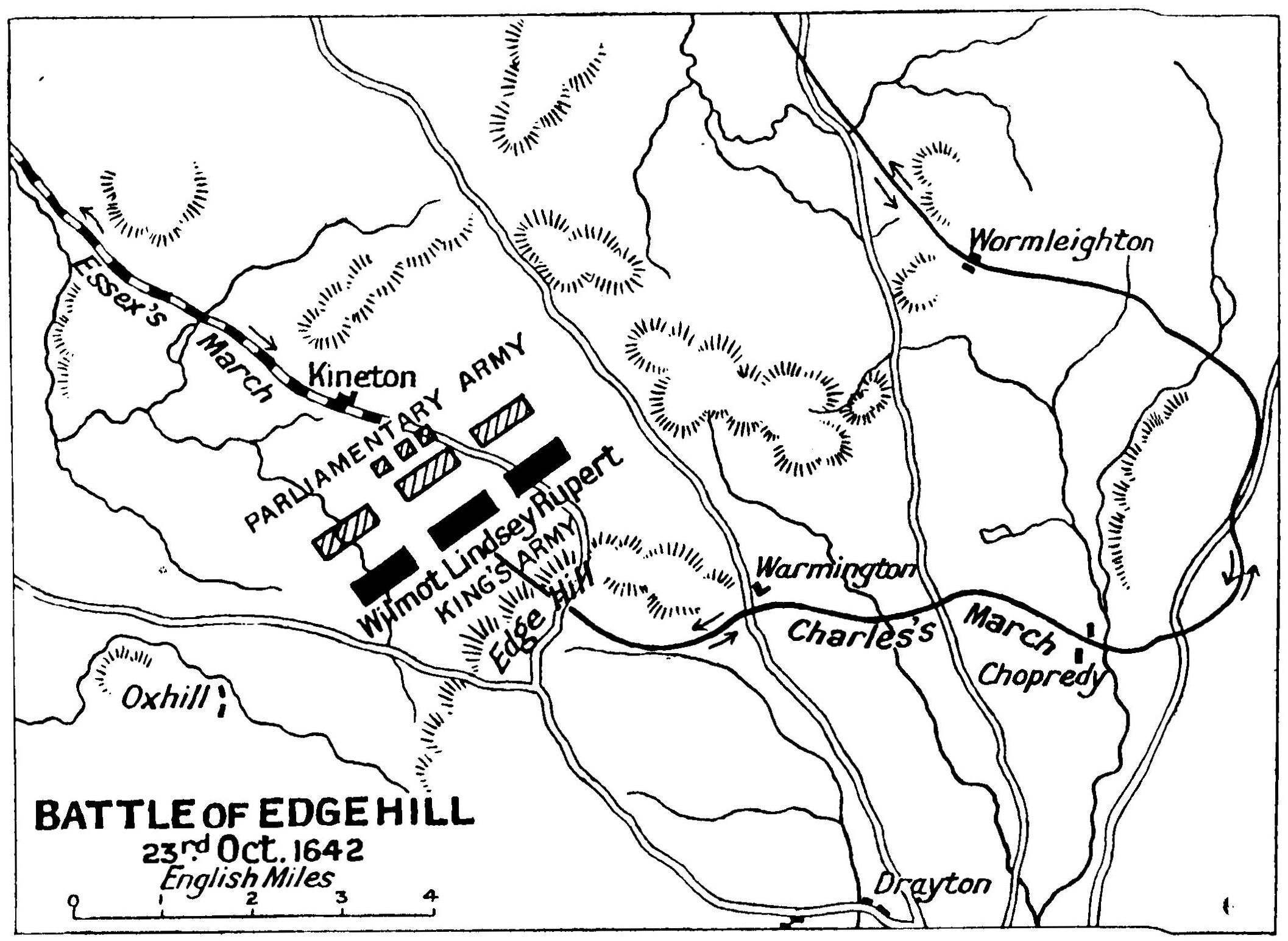
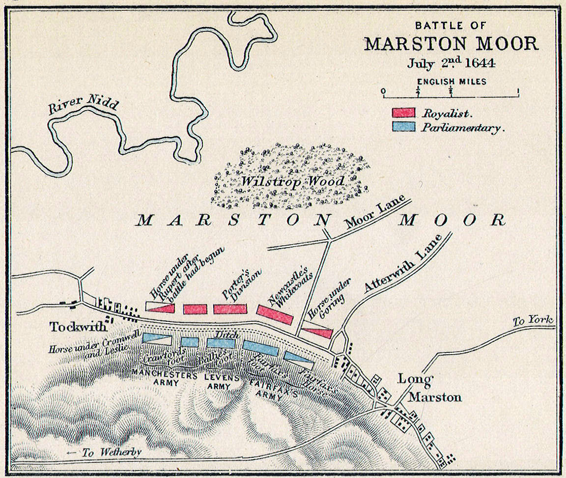
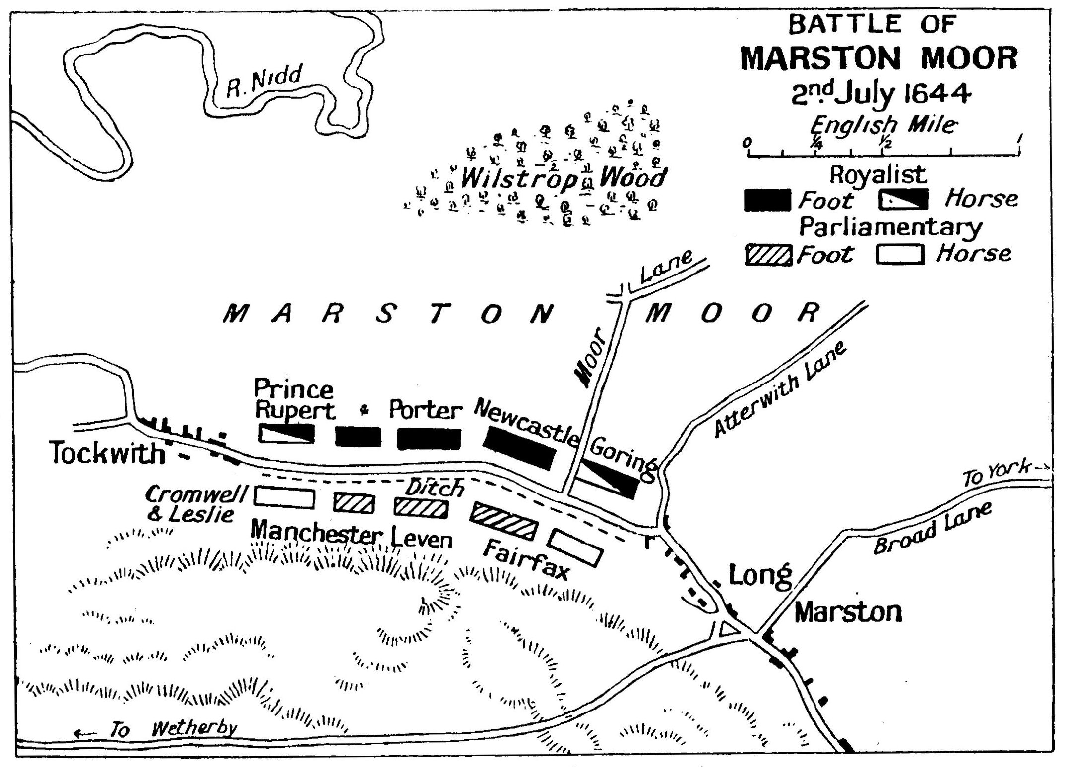
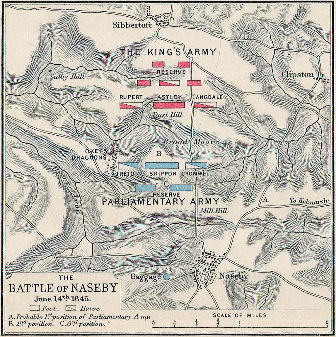
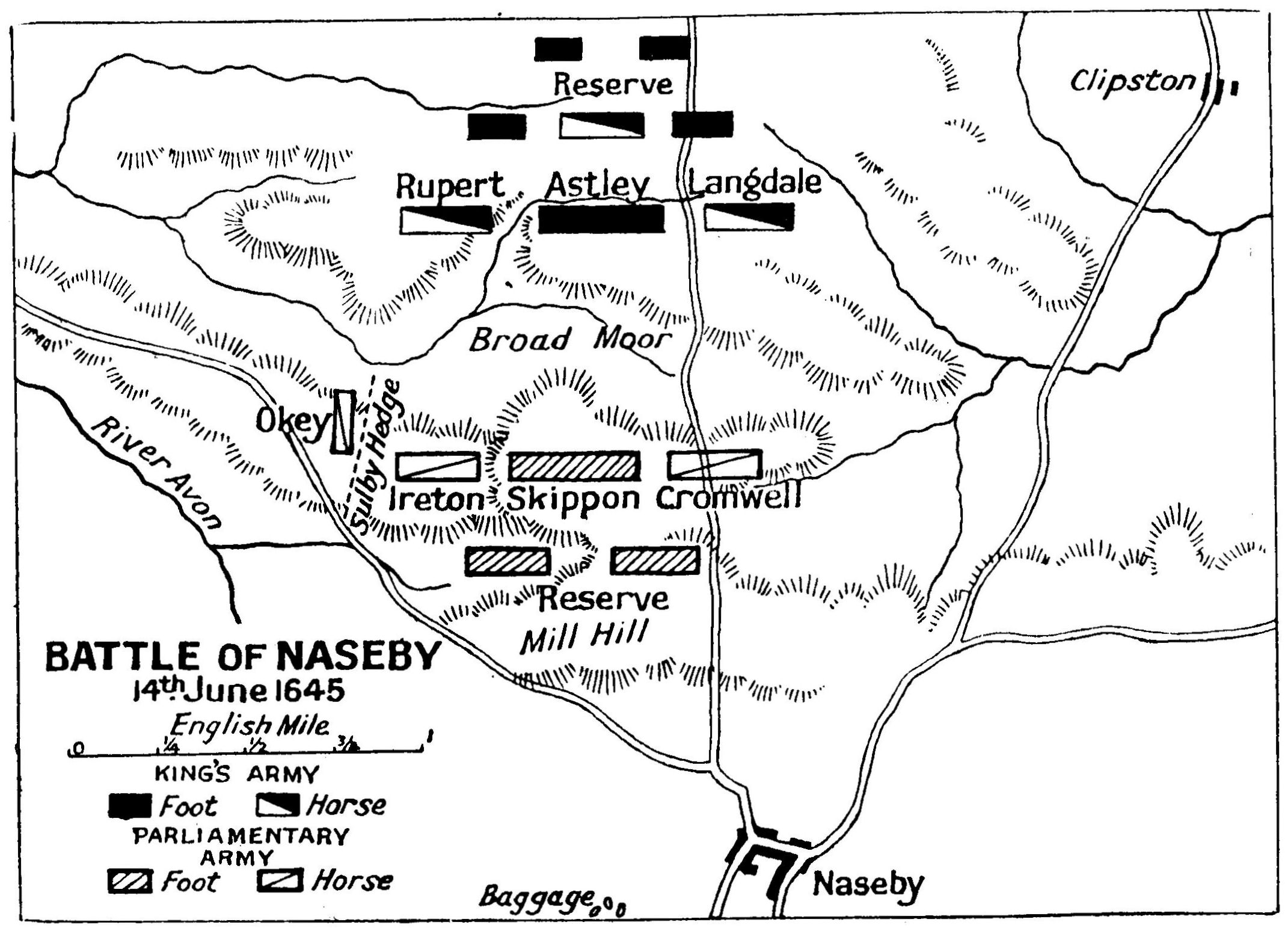
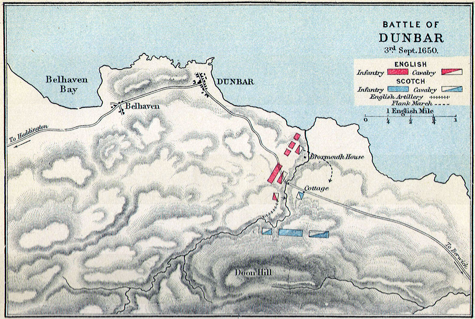
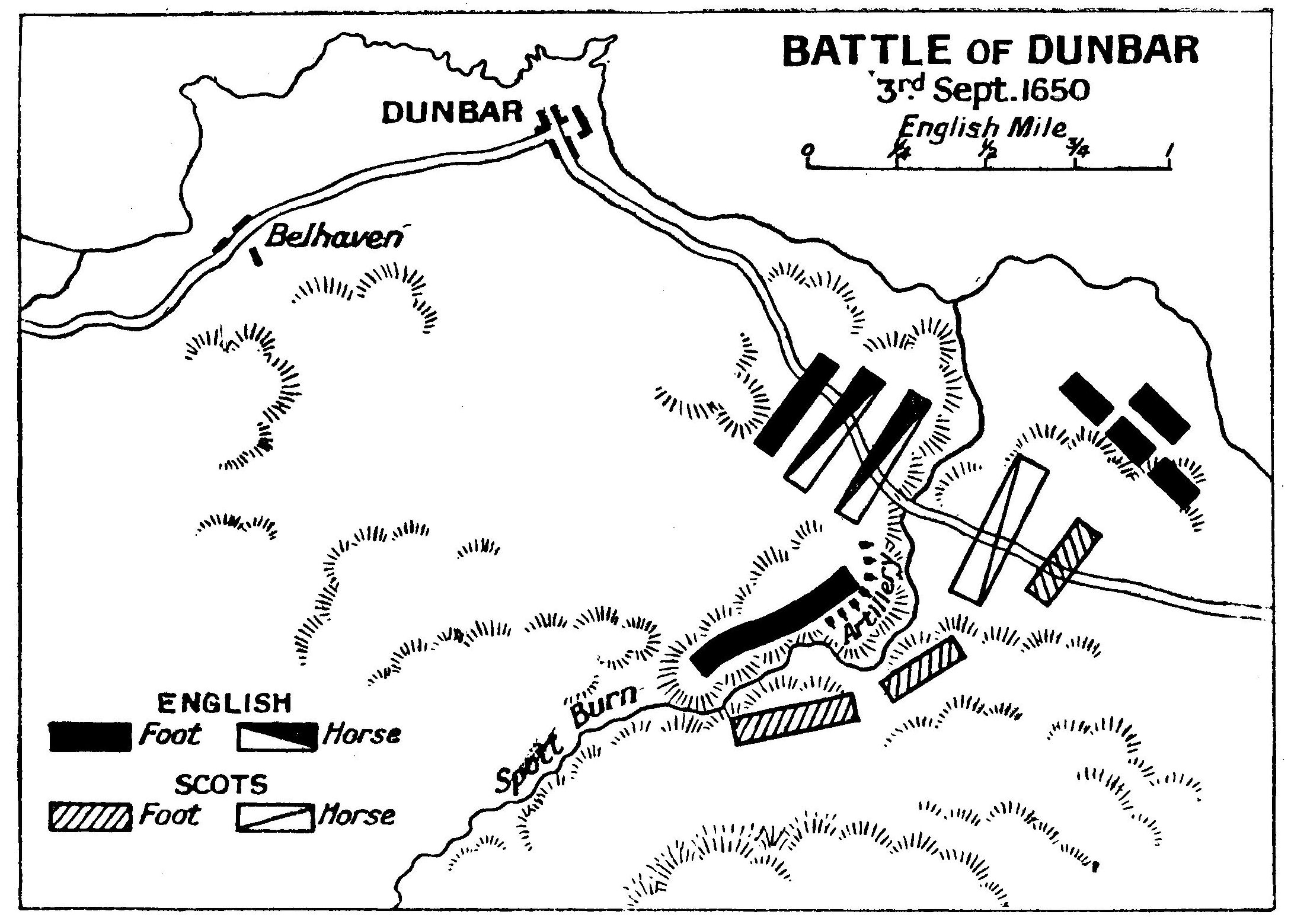
Battles:—Stirling, Falkirk, Bannockburn, Neville's Cross, Dunbar, Culloden
Water Bodies:—Firth of Forth, Firth of Clyde, Moray Firth, Solway Firth
Lakes:—Loch Ness, Loch Lomand

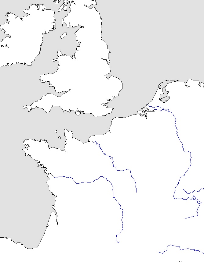
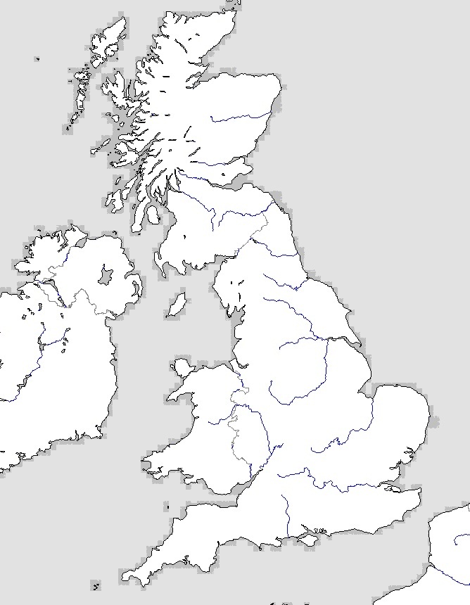 British Isles—Outline Map
  British Isles—Physical Map
 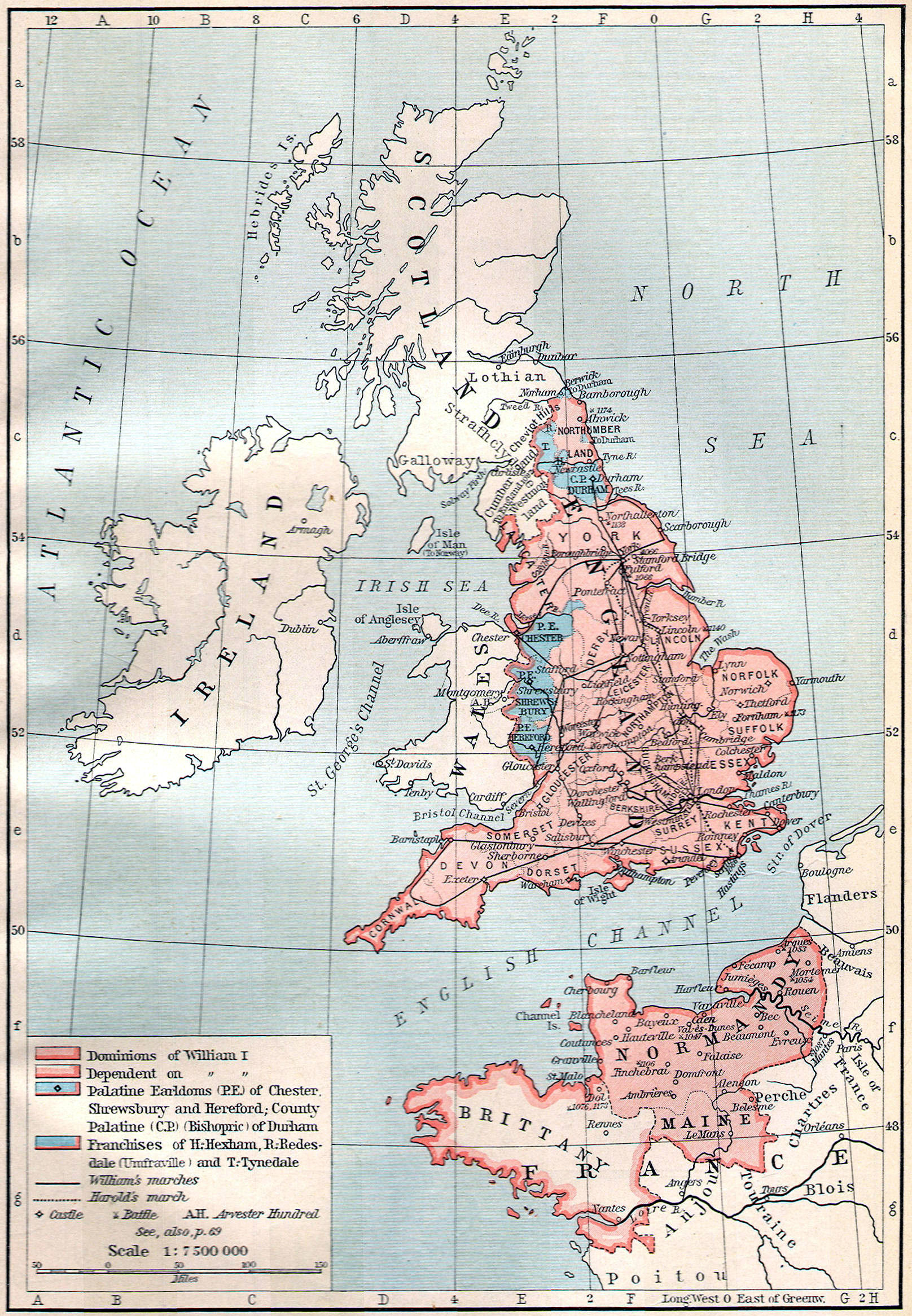 Norman Conquest, 1070 A. D.
 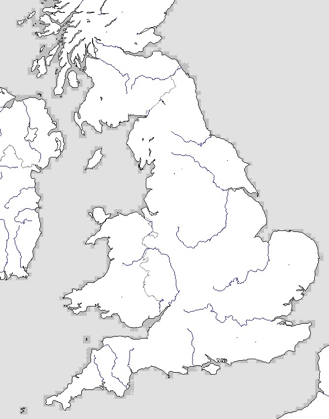 England—Outline Map
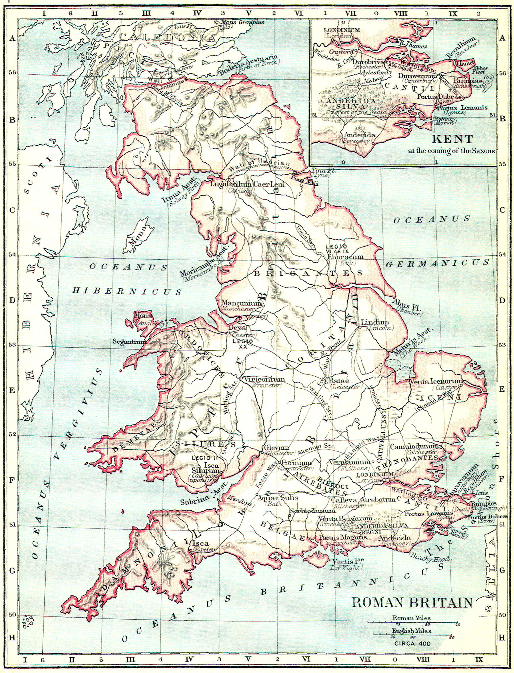
 Plantagenet Empire—Outline Map
 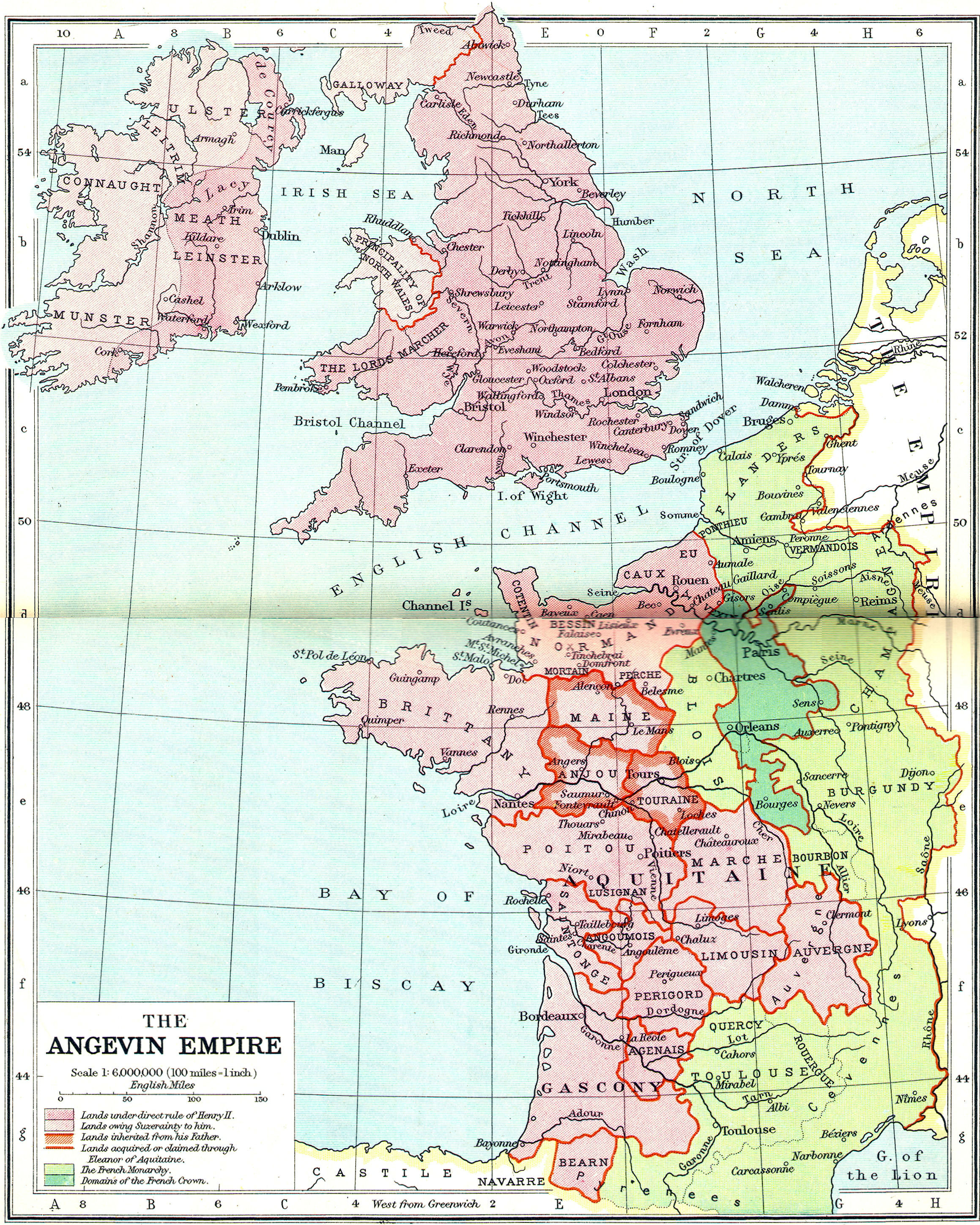 Angevin Empire 1100 A.D.
 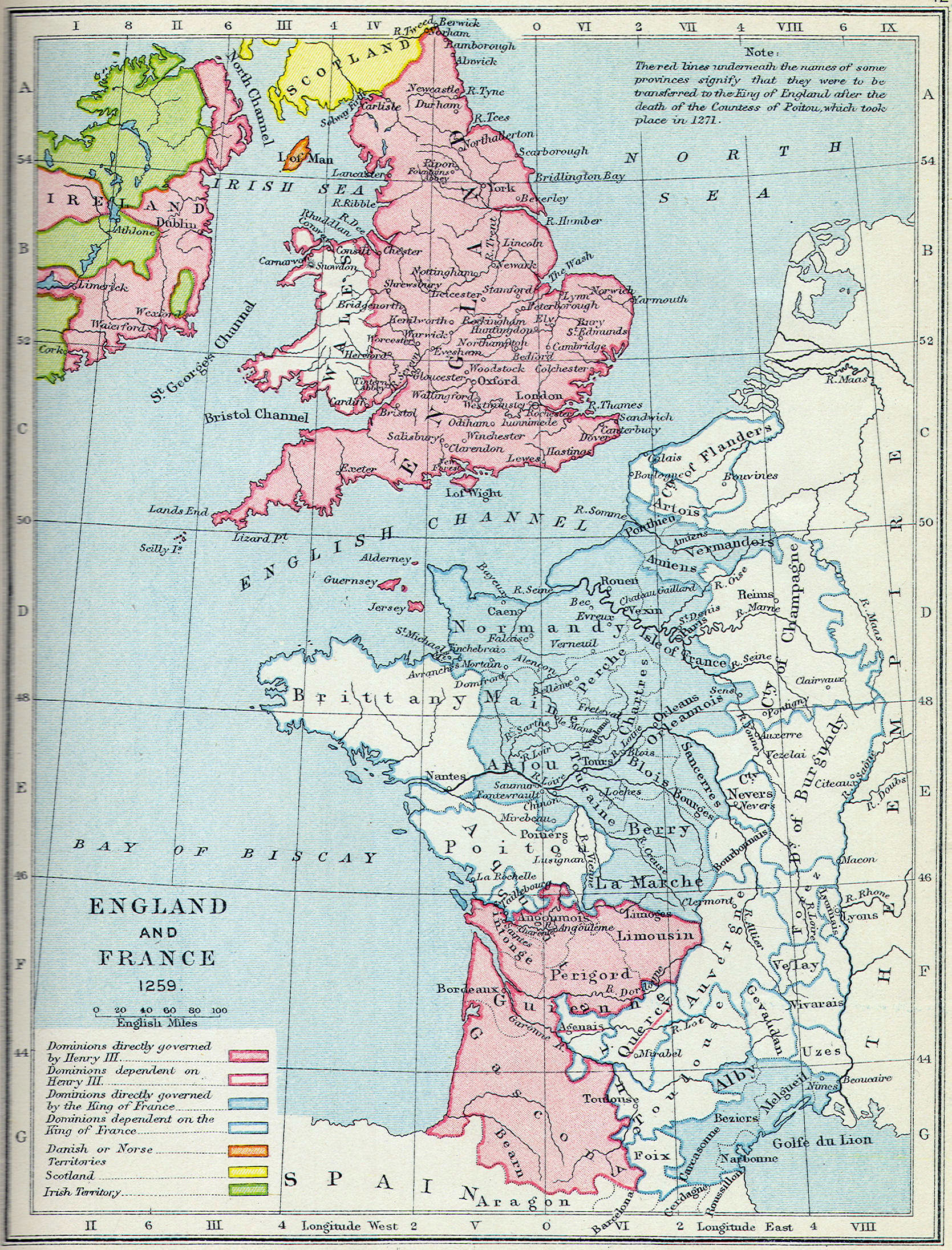 England and France, 1260 A.D.
 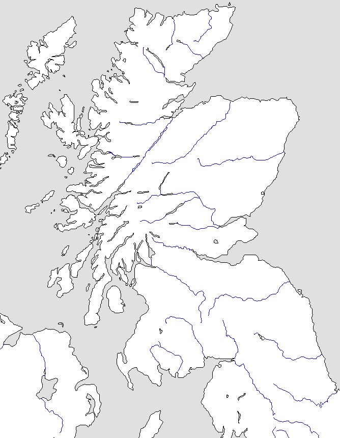 Scotland—Outline Map
 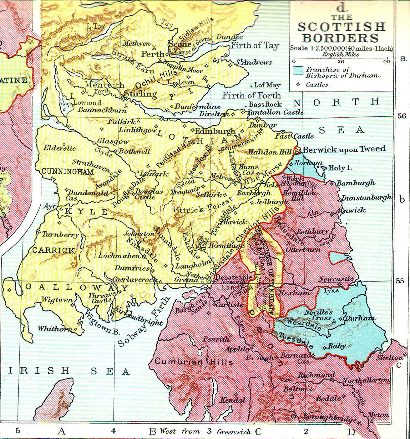 Scotland, border region
 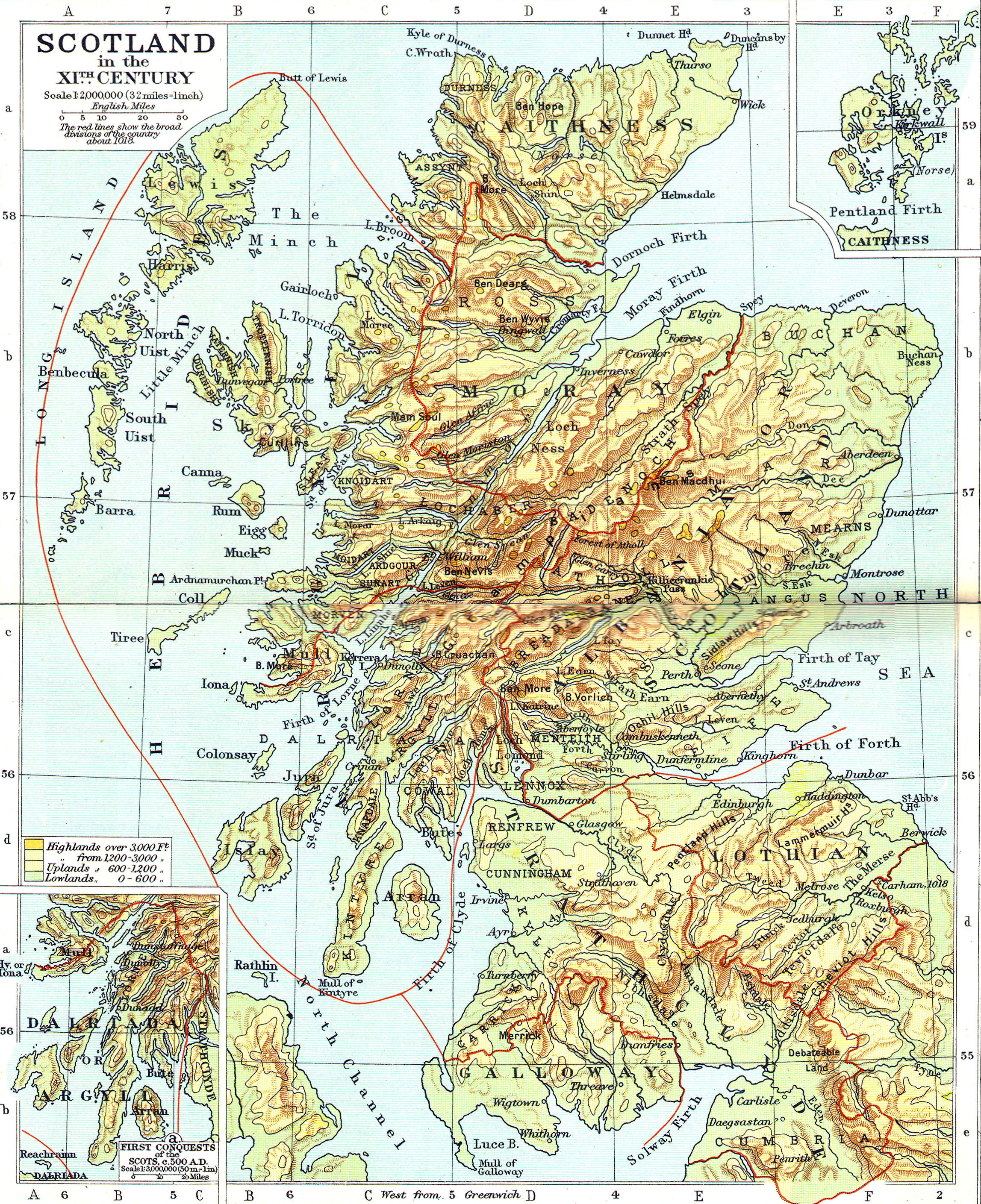 Scotland, Physical map
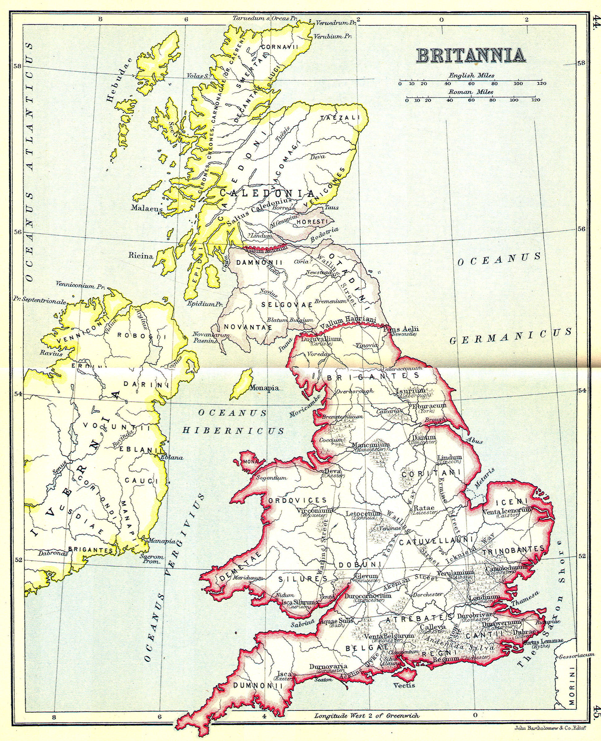