British America
Canada:—Acquired in 1759 following the French-Indian Wars.
Bahamas:—Became a crown colony in 1718.
Bermudas:—Settled by the British Virginia Company in 1612
Jamaica:—Acquired in 1655 as during the Anglo-Spanish Wars.
British Guiana:—Dutch colony ceded to the British in 1814.
Trinadad:—Acquired from Spain in 1797.
Barbados:—Acquired from Spain in 1625 for sugar crop.
British Honduras:—Acquired from Spain in 1862, present day Belize.
Falkland Islands:—Acquired in 1765, lost, then re-acquired in 1833.
British Mediterranean
Gibraltar:—Acquired in 1704 during the War of Spanish Succession.
Malta:—Acquired in 1814 following Napoleonic Wars.
Cyprus:—Acquired in 1878 from the Ottoman Empire
British Asia
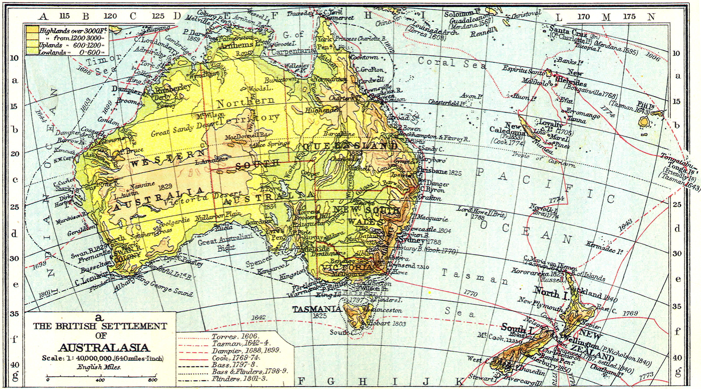
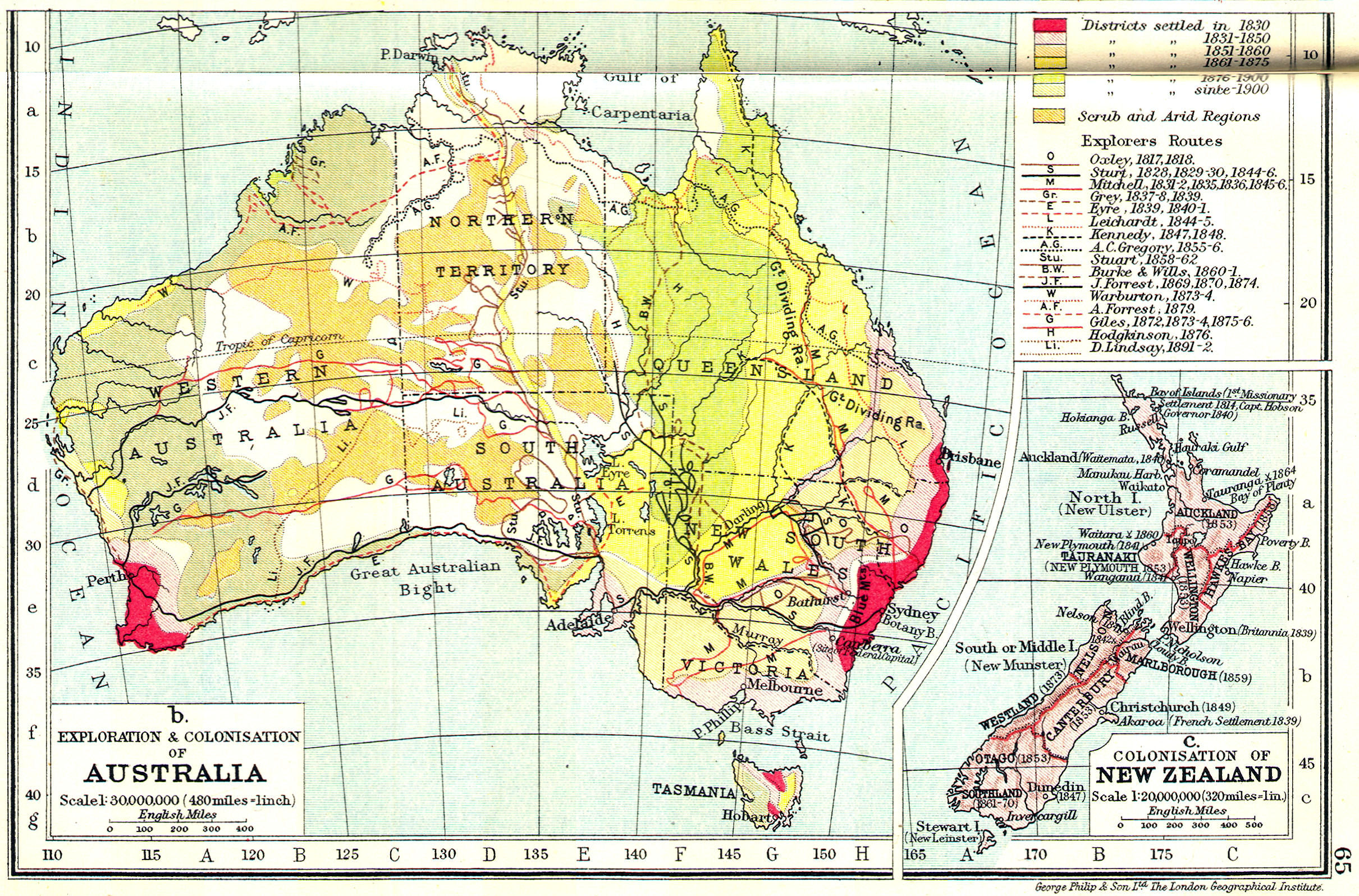
Australia:—Claimed for Britain in 1770 by James Cook.
New Zealand:—Claimed for Britain in 1770 by James Cook.
India:—Conquered Bengal in 1757, Battled of Plassey
Burma:—Conquered in 1824 in first British-Burma War.
Singapore:—British trading post established in 1819.
Hong Kong:—Acquired by Britain in 1843, in First Opium War.
North Borneo:—British protectorate established in 1882.
Ceylon:—Acquired in 1796 following French Revolution Wars.
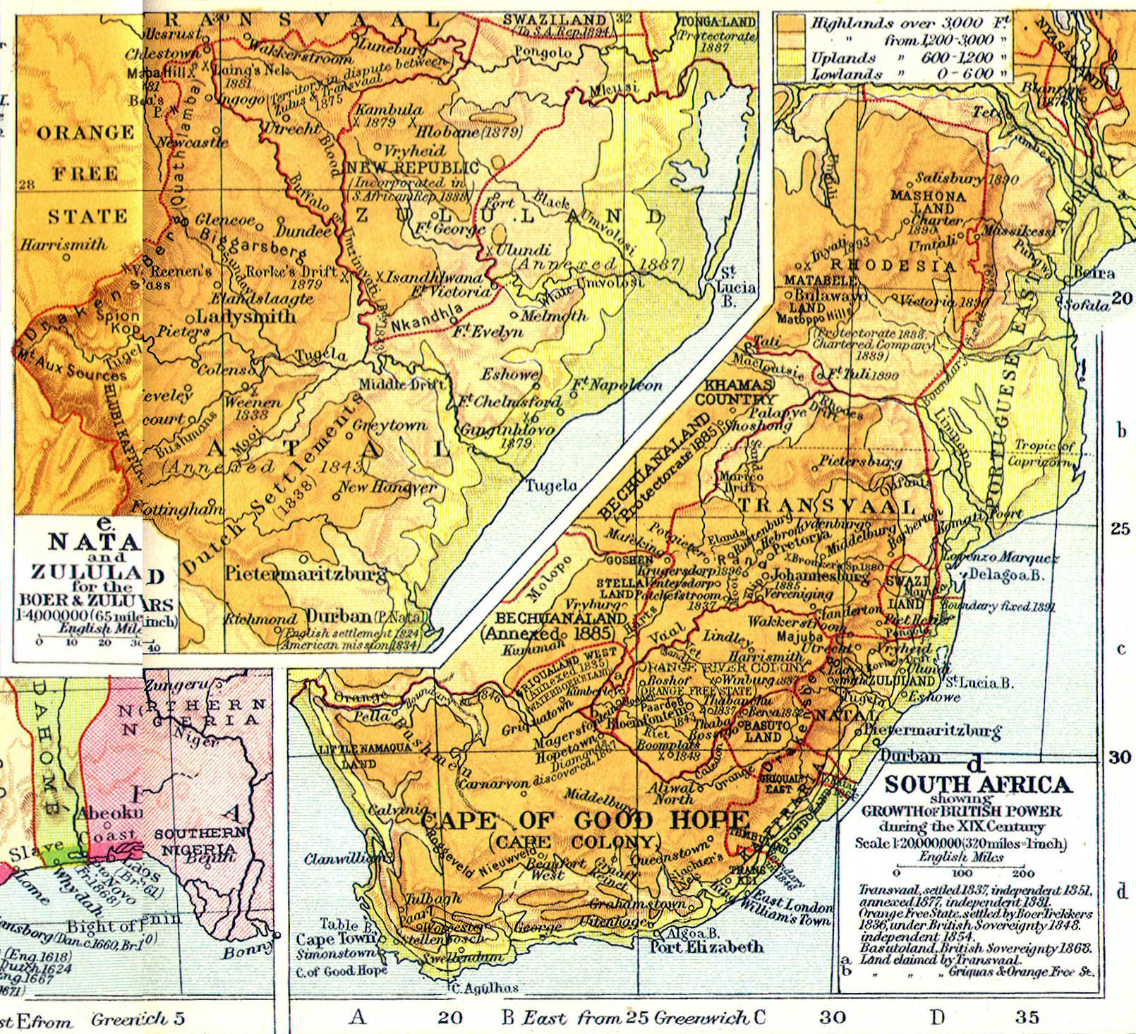
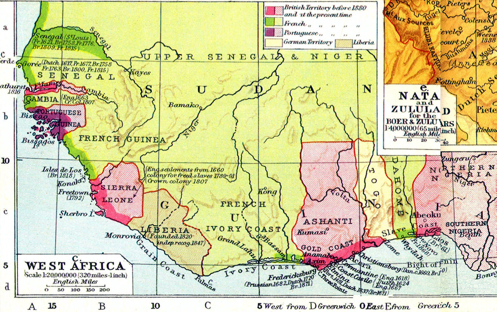
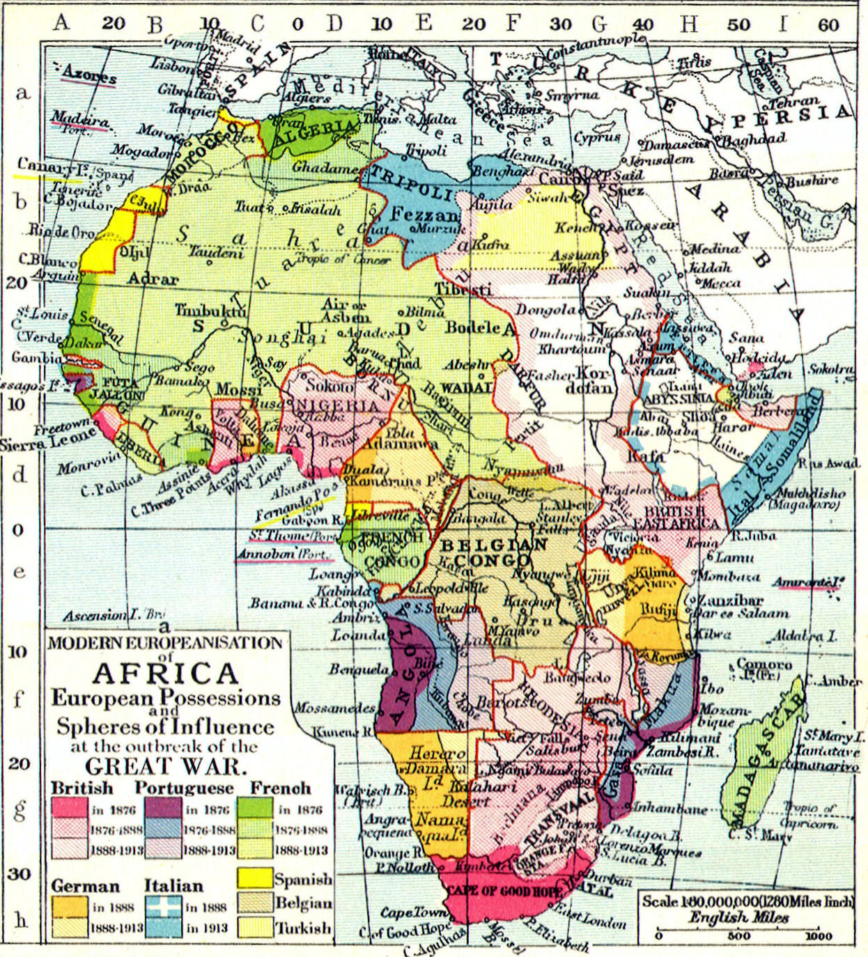
British Africa
Cape Colony:—Dutch colony acquired by Britain during Napoleonic Wars.
Transvaal Republics:—Boer Republic conquered by Britain during Boer Wars.
Northern Rhodesia:—Protectorate formed in 1911, modern Zambia.
Southern Rhodesia:—Protectorate formed in 1895, modern Zimbabwe.
Bechuanaland:—Protectorate established in 1885, modern Botswana.
British East Africa:—Protectorate established in 1880, modern Kenya.
Nigeria:—Protectorate established in 1901.
British Gold Coast:—British trading colony since 1820, modern Ghana.
Sierra Leone:—Freetown made a crown colony in 1808.
Egypt:—Protectorate established in 1914 at start of WWI.
Sudan:—Protectorate established in 1899 after Battle of Omdurman.

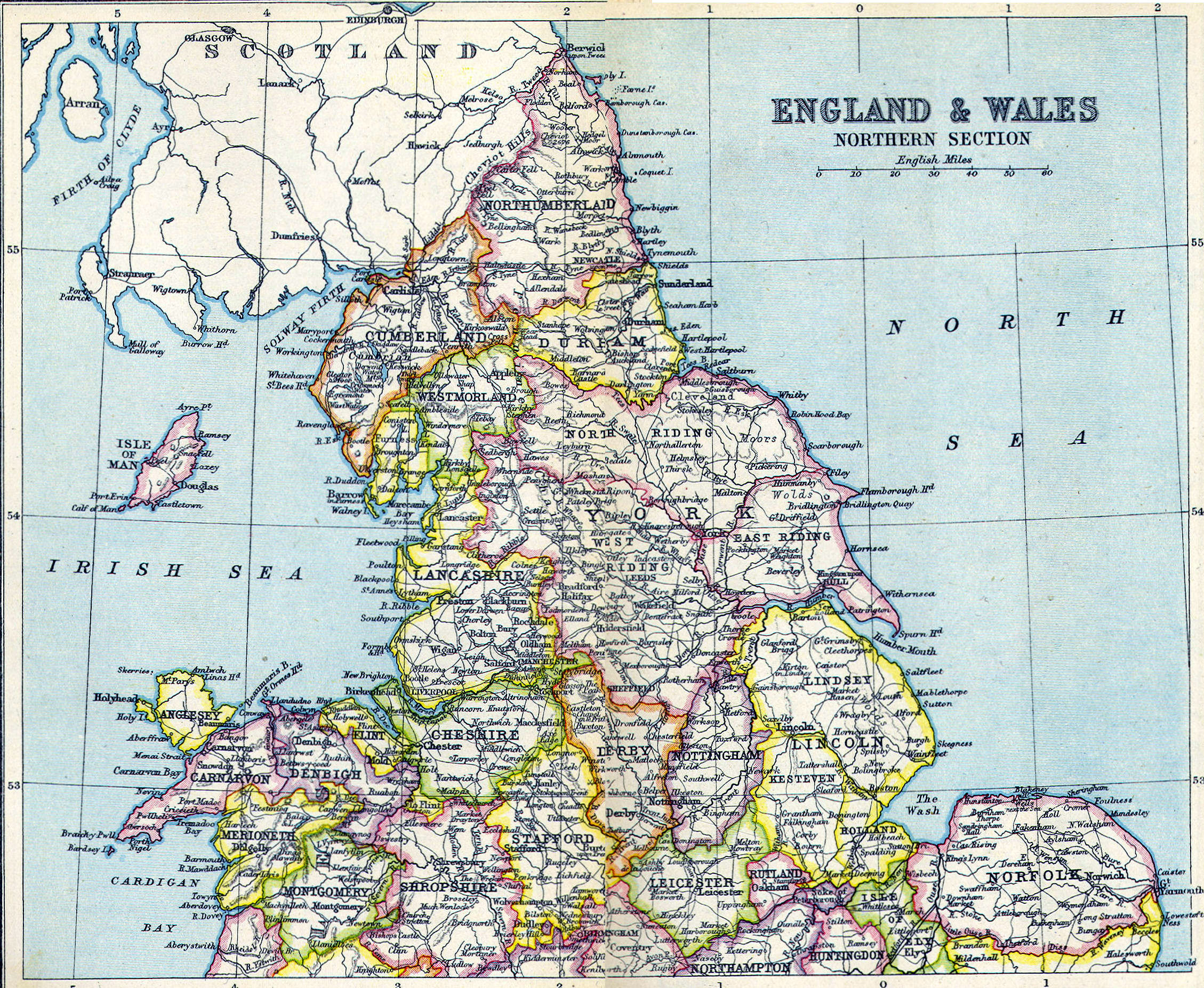
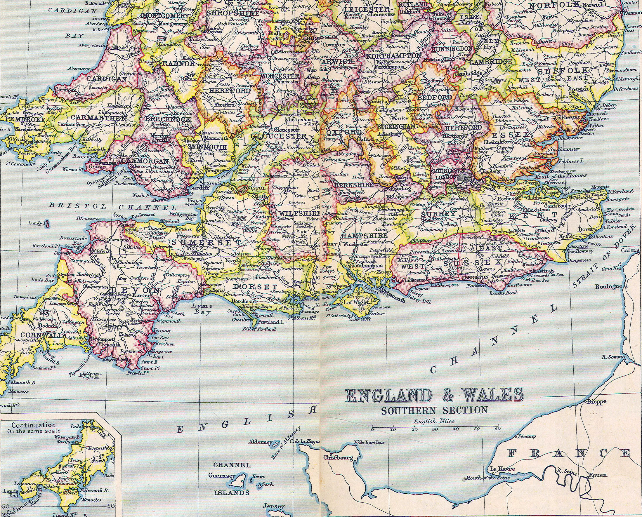
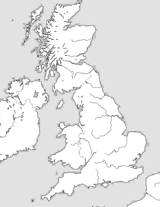 Great Britain—Outline Map
 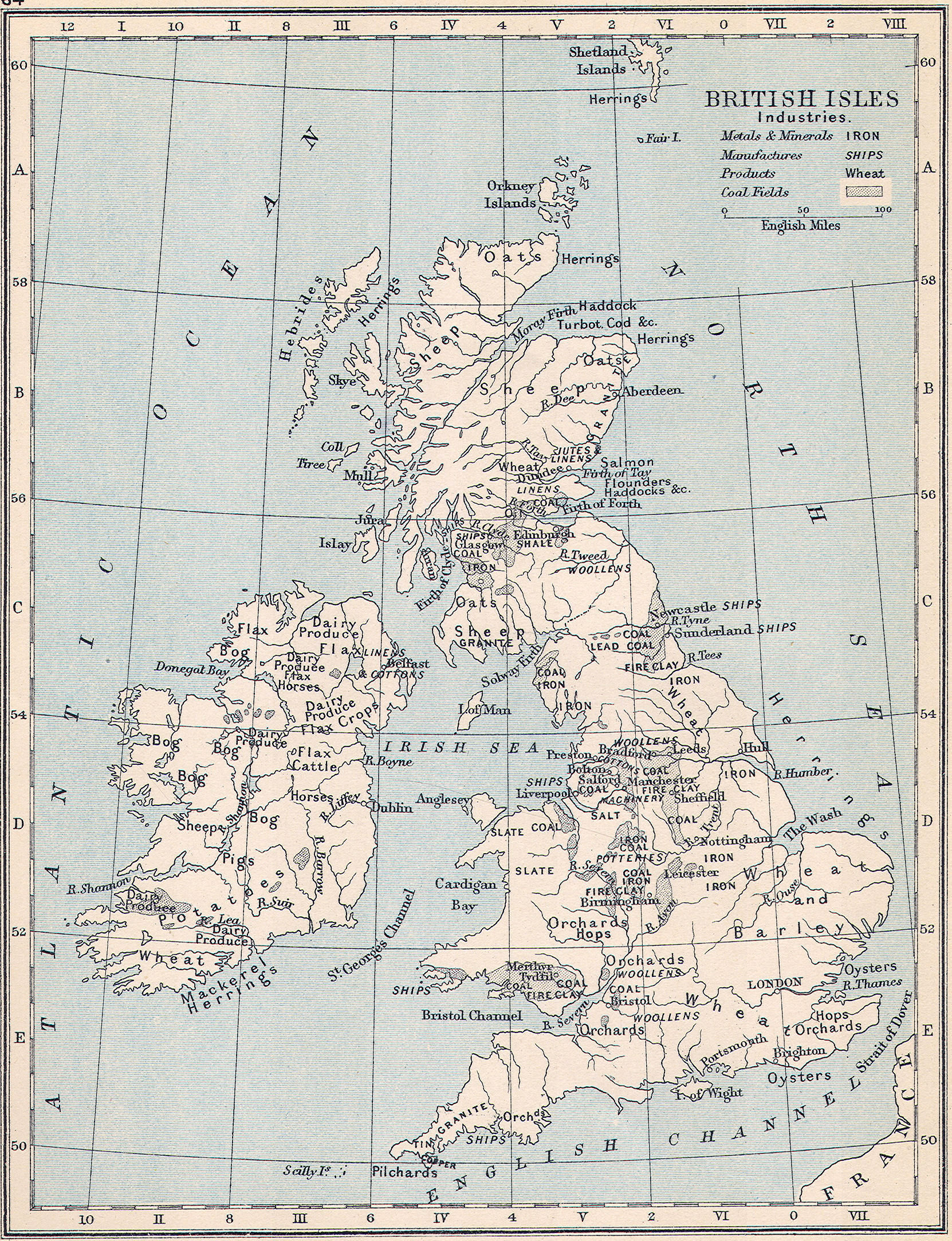 Industrial Map, 1900
 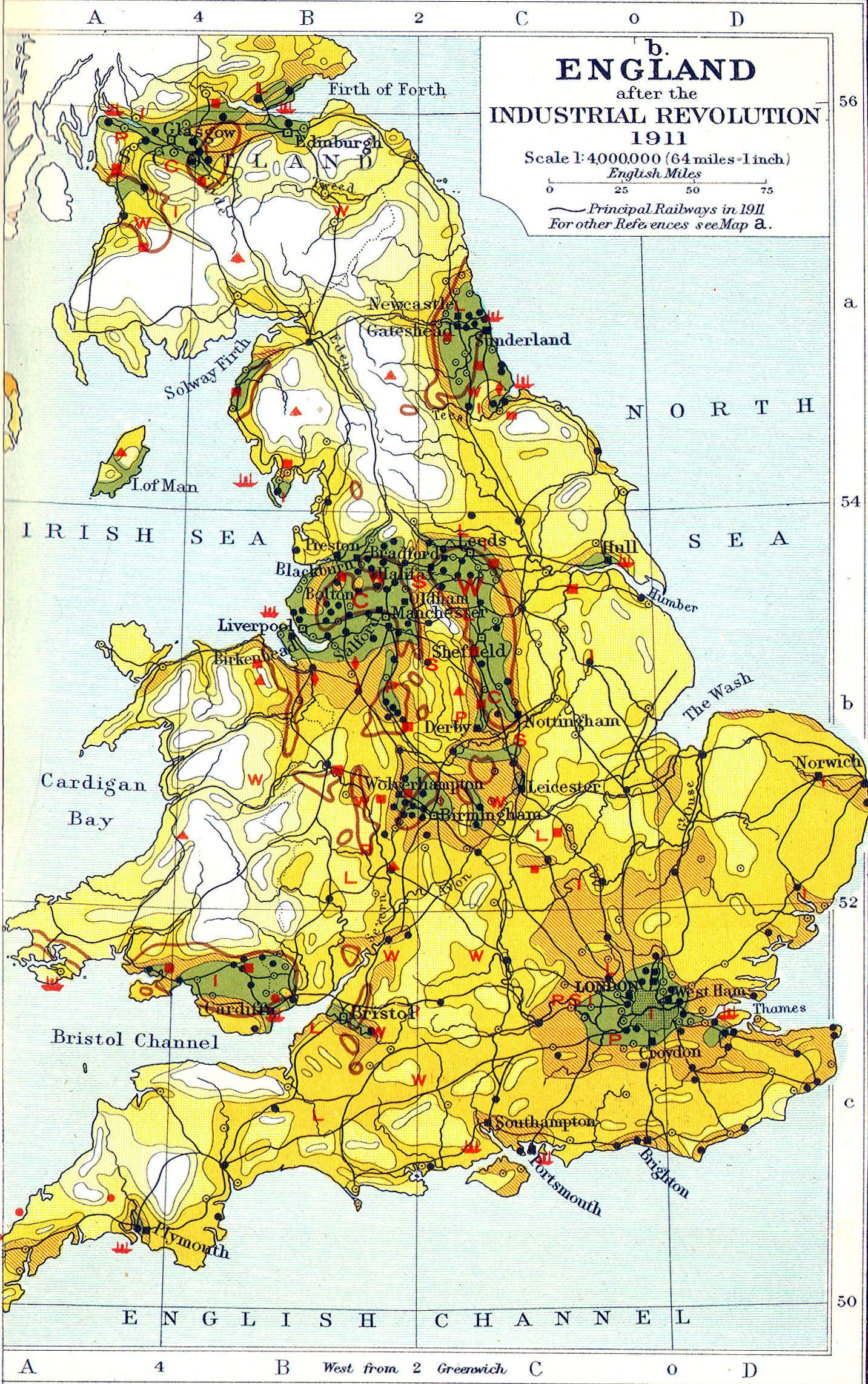 Population Density, 1911
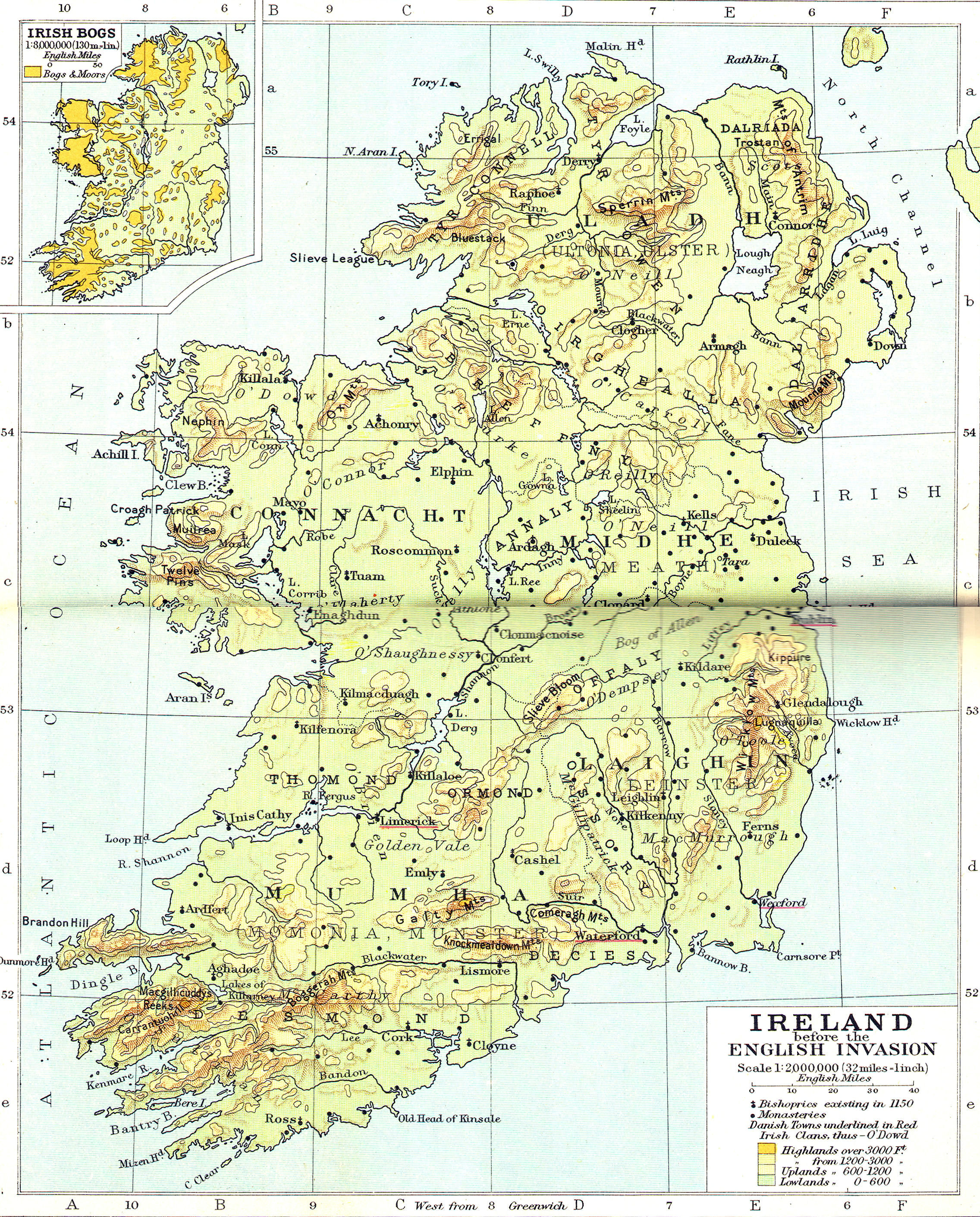
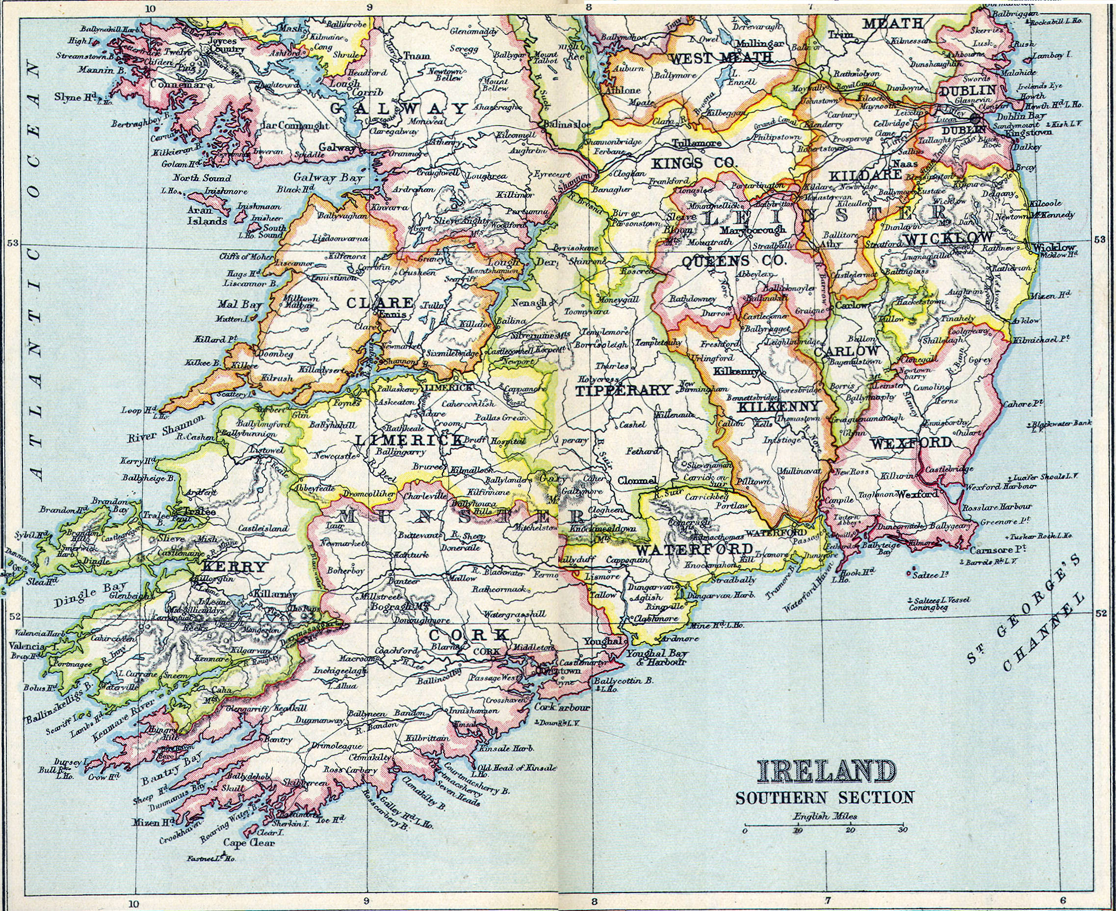
 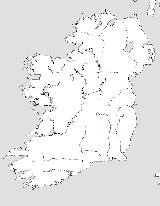 Ireland—Outline Map
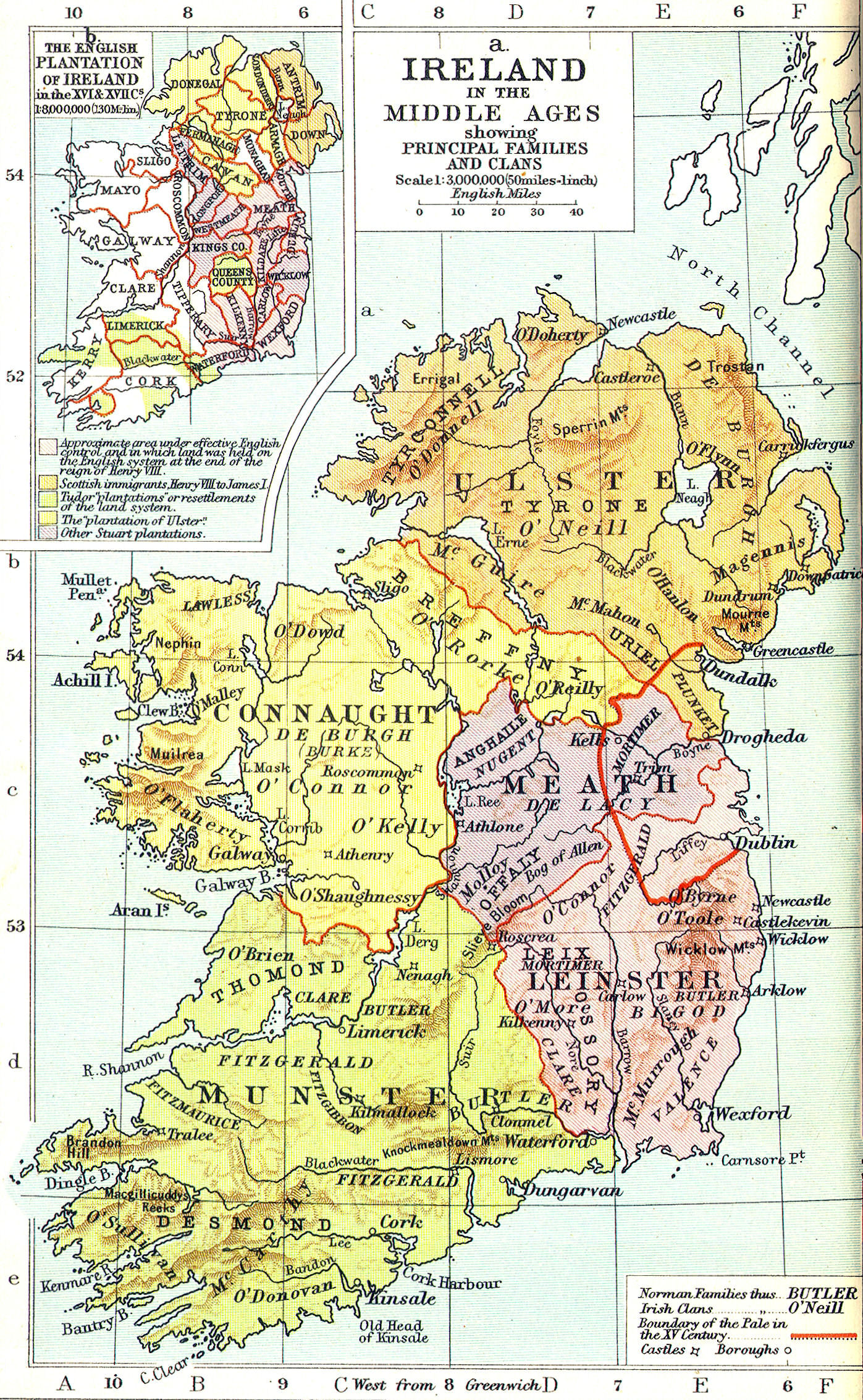
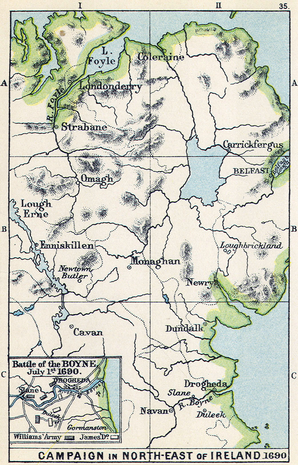
 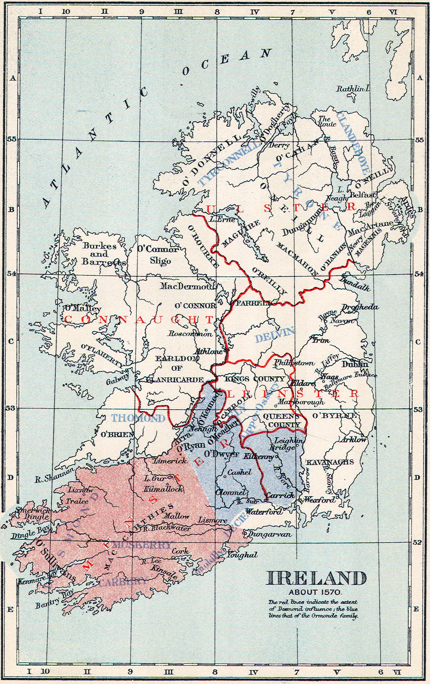 Ireland, Tudor Conquest
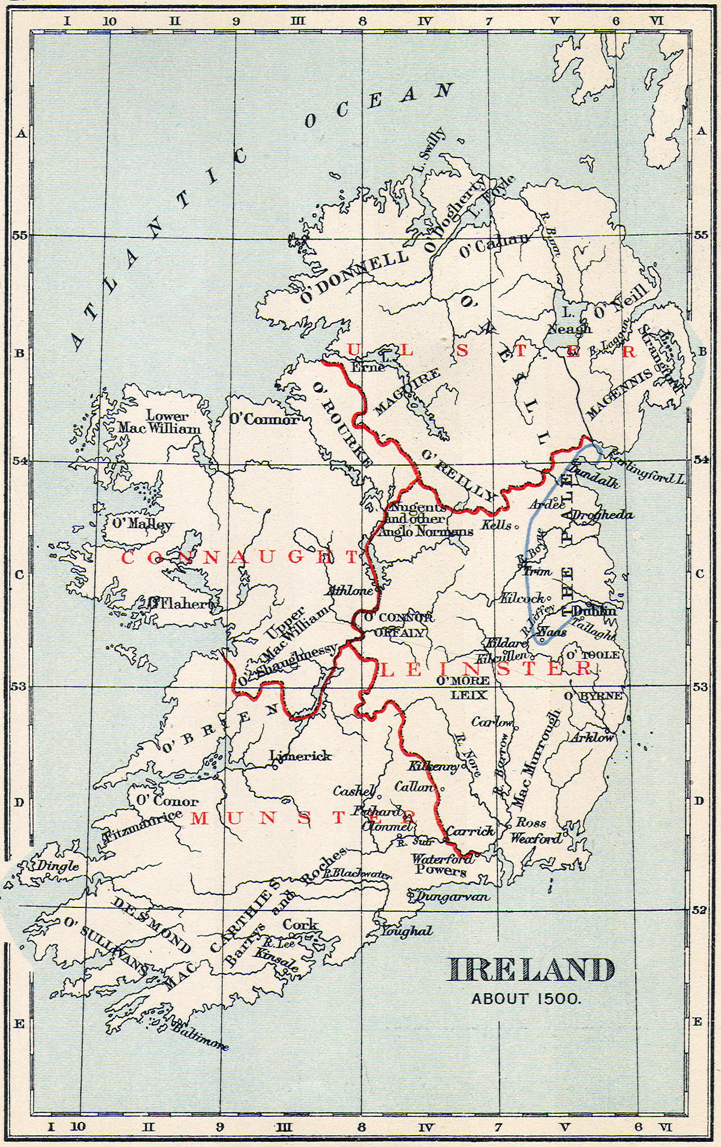
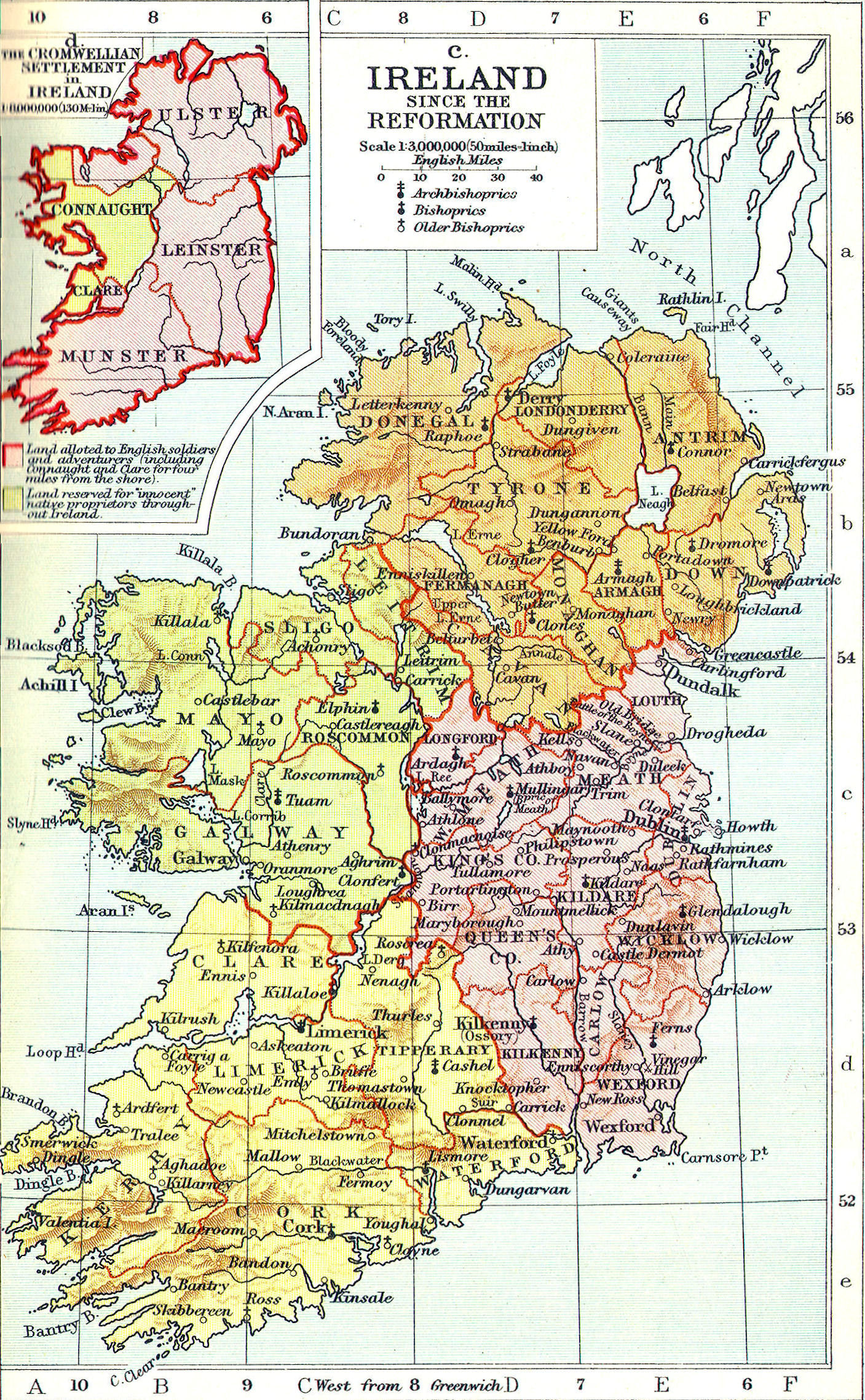
 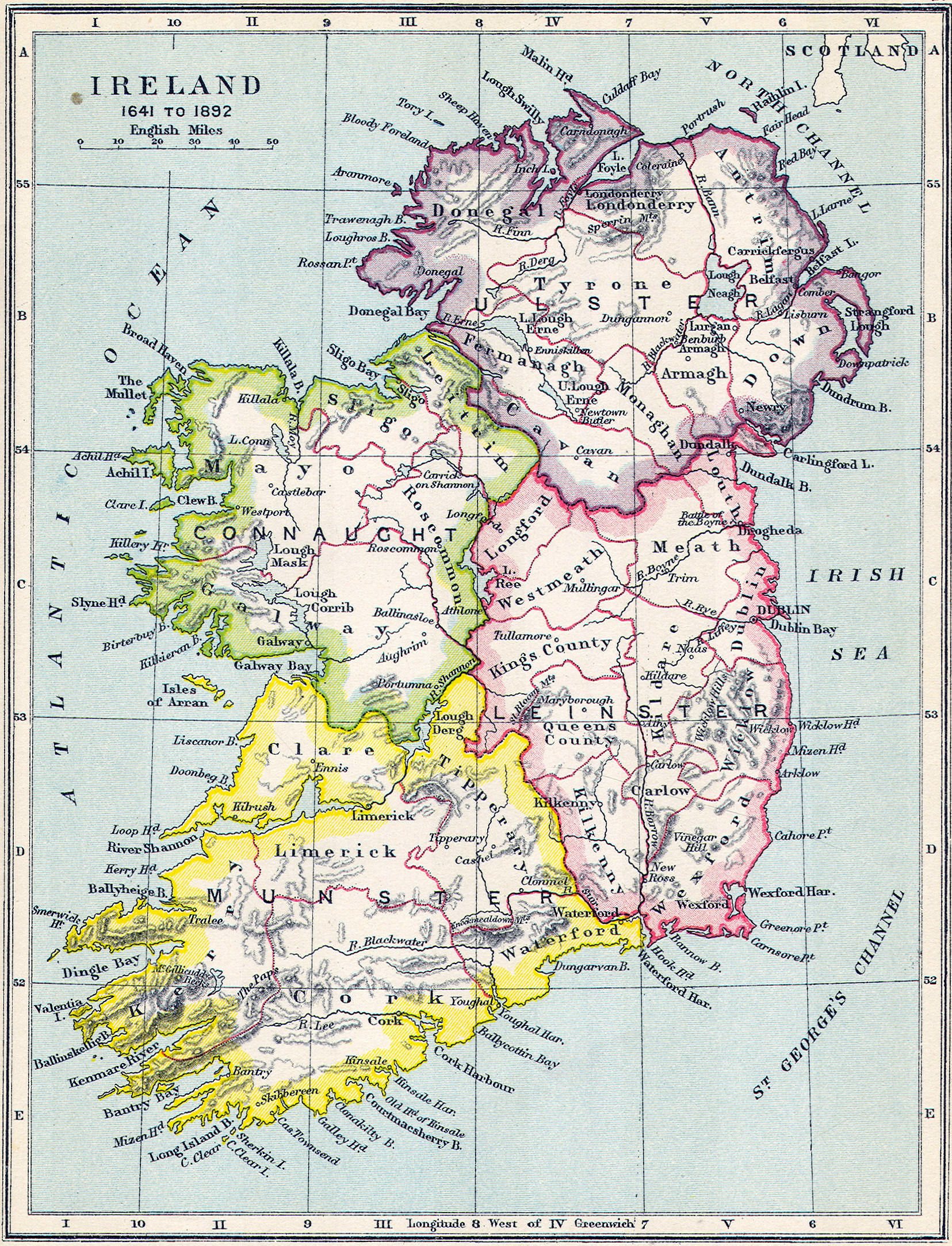 Ireland, 18th & 19th century
  American Colonies—Outline Map
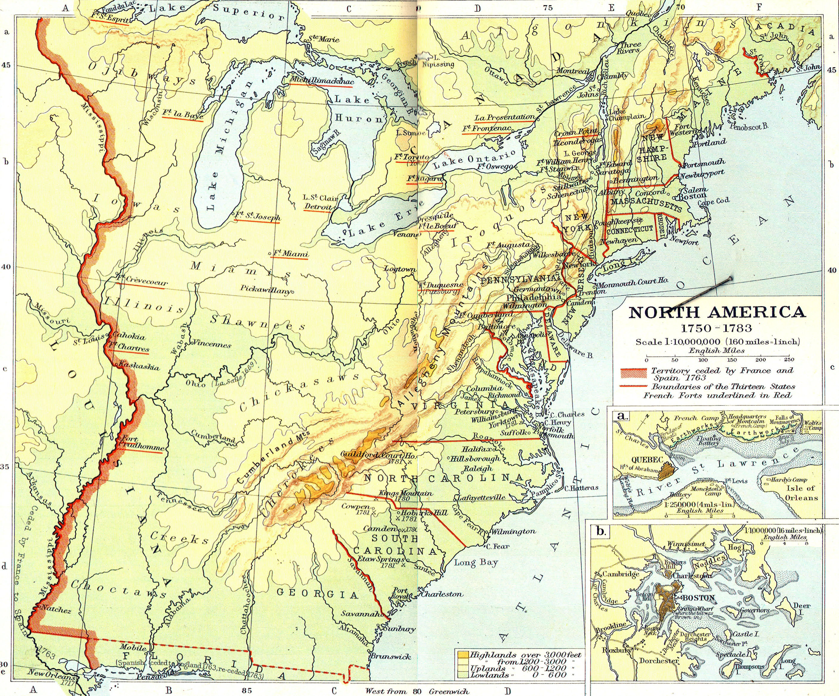
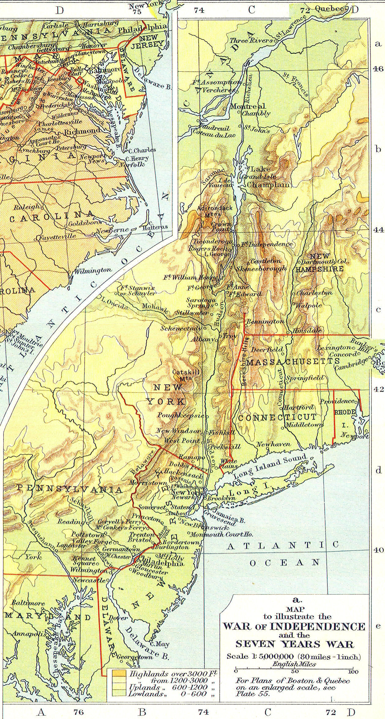
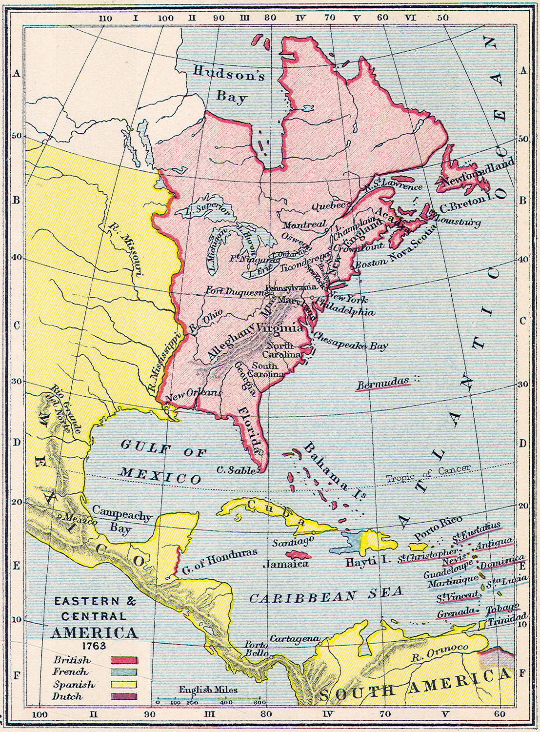
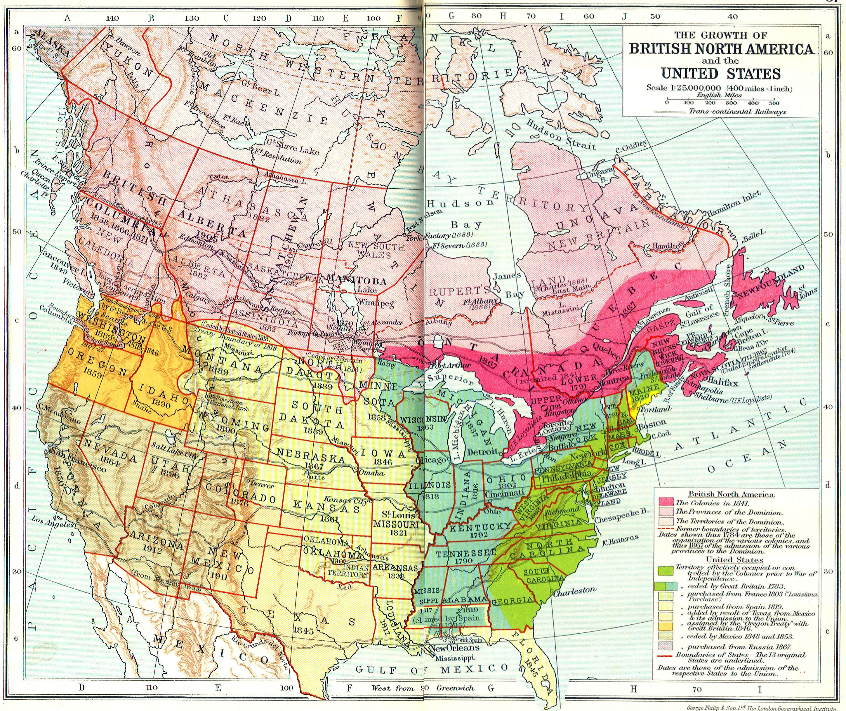
  American Colonies, 1755
 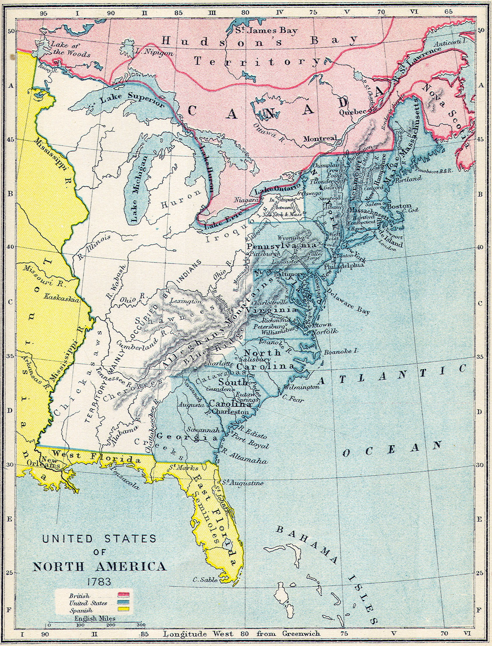 American Colonies, 1783
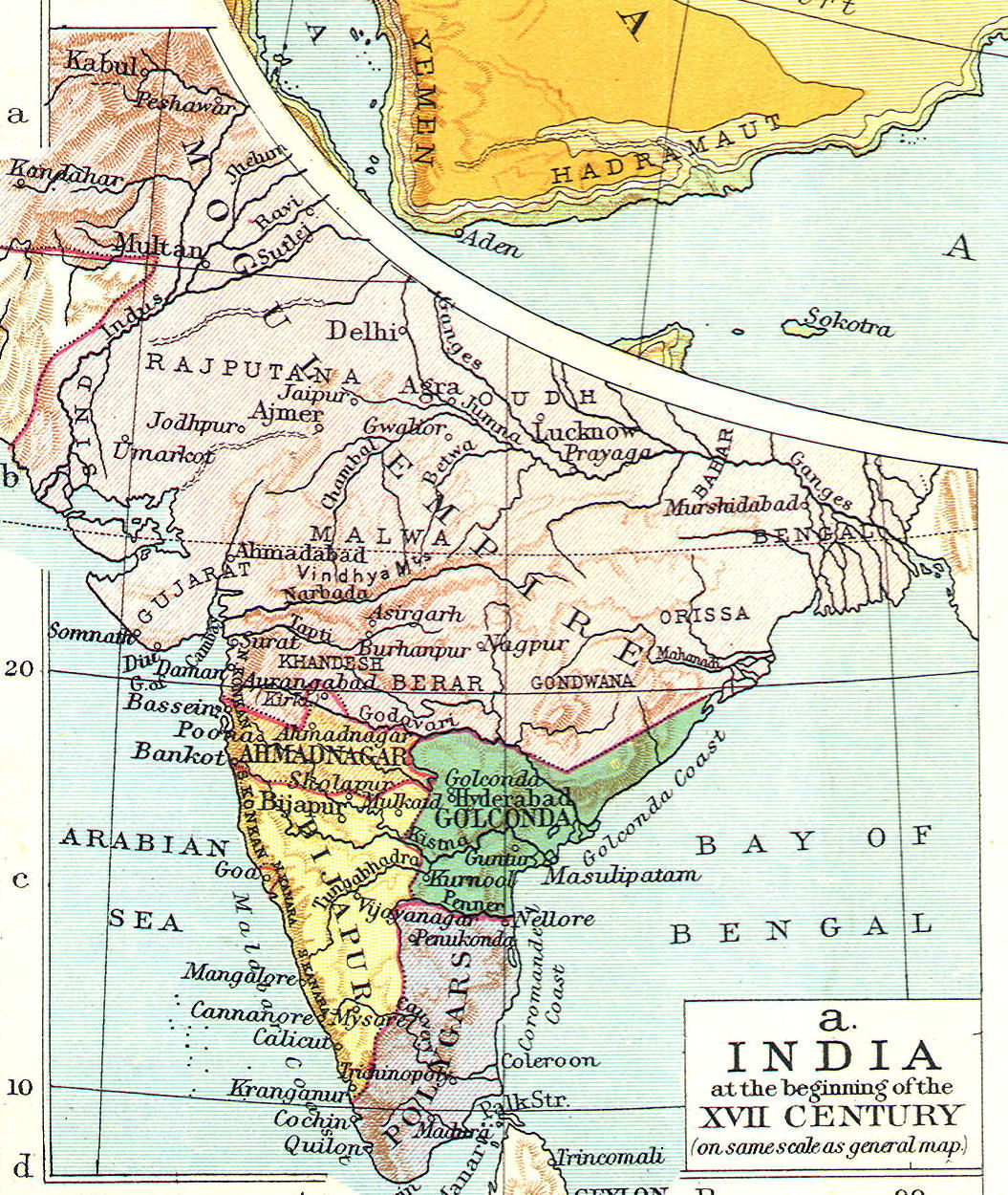
 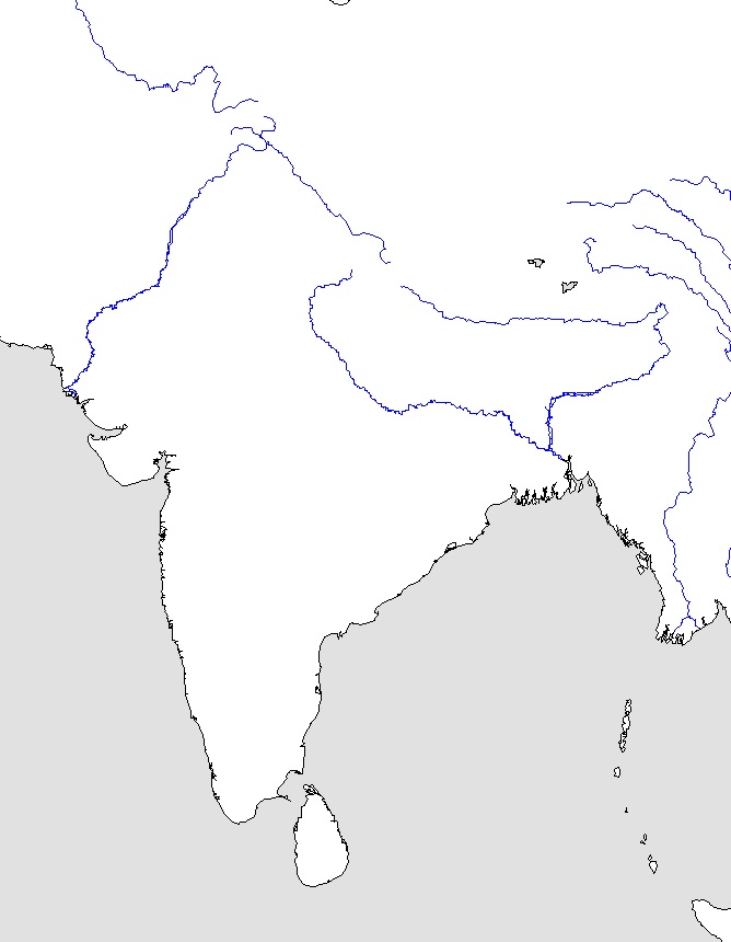 Indian Subcontinent—Outline Map
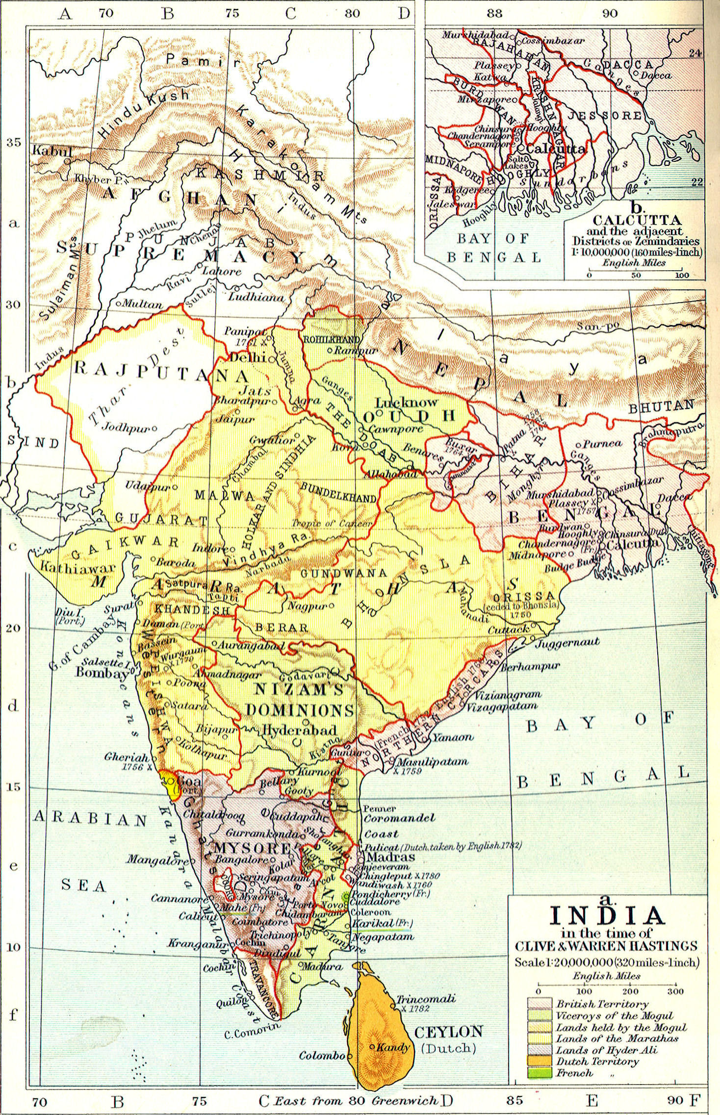
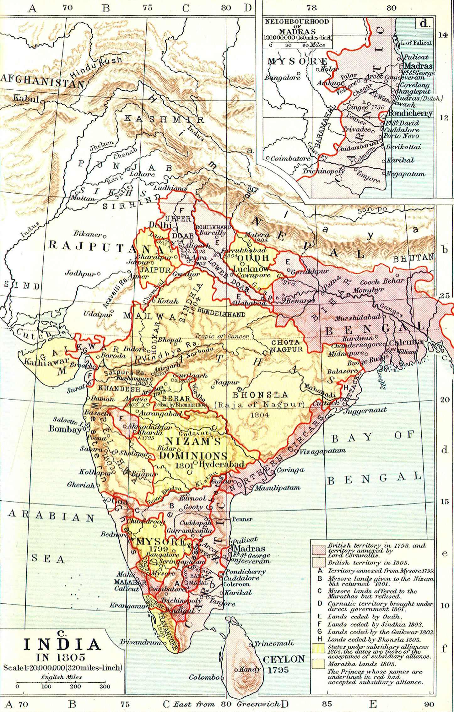
 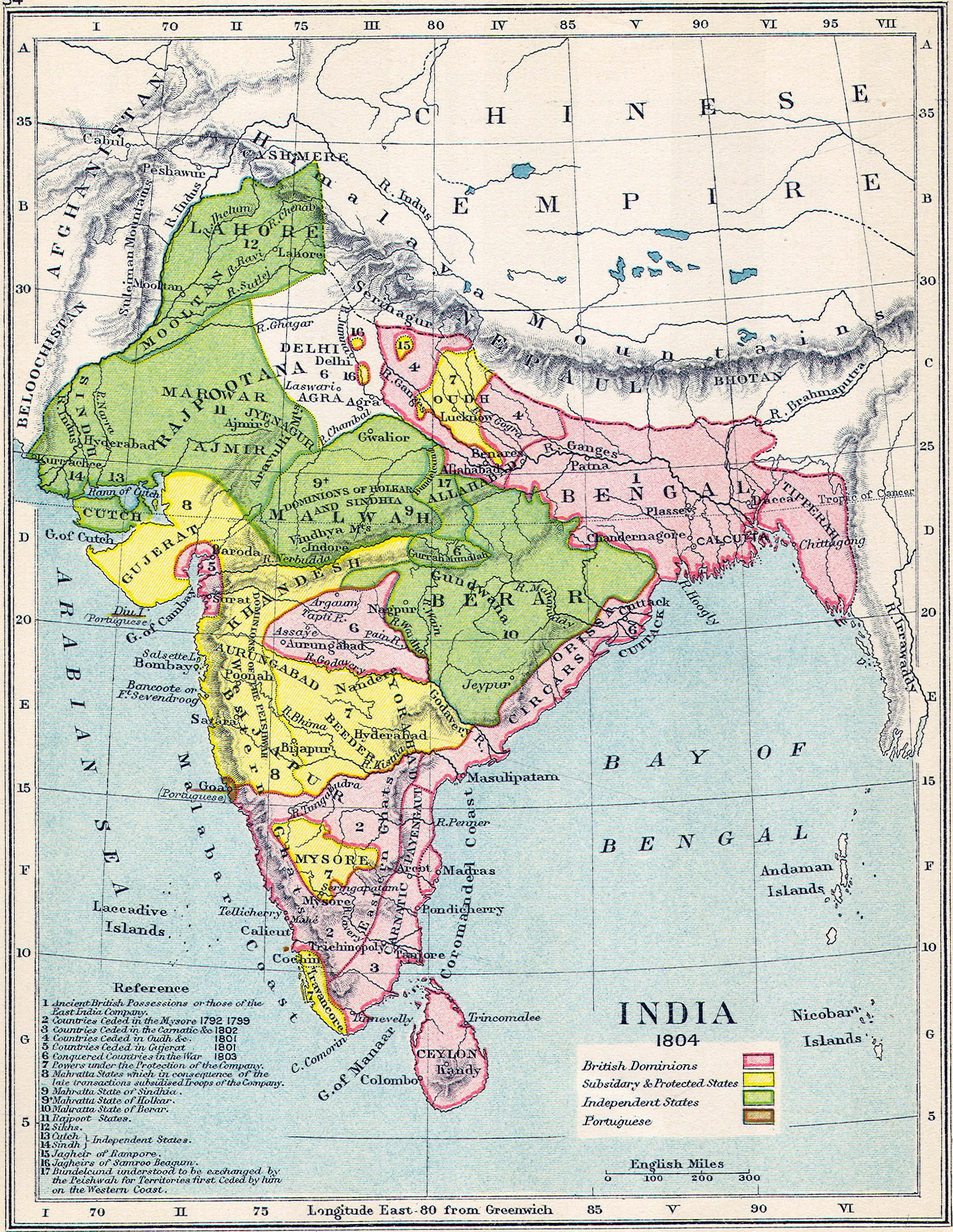 British India, 1804
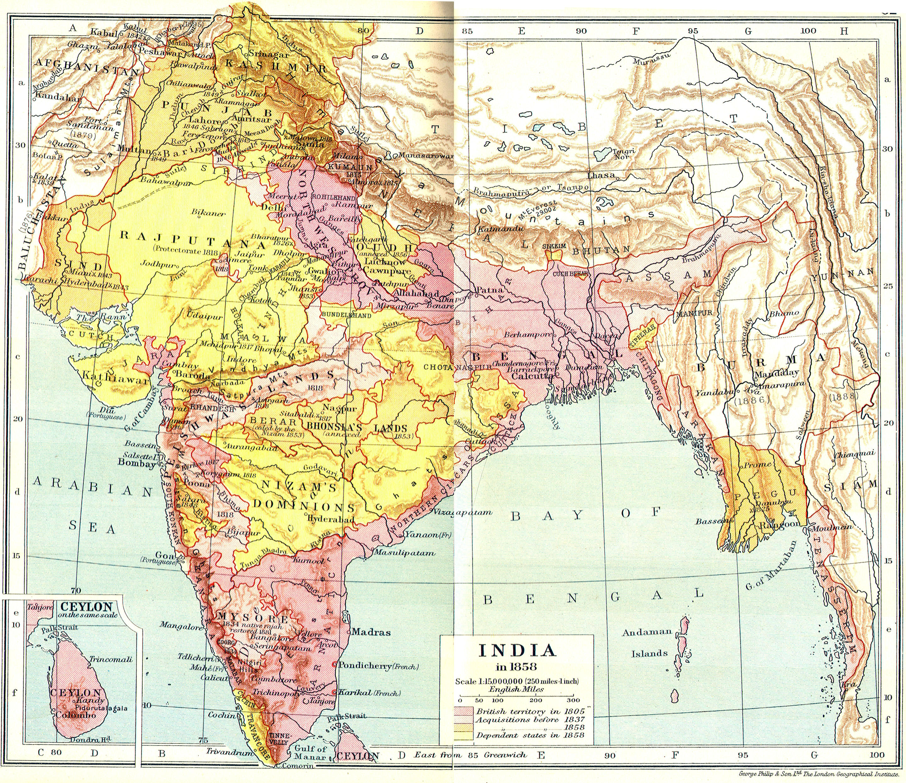
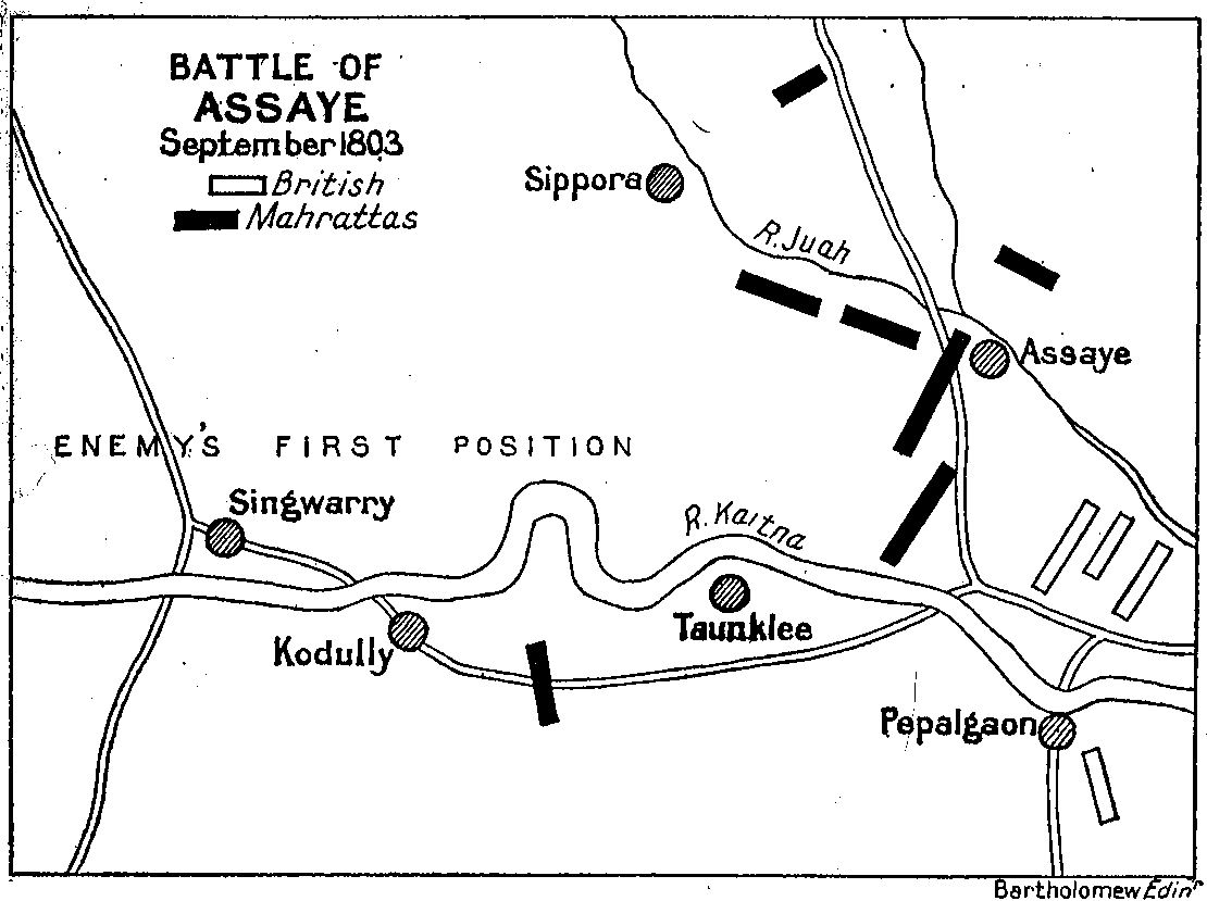
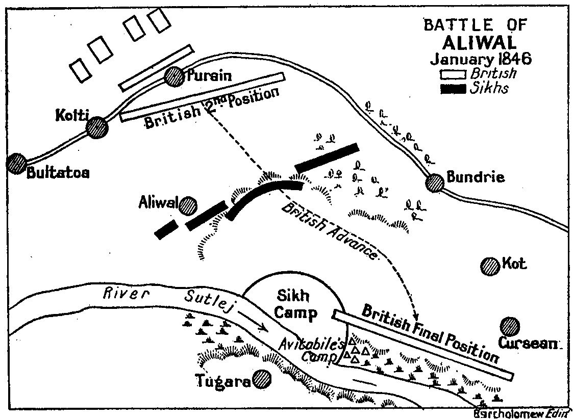
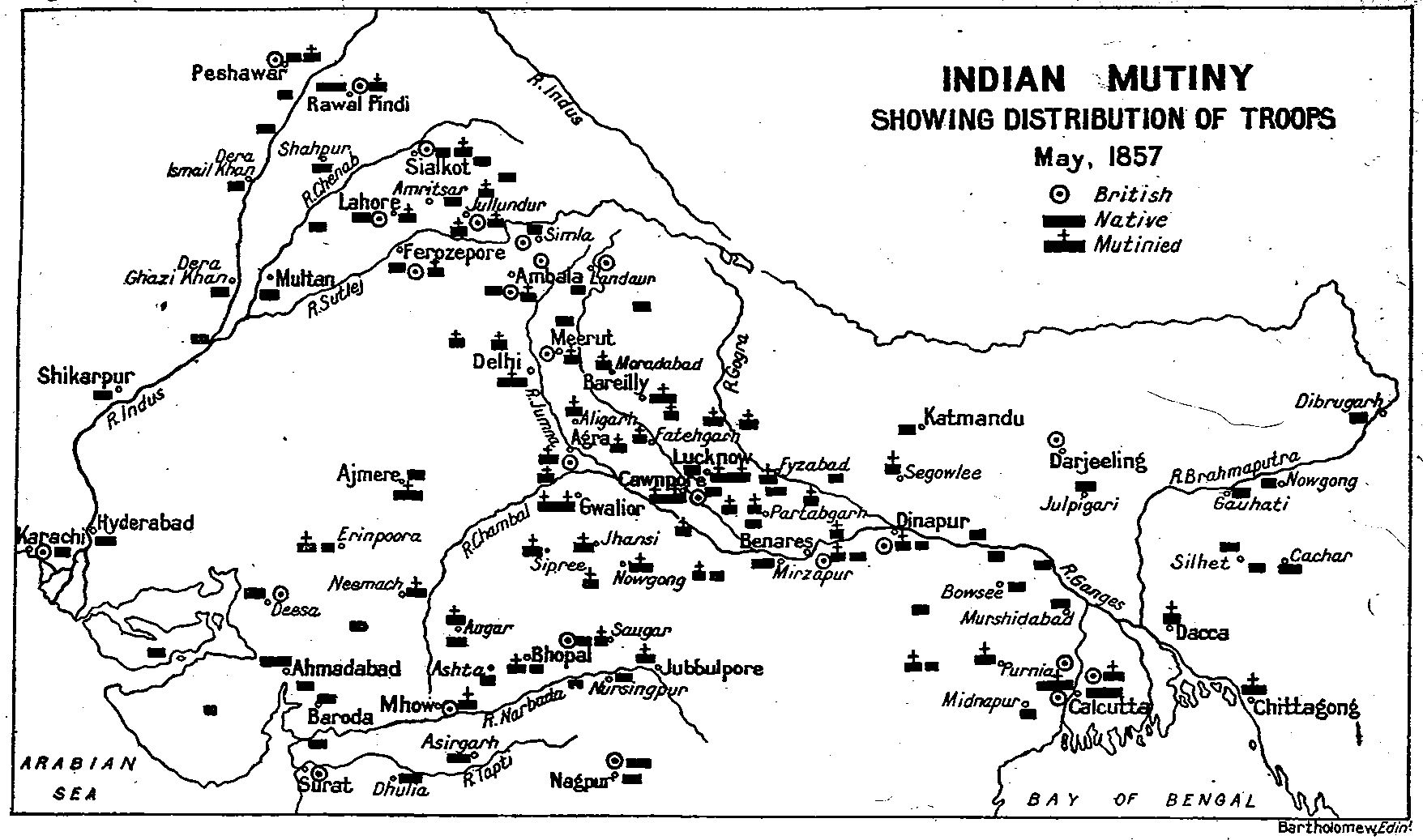
  British India, 1857
 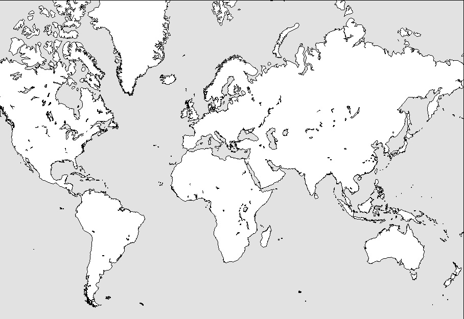 World—Outline Map
  British Empire
 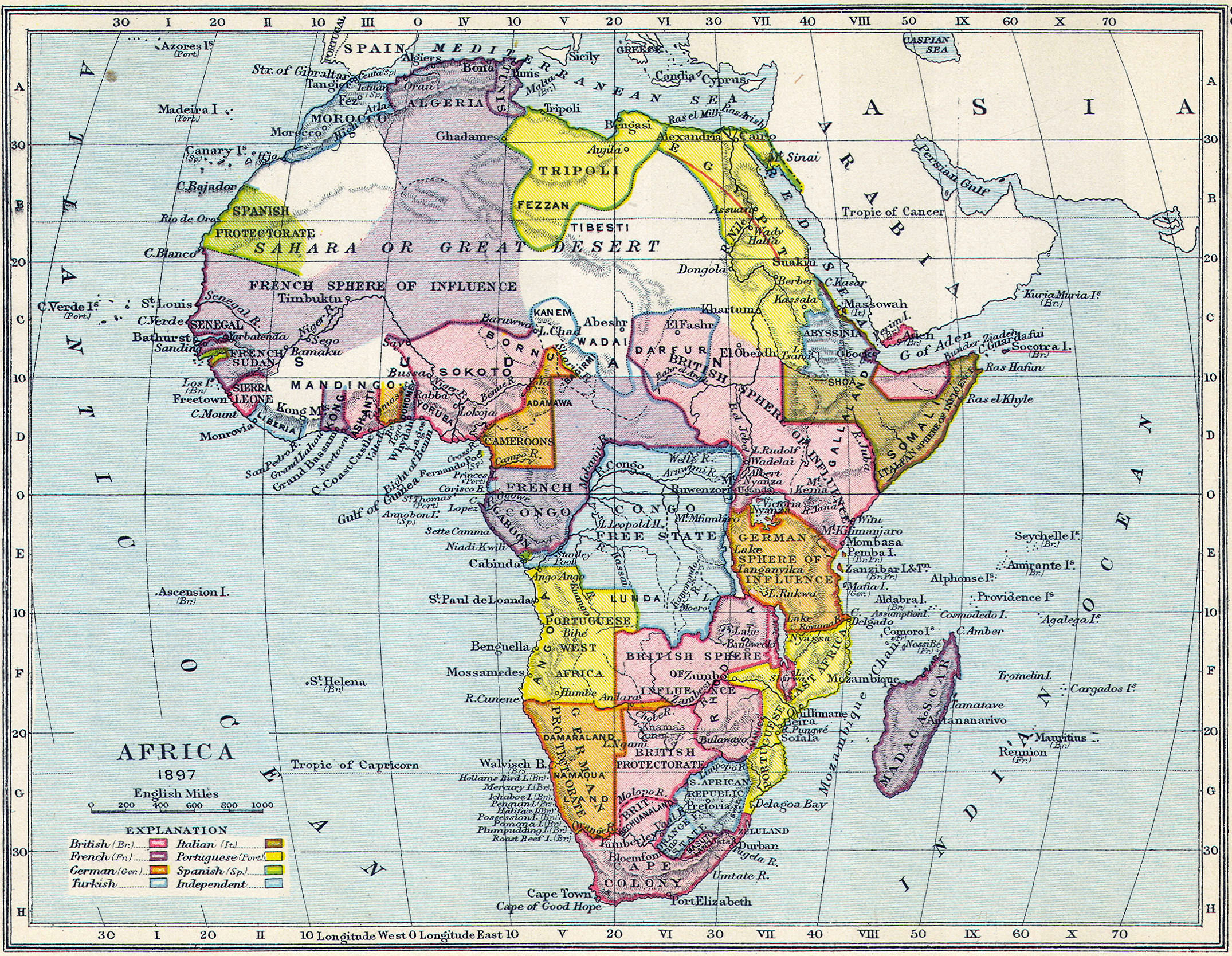 Colonial Africa
 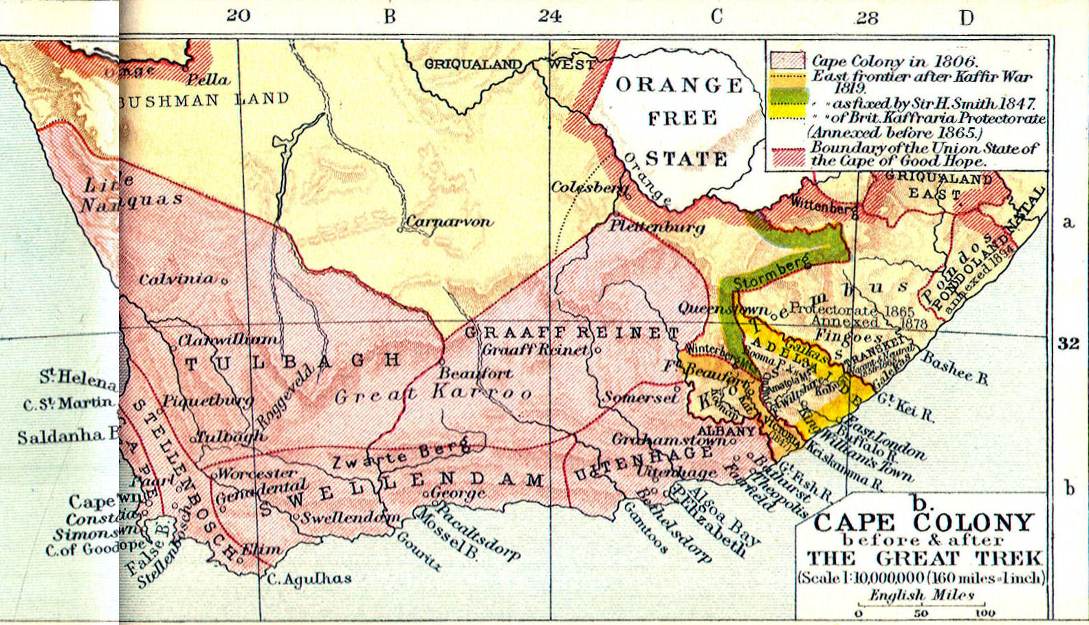 South Africa
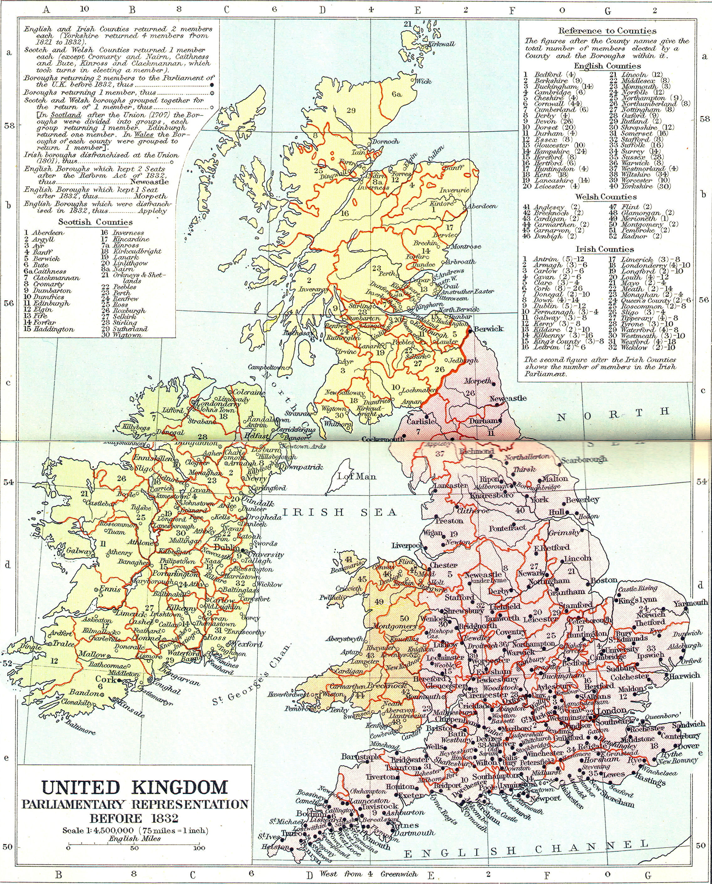