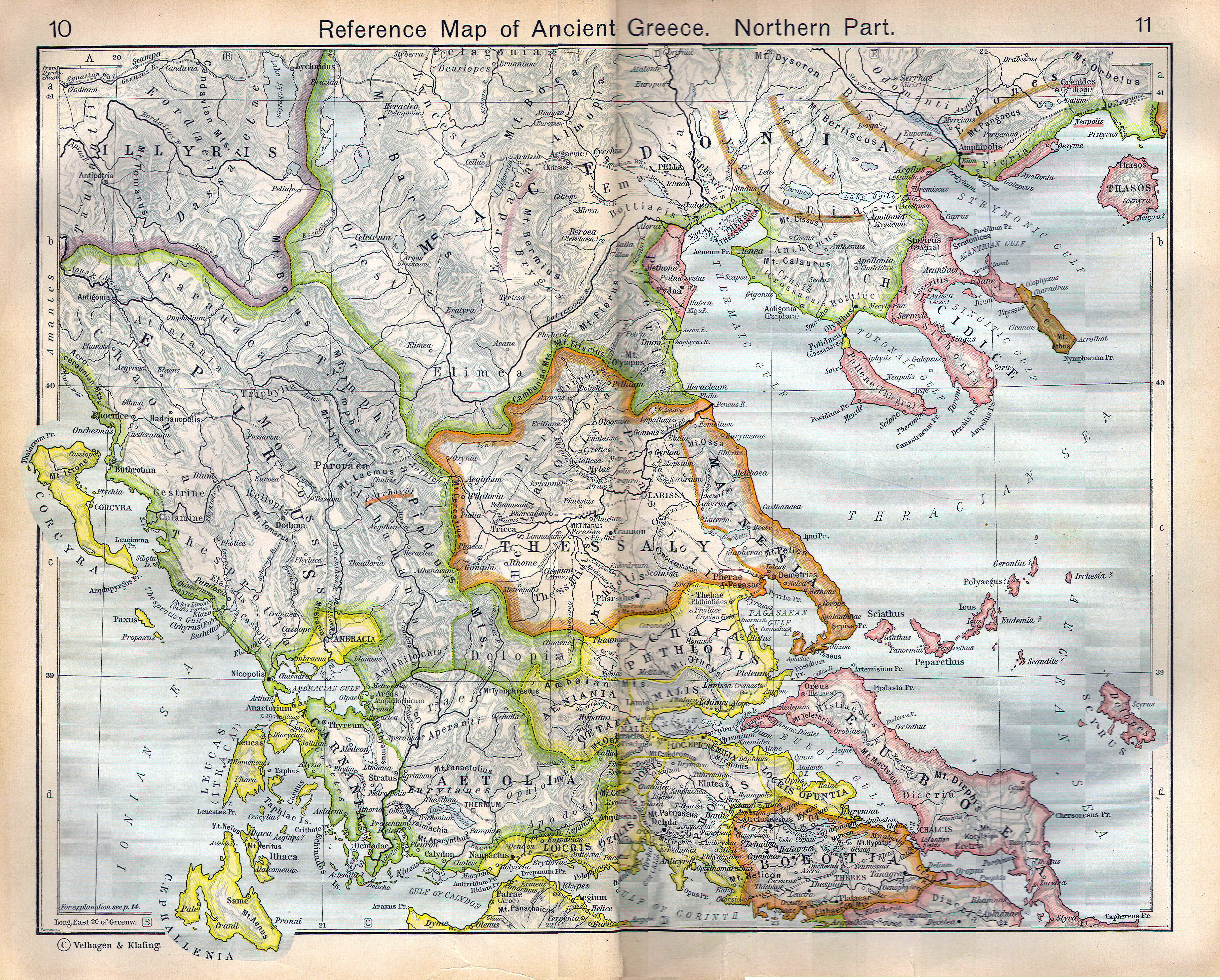
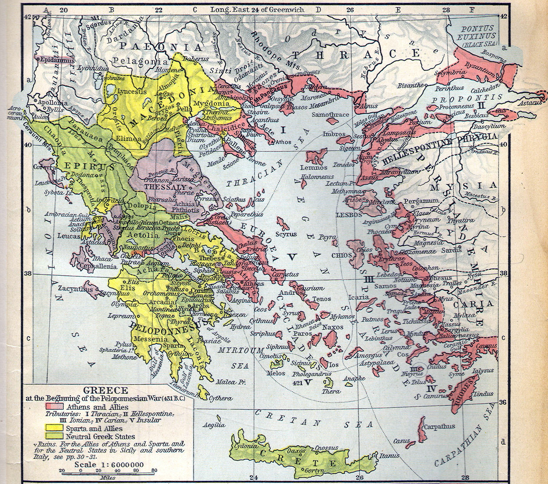
Mainland Greece
City States: Sparta, Athens, Thebes, Olympia, Delphi, Corinth, Argos
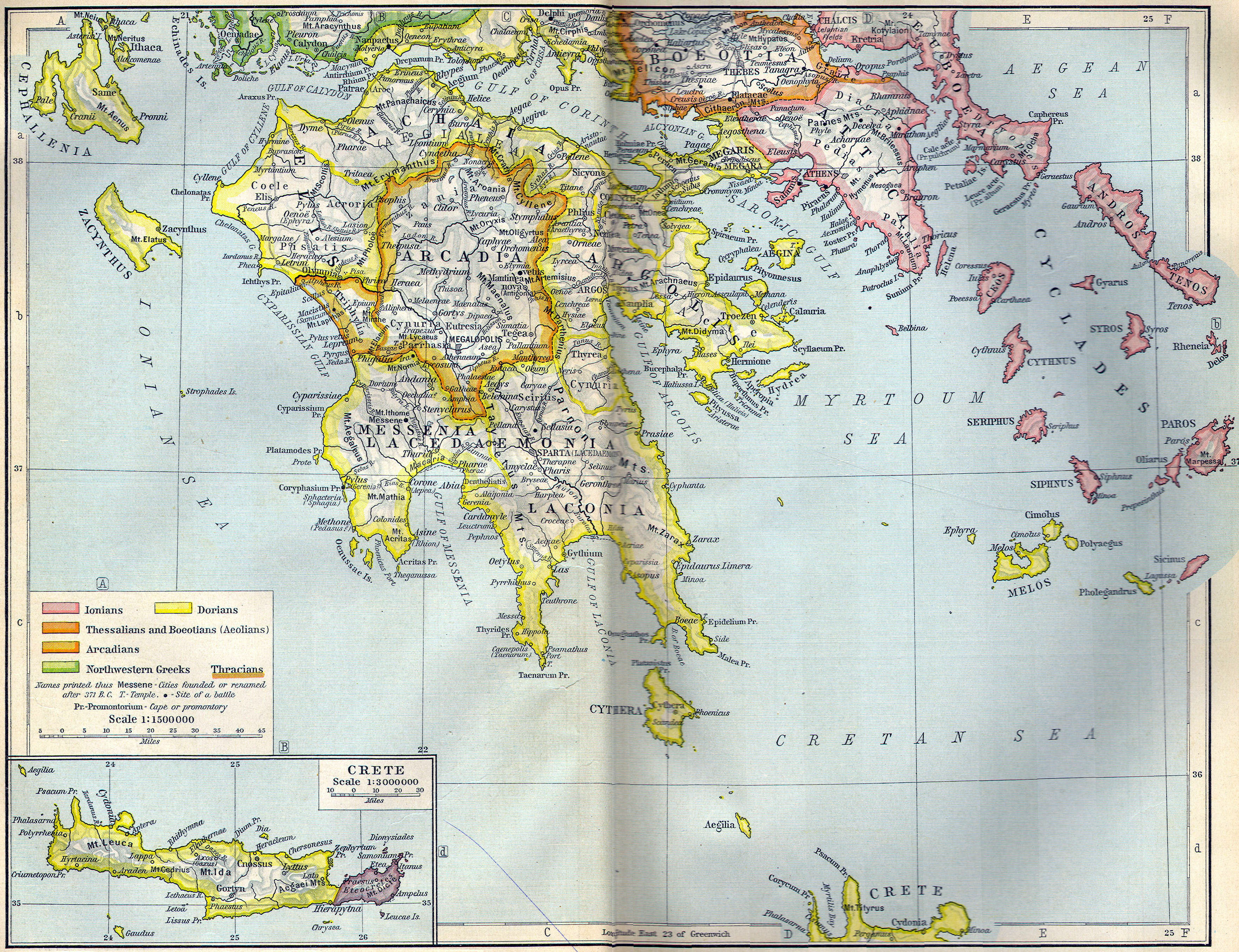
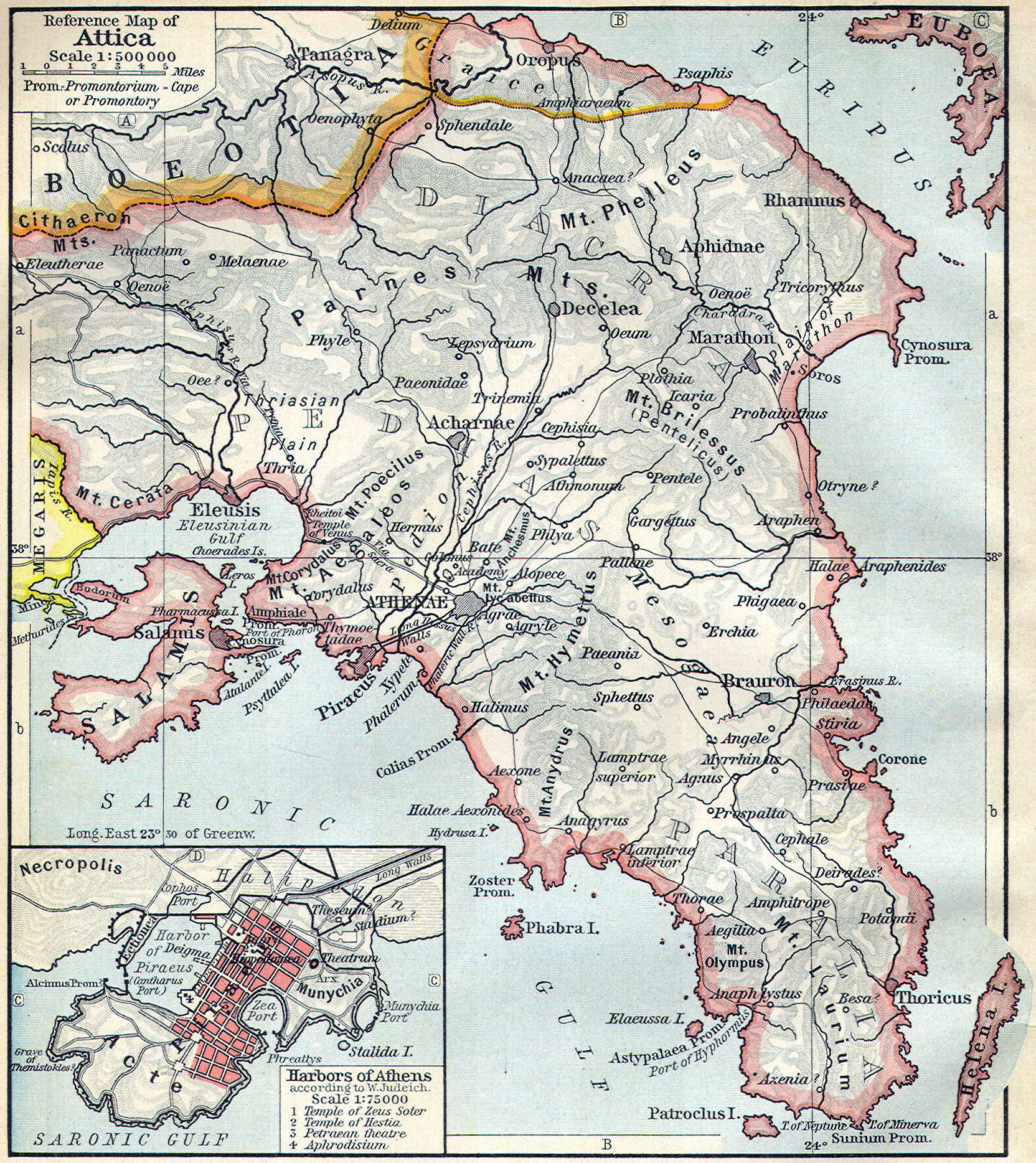
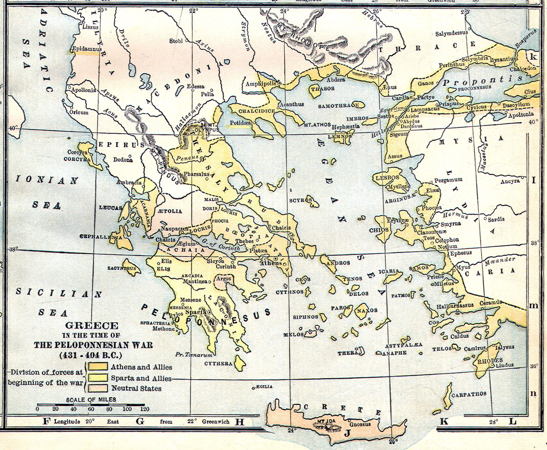
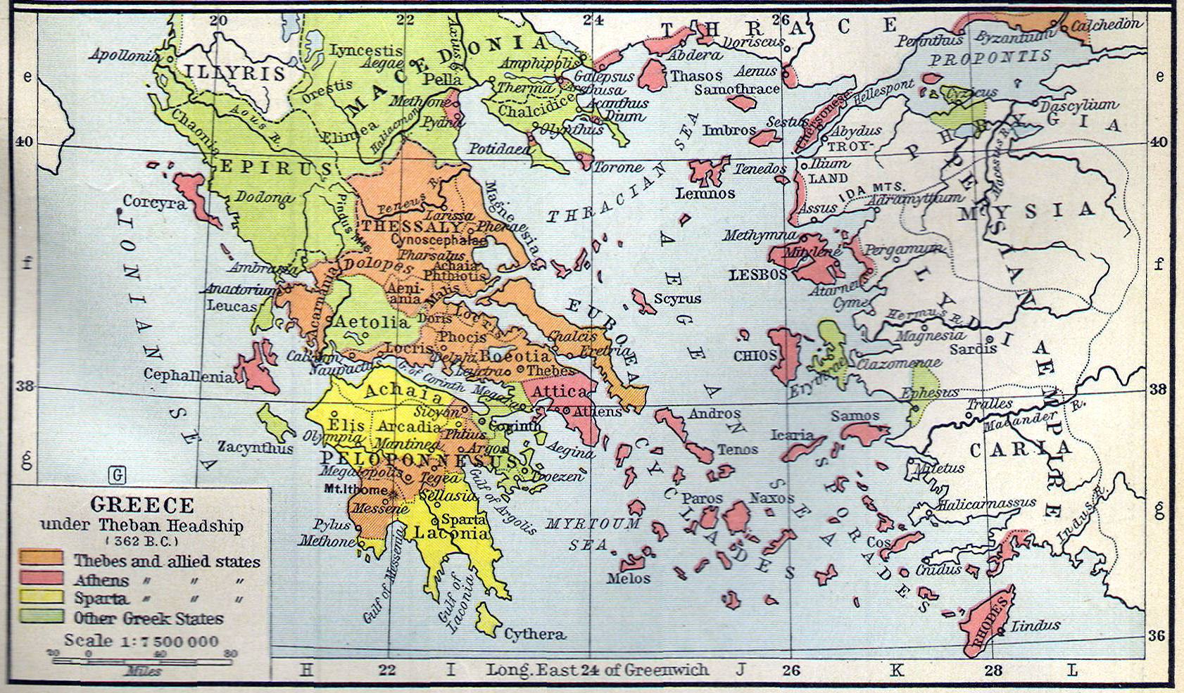
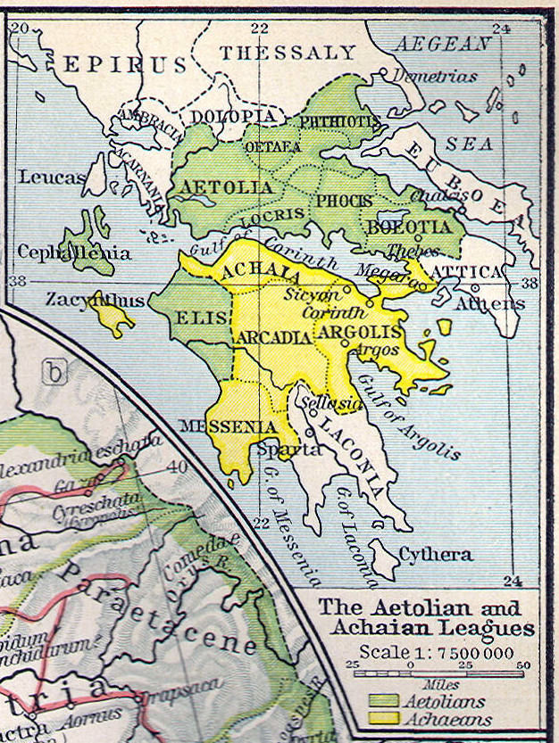
Regions: Lacedaemonia (Laconica), Attica, Boeotia, Argolis, Peloponnese
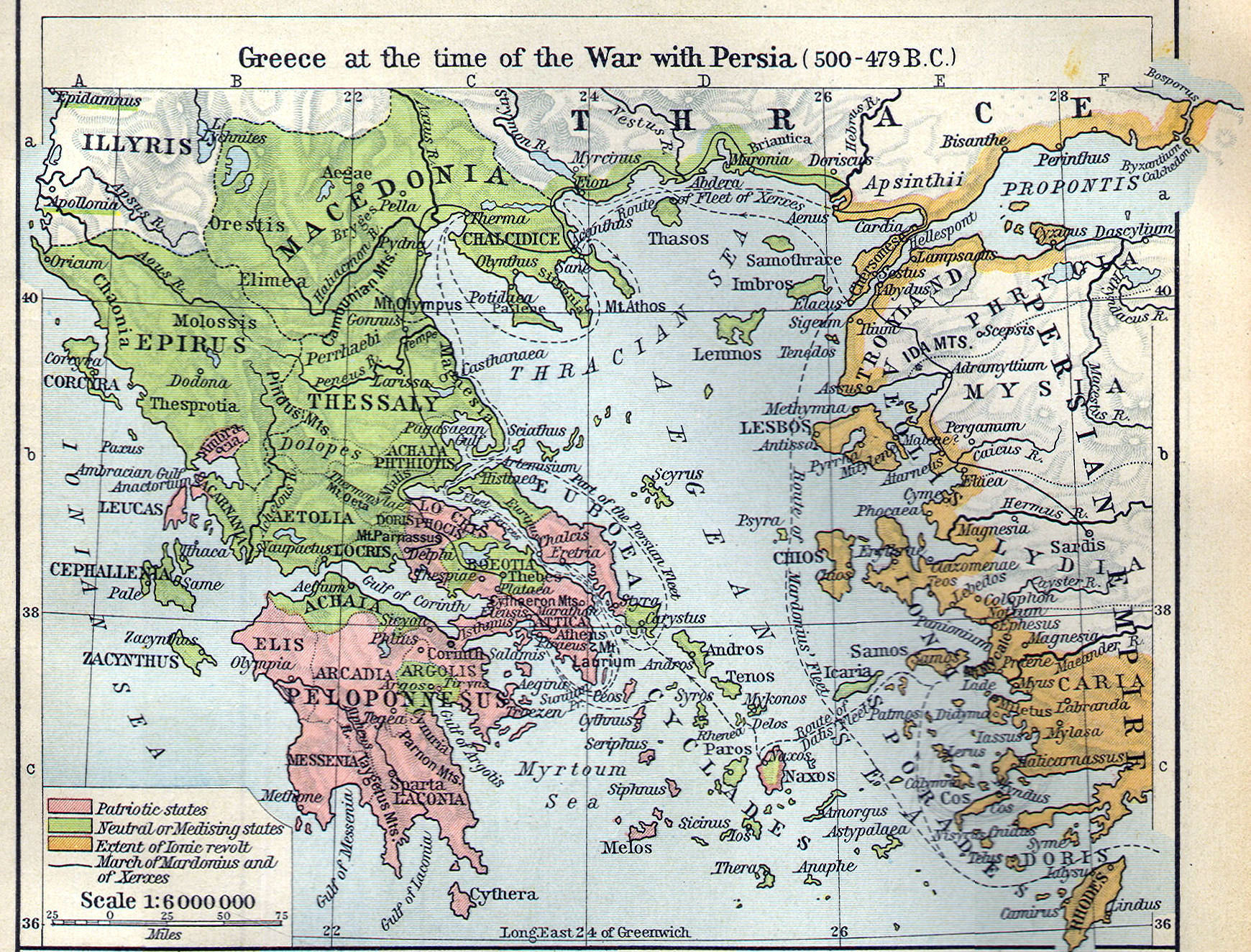
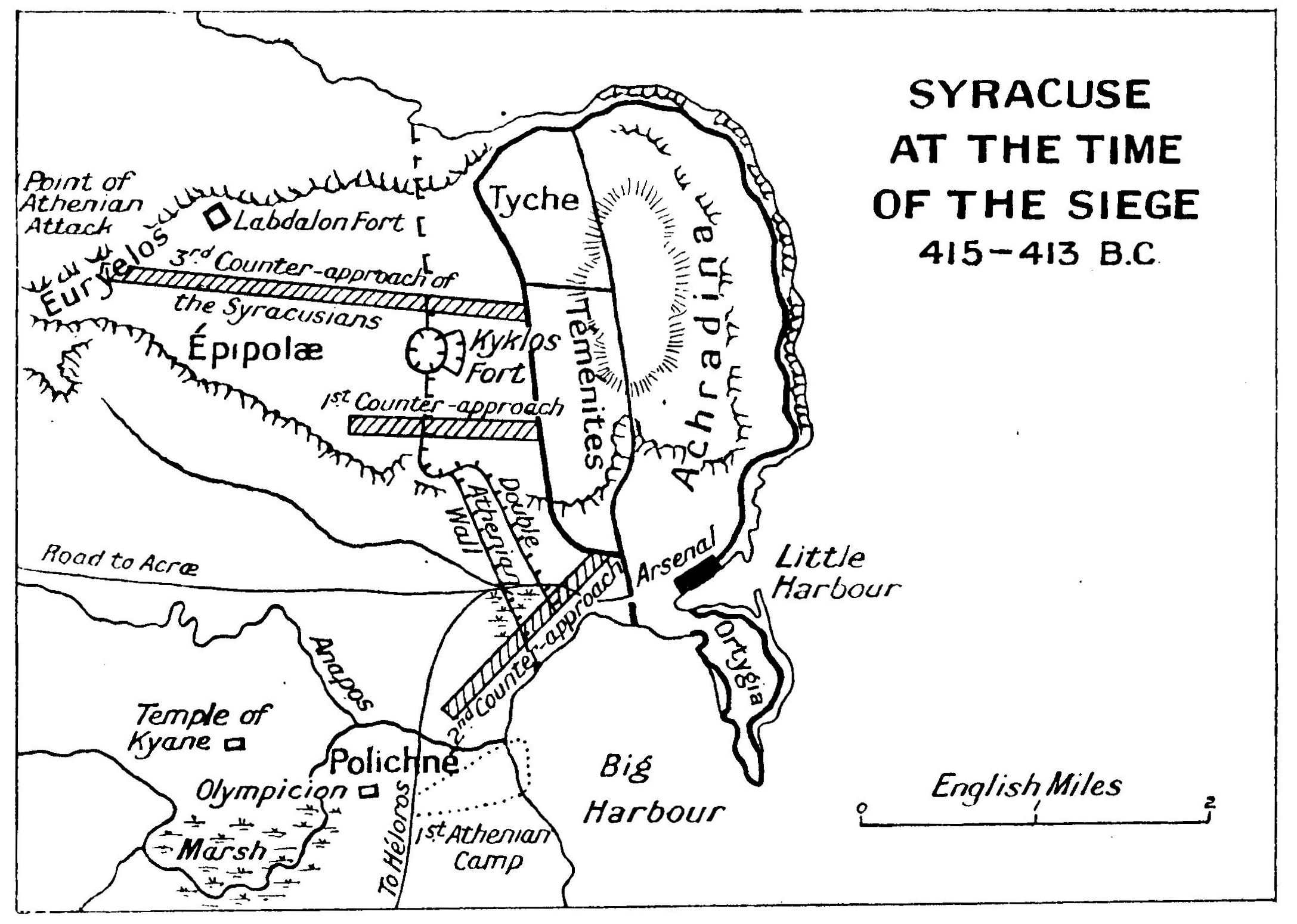
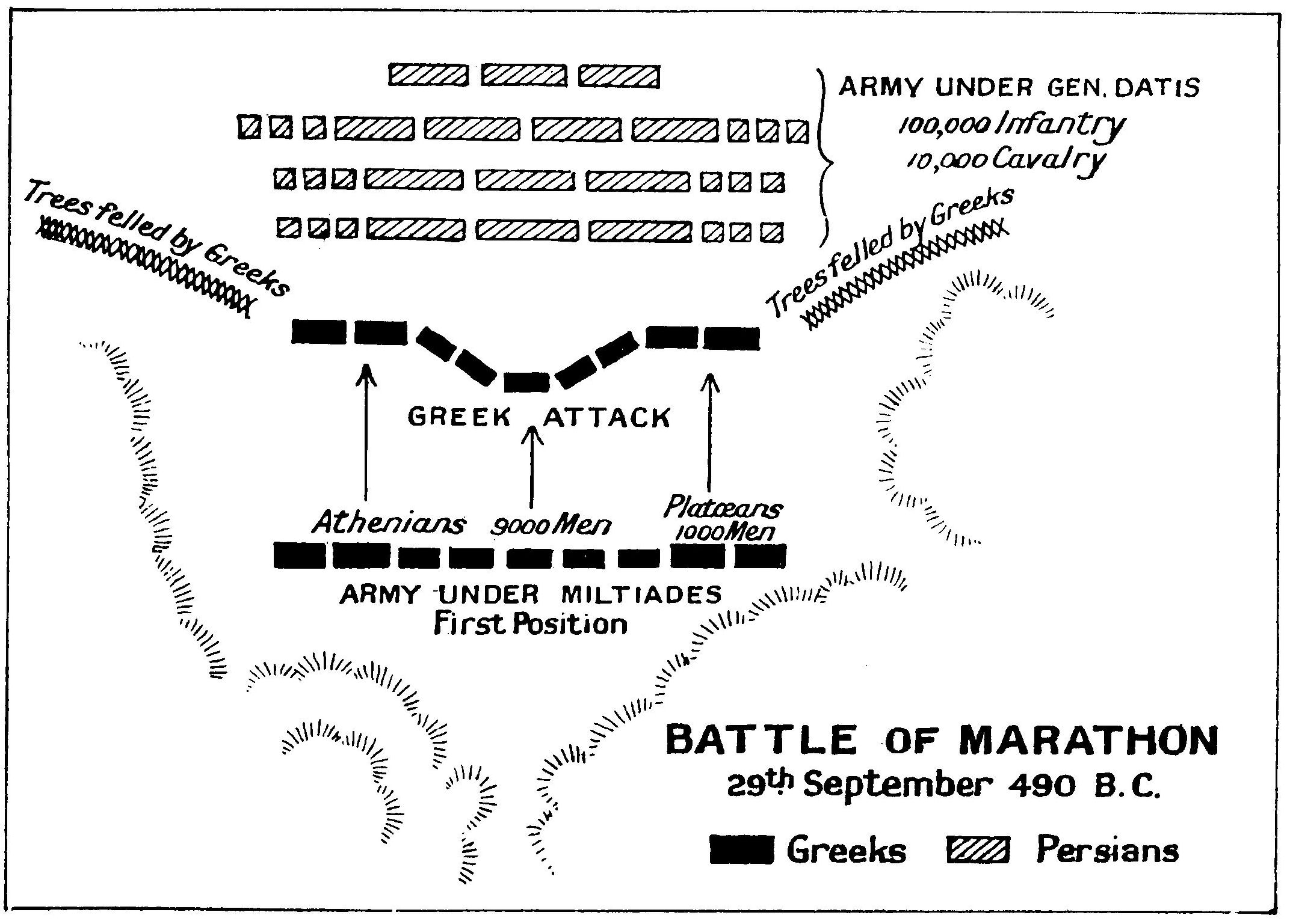
Battles: Salamis, Marathon, Plataea
Water Bodies: Gulf of Corinth
Mountains: Parnassus
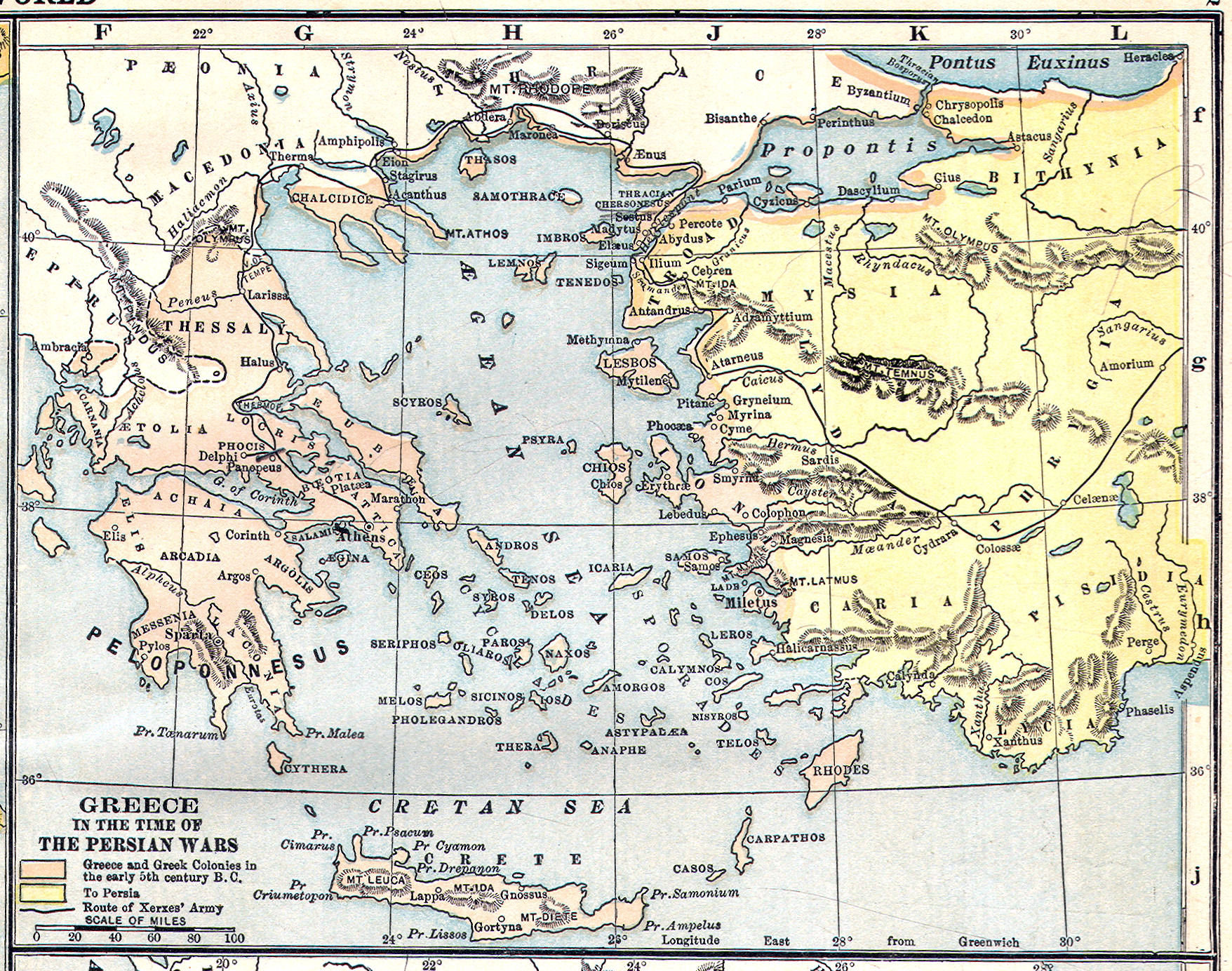
Greater Greece/Asia Minor:
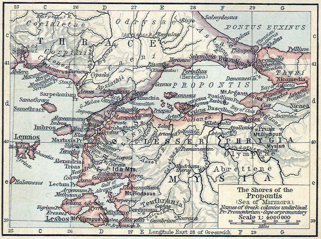
Cities: Pella, Amphipolis, Byzantium, Sardis, Ephesus, Miletus, Halicarnassus
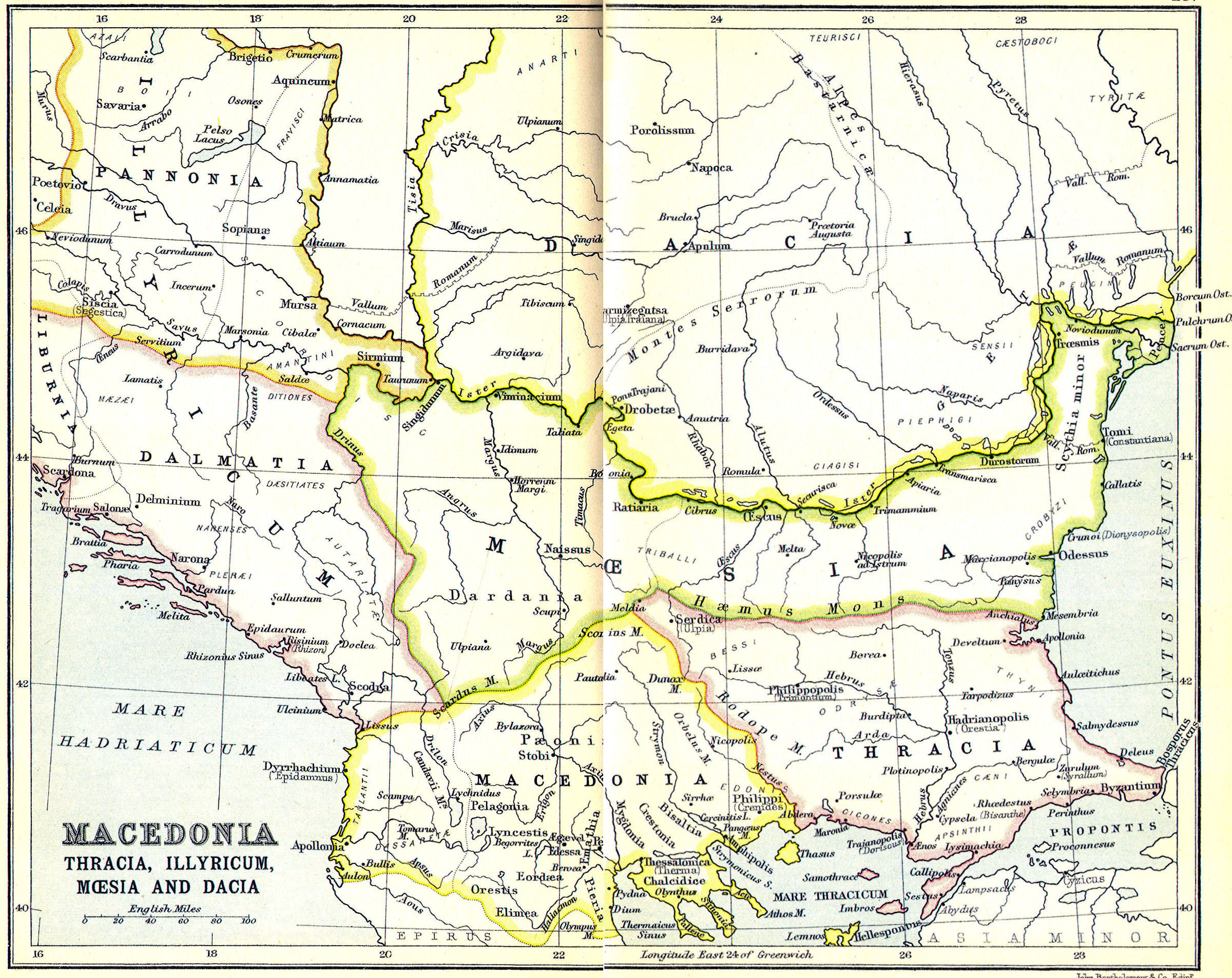
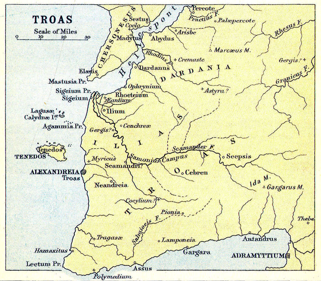
Regions: Thessaly, Macedonia, Thrace, Lydia, Phrygia, Asia Minor
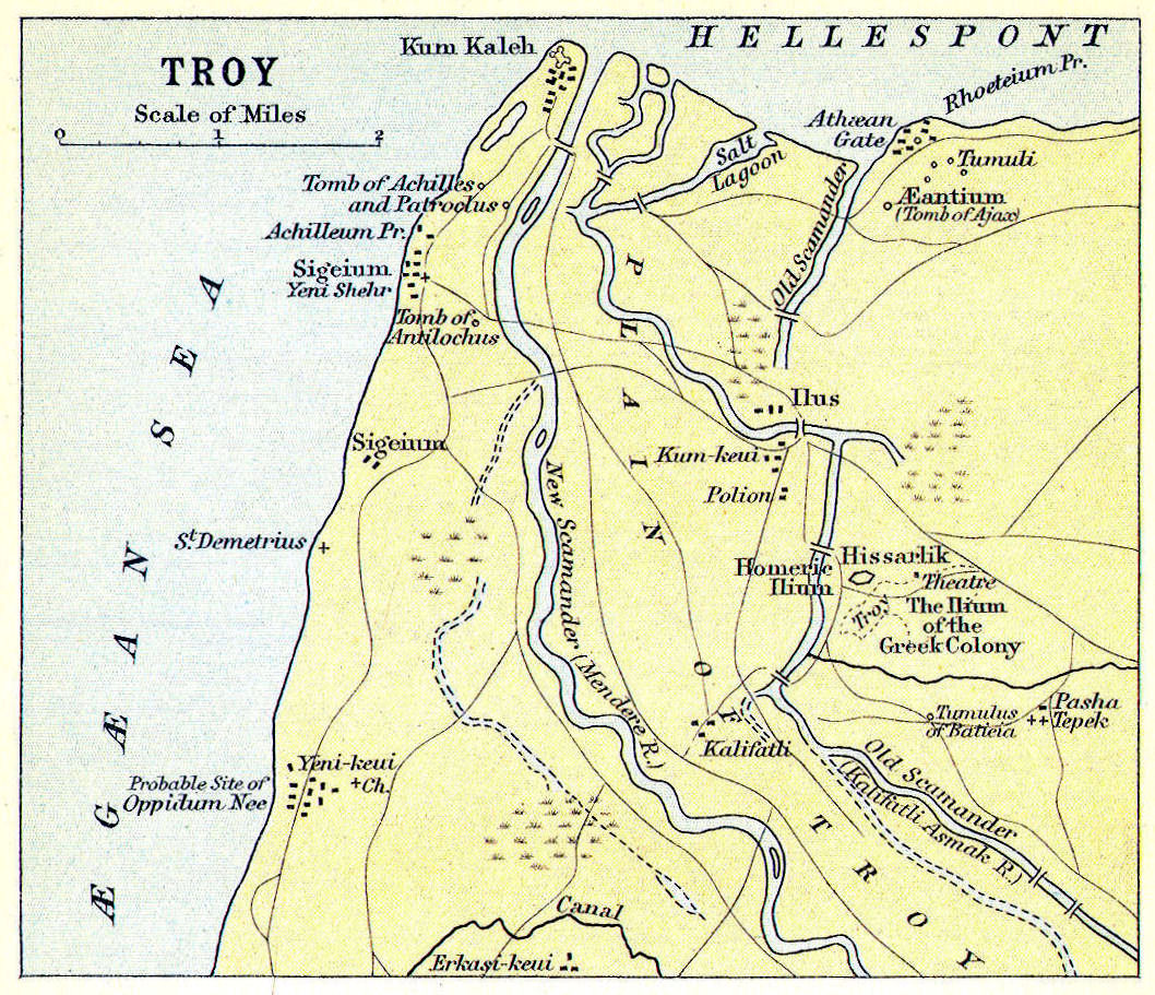
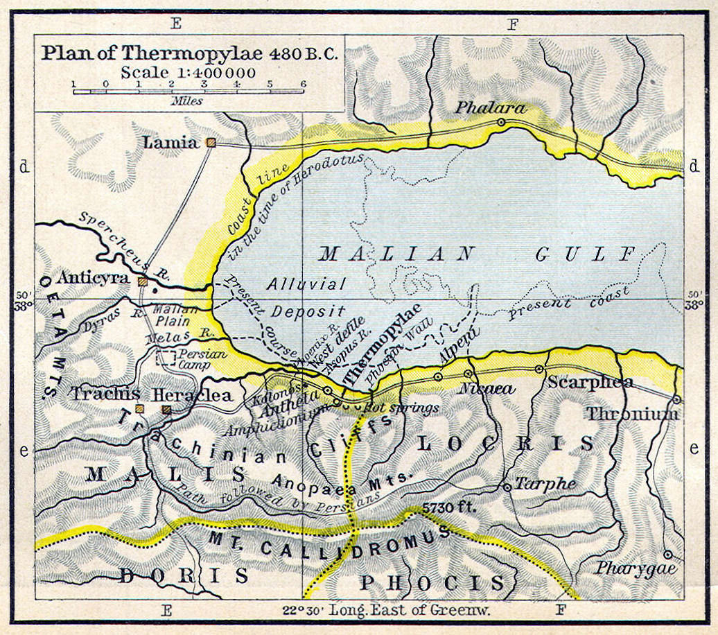
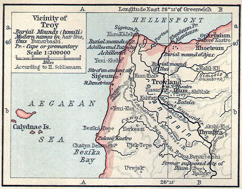
Battles: Troy, Thermopylae, Granicus
Water Bodies: Aegaen Sea, Hellespont, Propontis (Sea of Marmara)
Islands: Delos, Crete, Rhodes, Chios, Lesbos
Mountains: Olympia
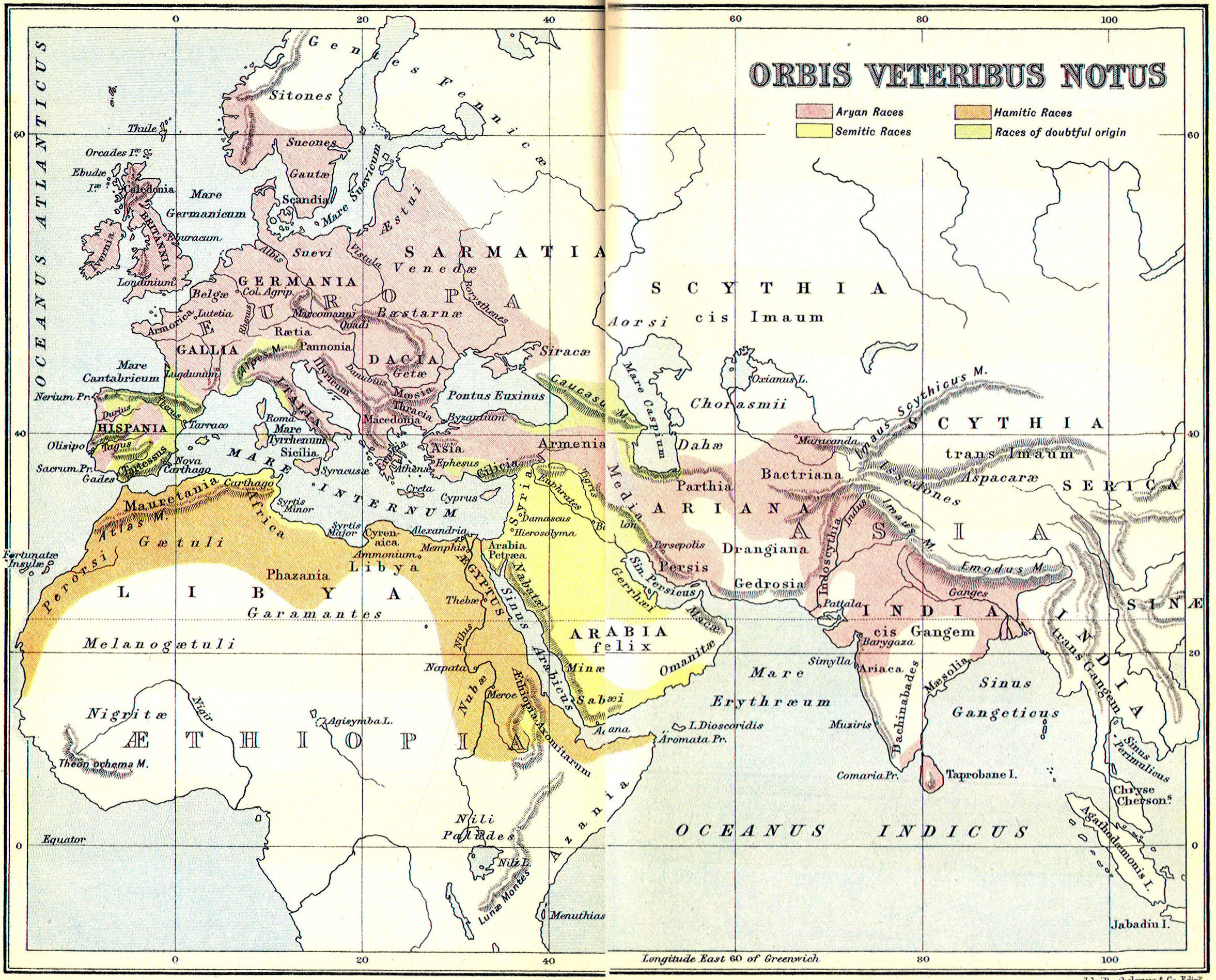
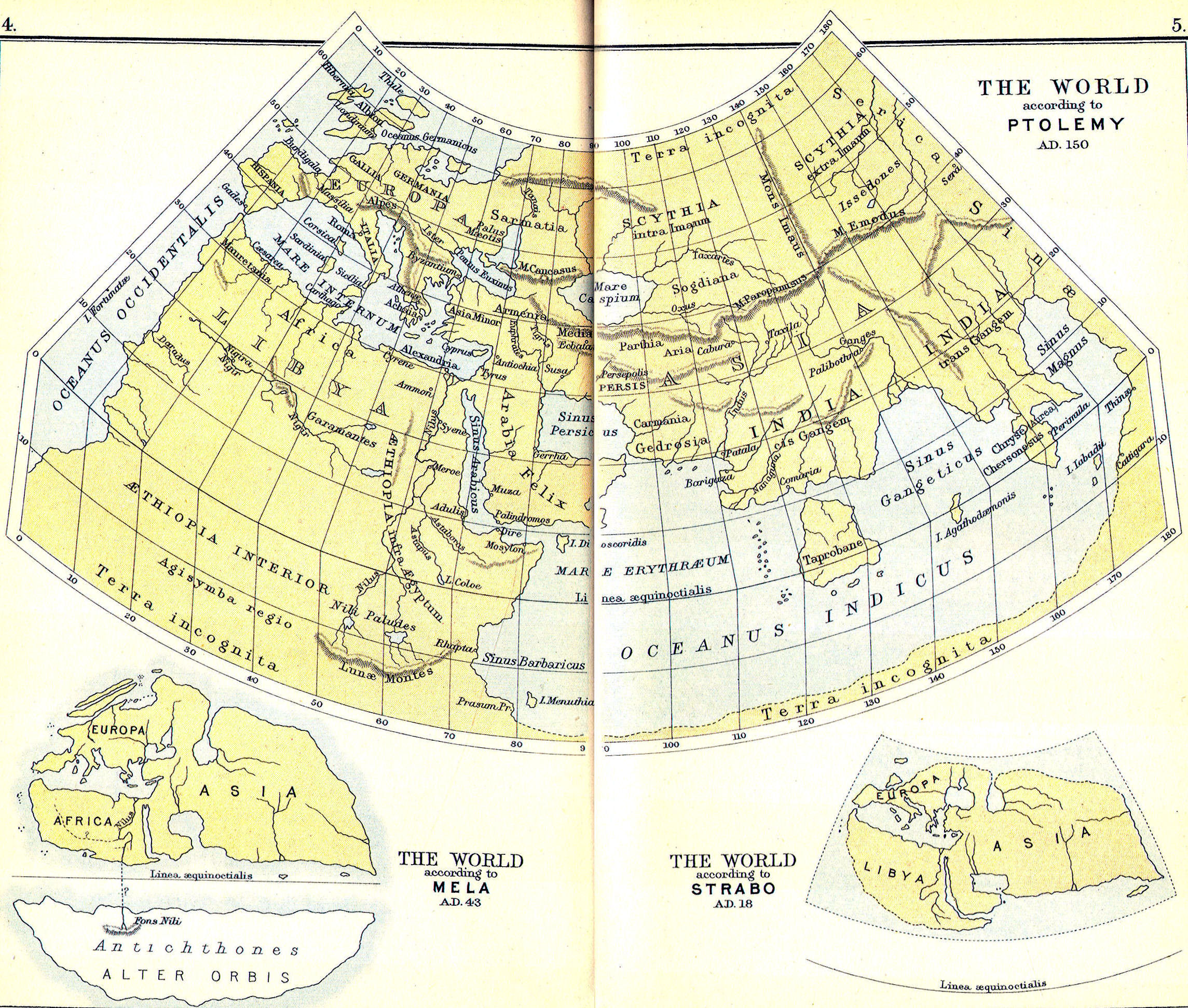
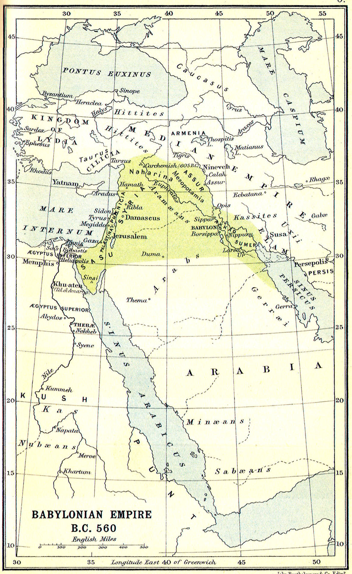
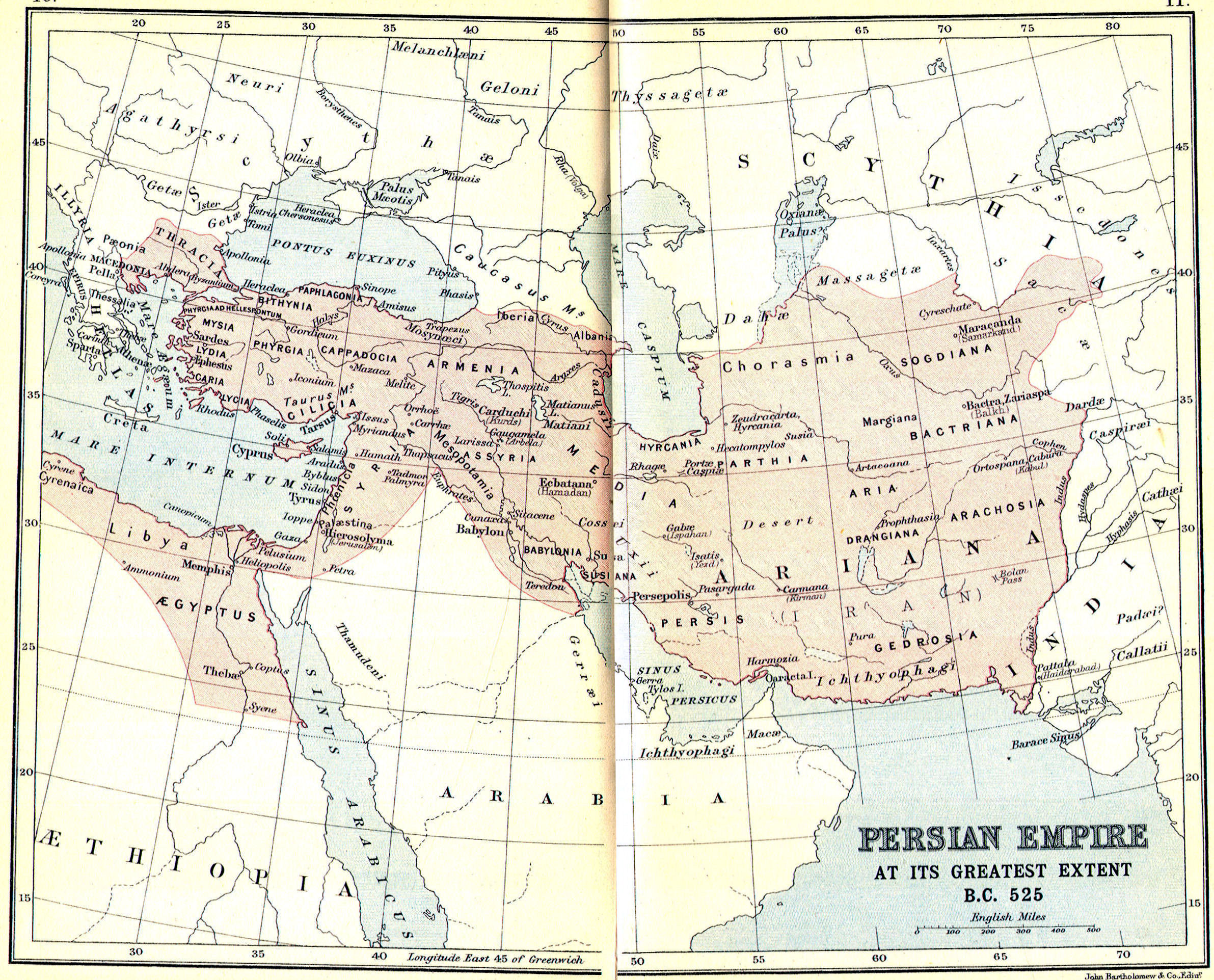
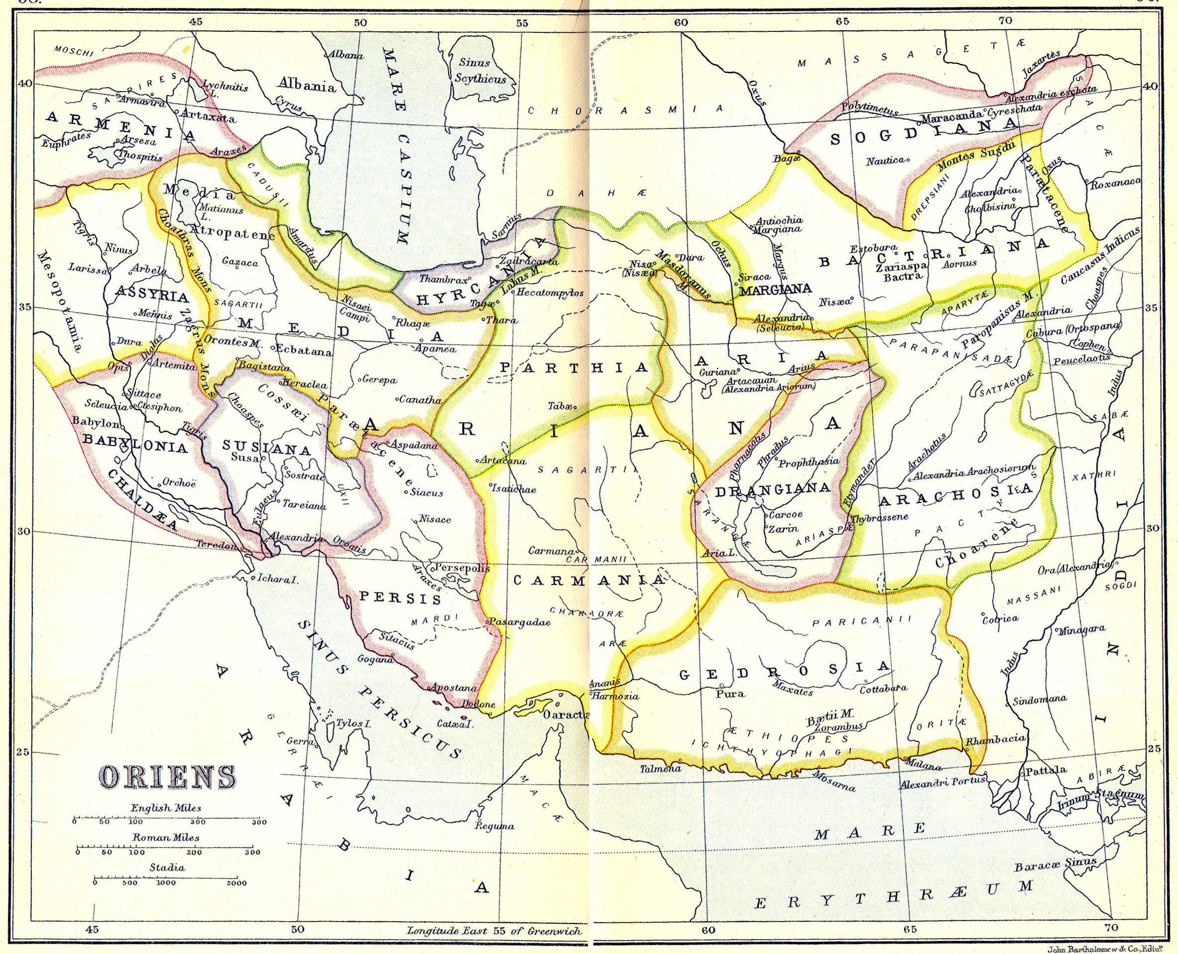
Eastern Empires:
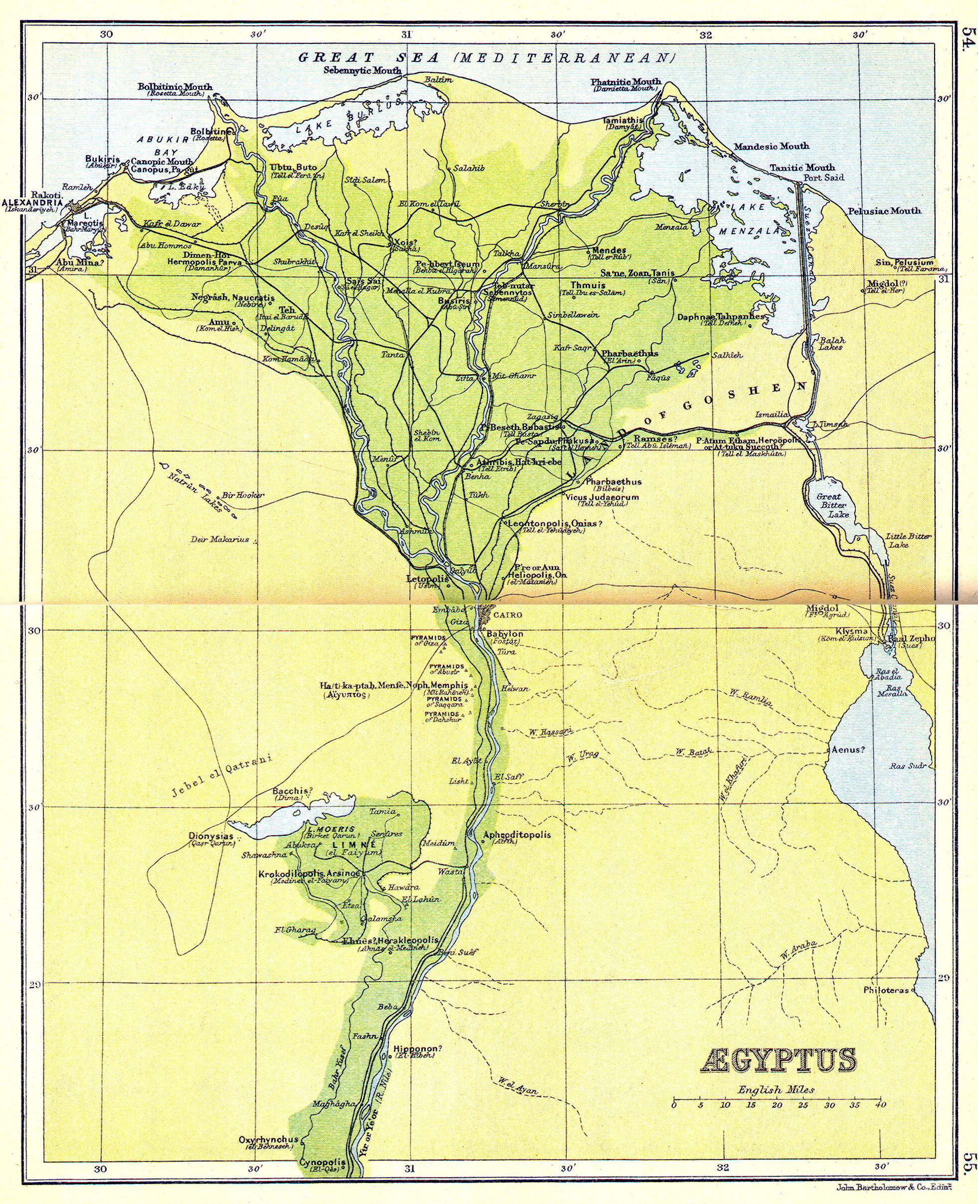
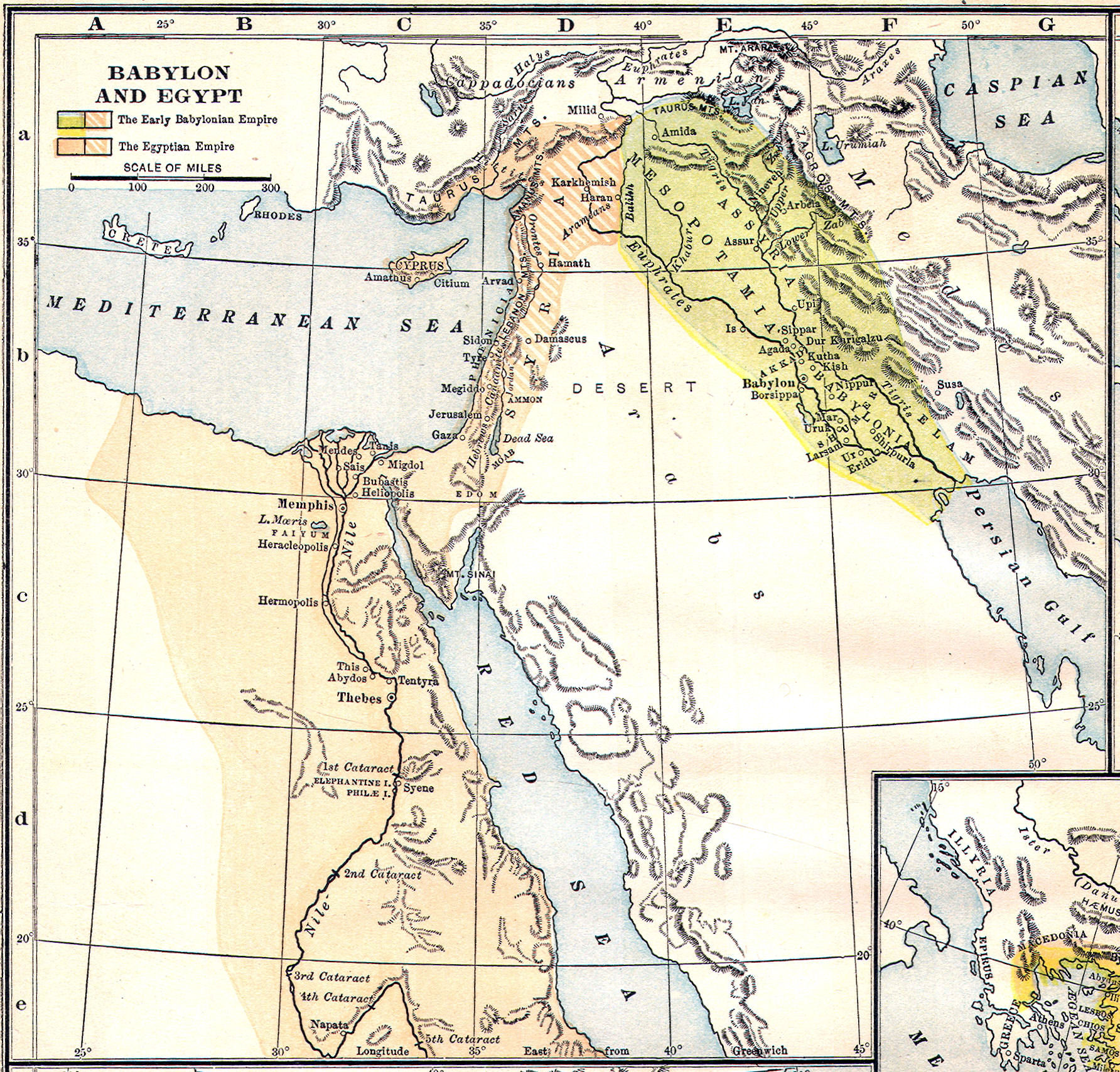
Cities: Damascus, Tyre, Babylon, Memphis, Pelusium, Ecbatana, Persepolis, Alexandria
Regions: Lydia, Egypt, Syria, Mesopotamia, Babylonia, Medes, Armenia, Bactria
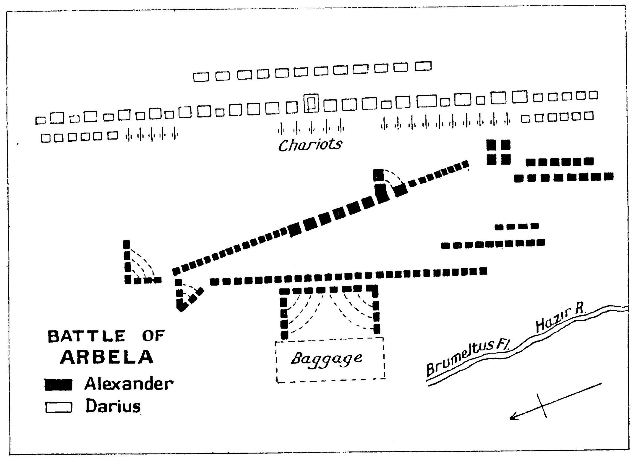
Battles: Tyre, Issus, Guagamela, Ipsus
Water Bodies: Tigris, Euphrates, Persian Gulf, Pontus Euxinus (Black Sea)
Islands: Cyprus
Mountains: Tarsus, Caucasus
Empires: Persian, Alexandrian, Ptolemaic, Seleucid, Antigonid

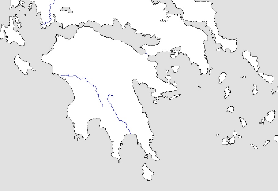 Peloponnesus—Outline Map
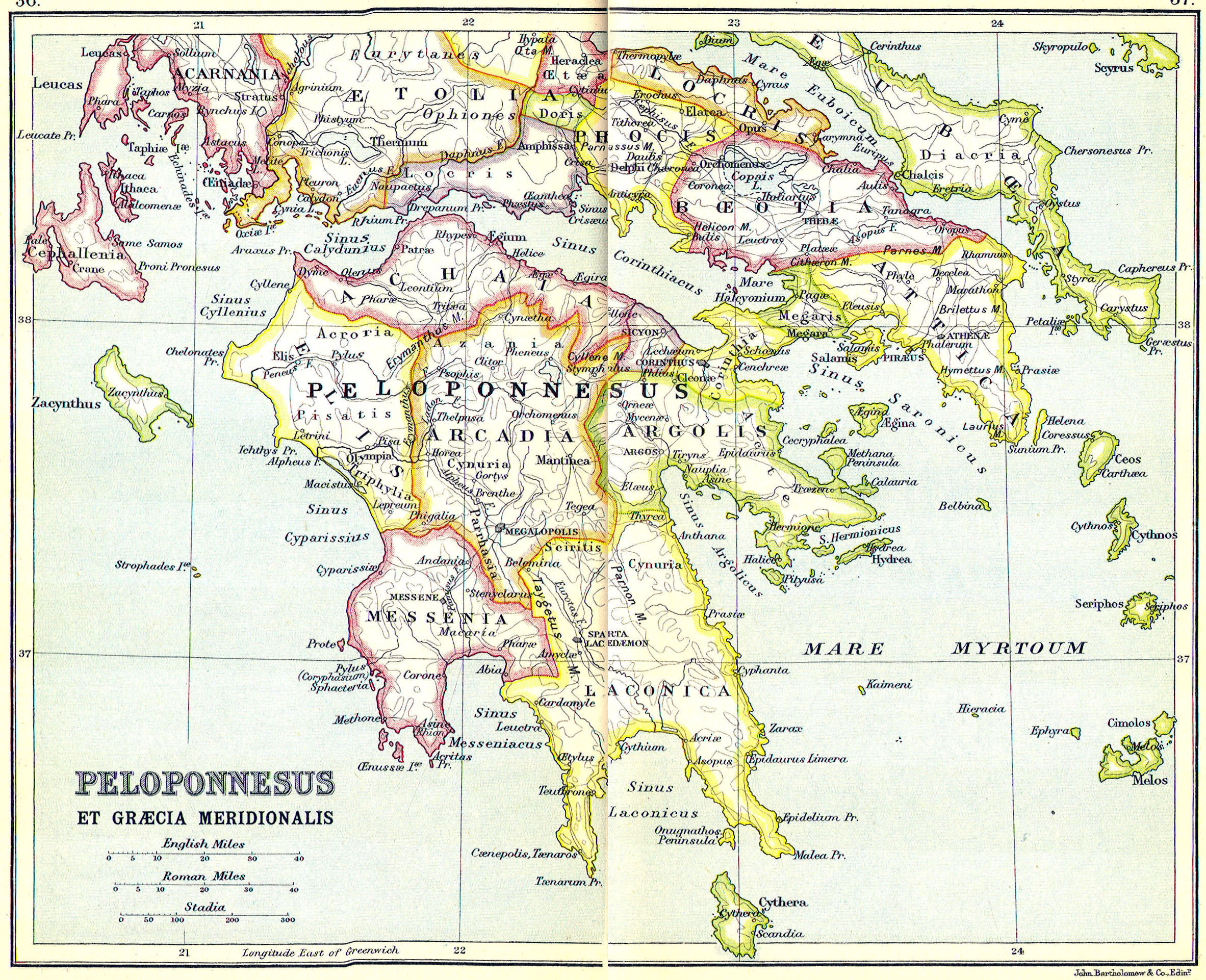
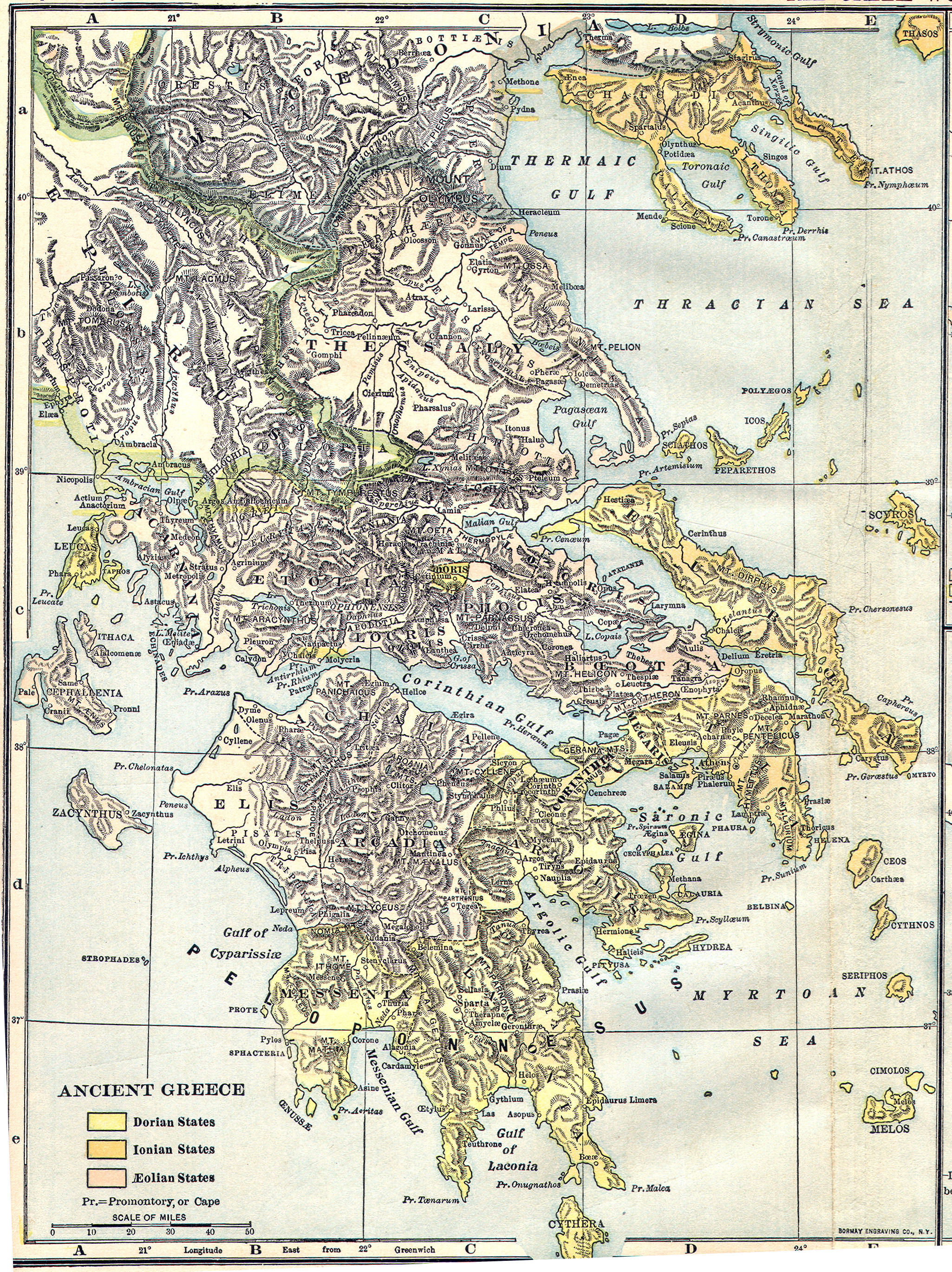
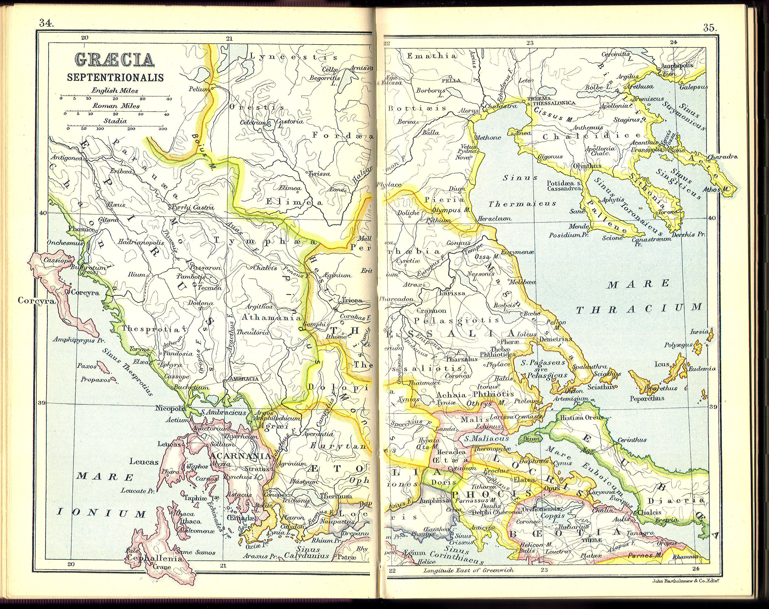
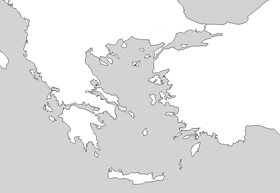 Ancient Greece—Outline Map
 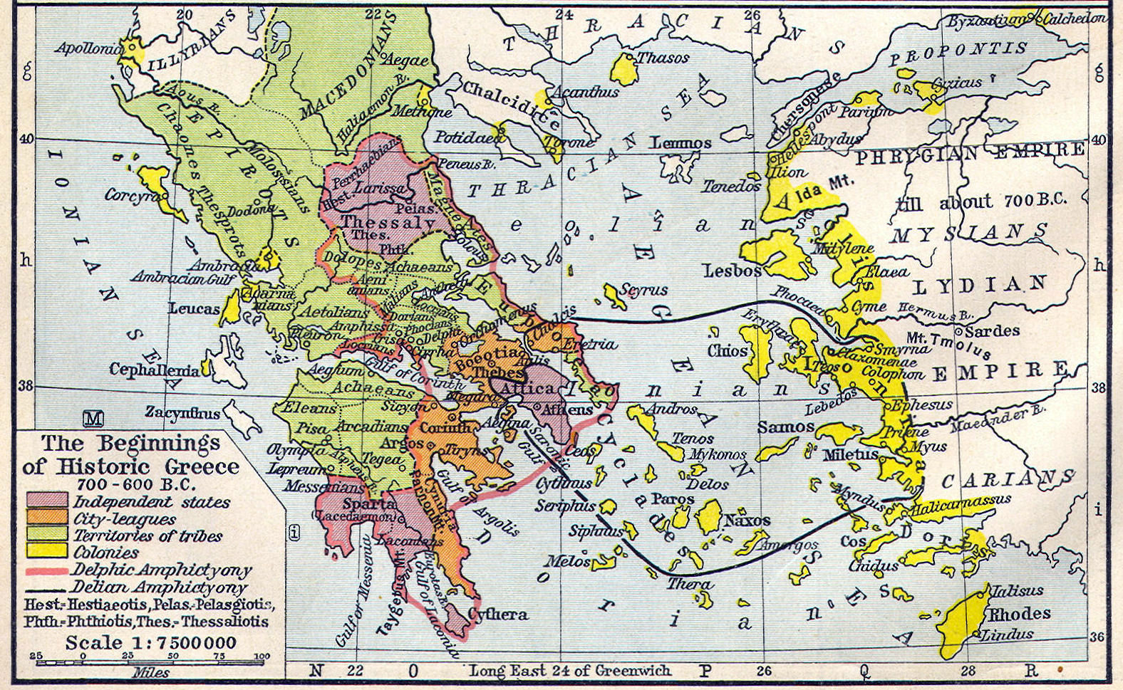 Greek City states and colonies, 600 B.C.
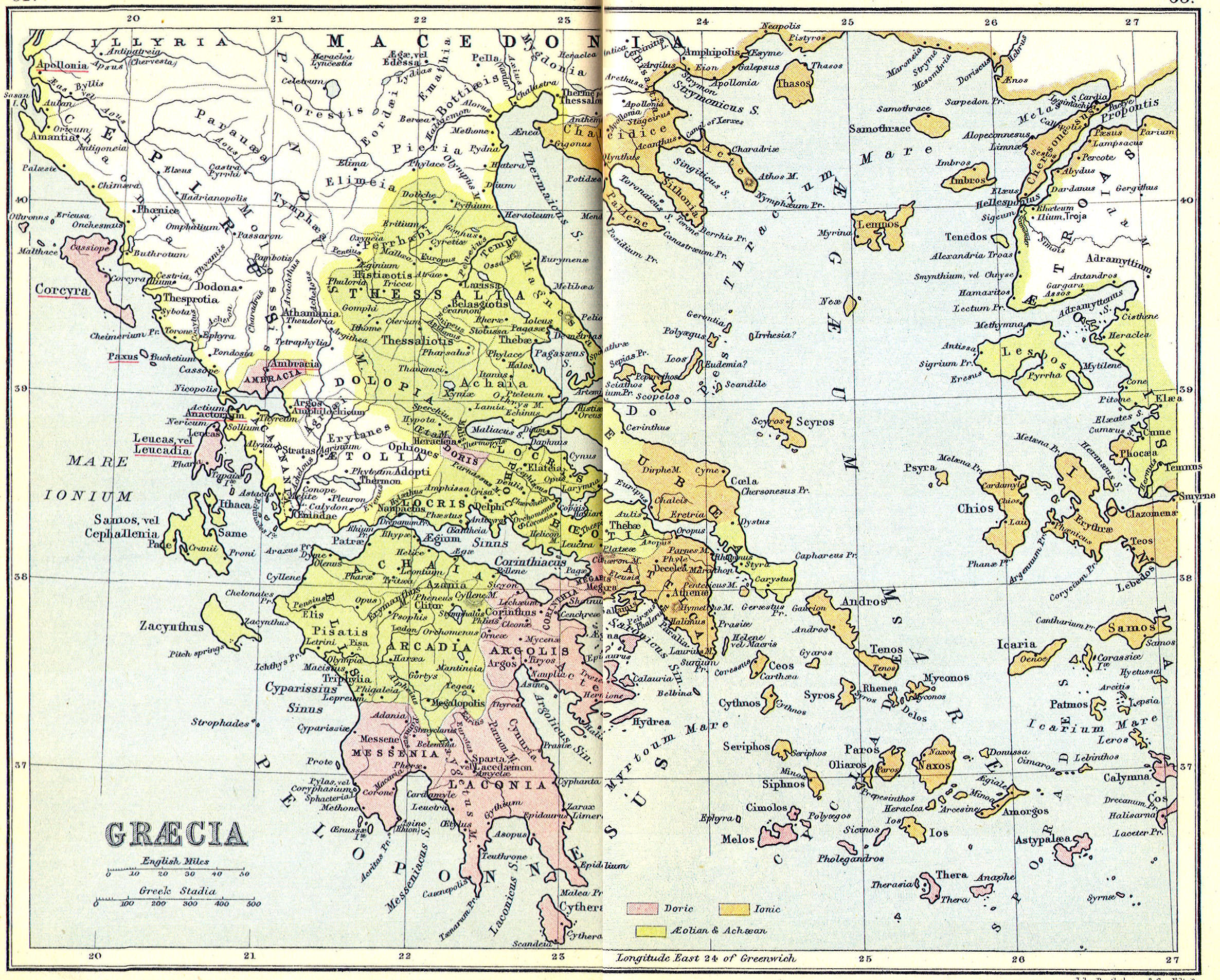
 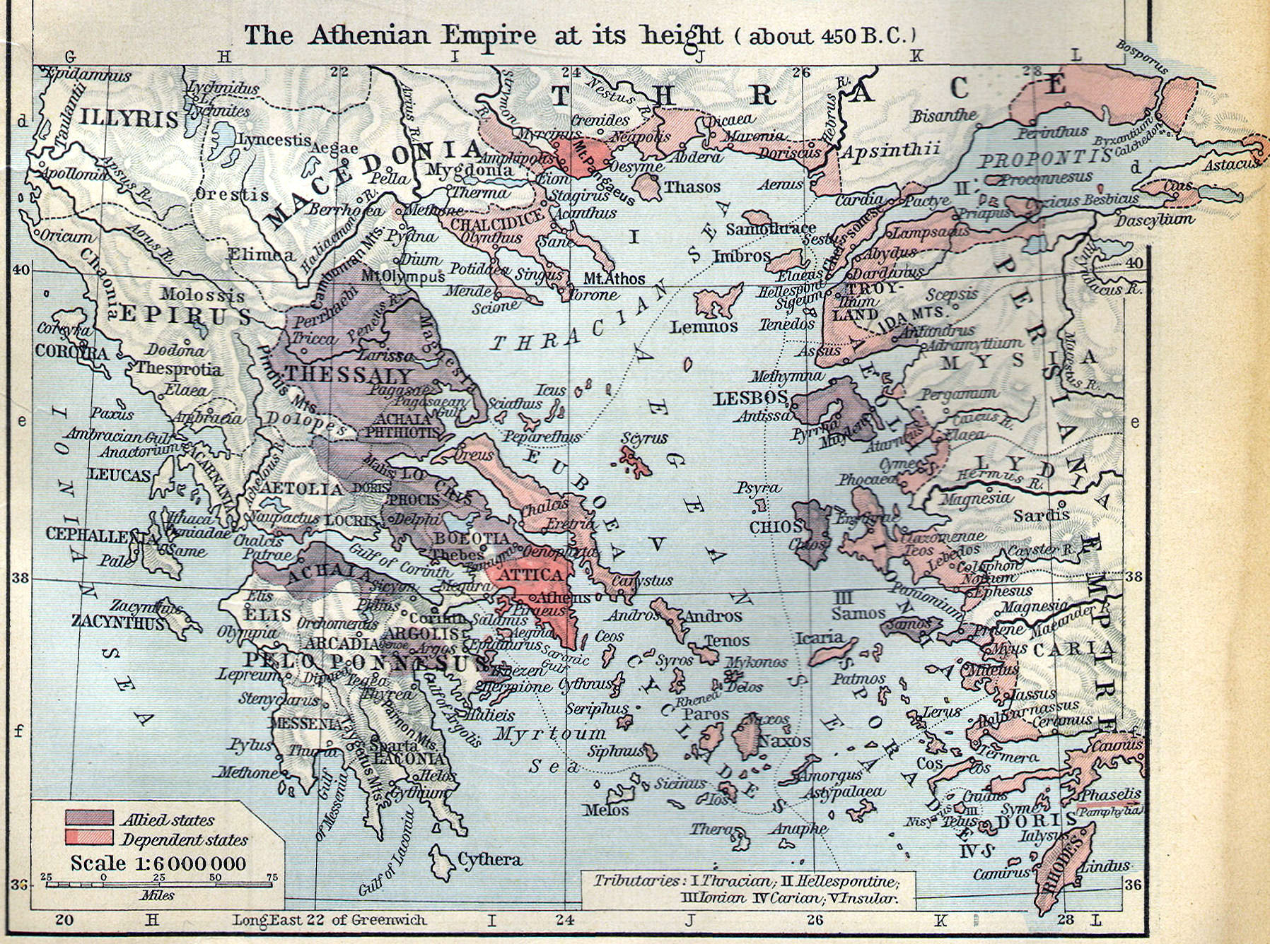 Empire of Athens, 450 B.C.
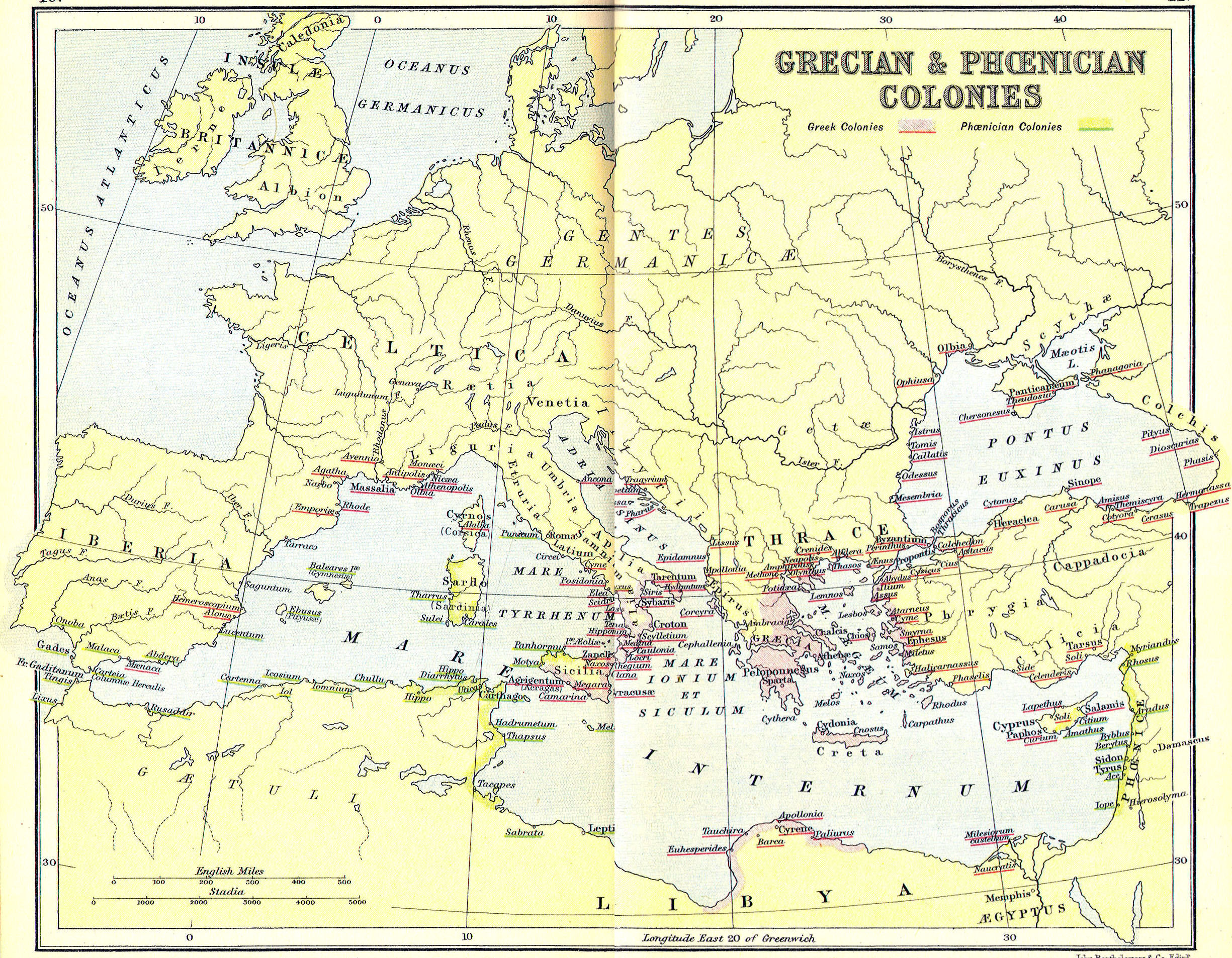
 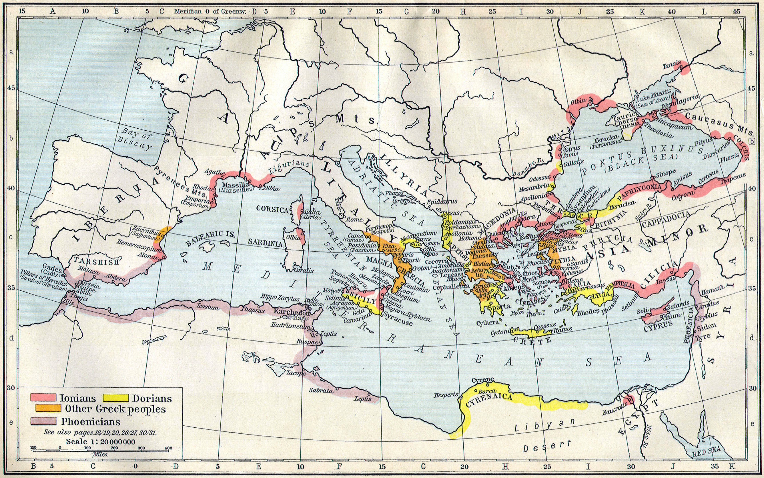 Greek Colonies, 550 B.C.
  Ancient Persia—Outline Map
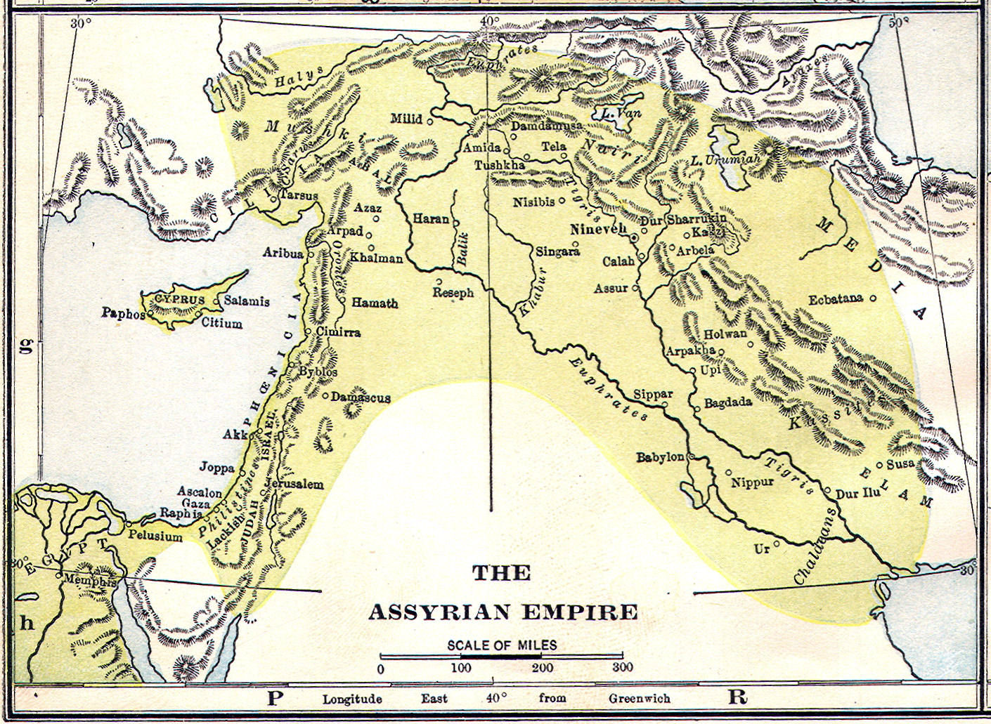
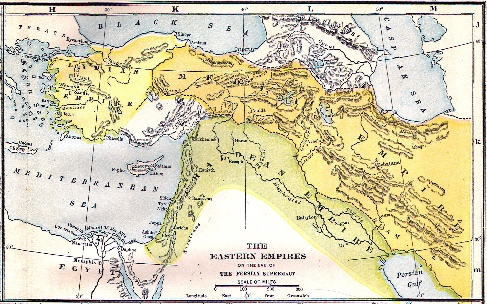
 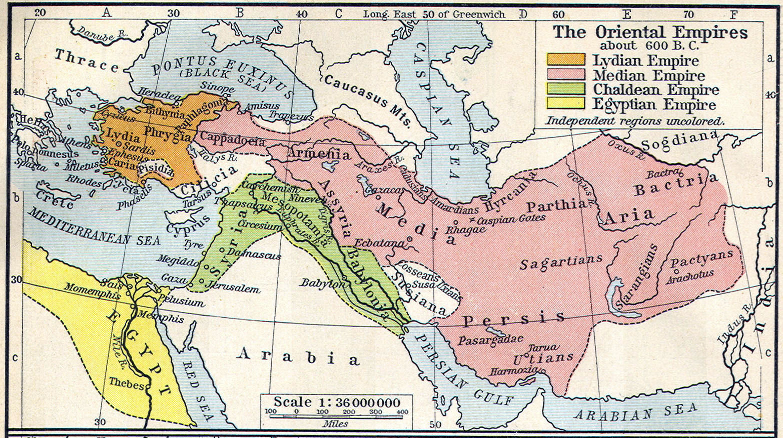 Eastern Empires, 600 B. C.
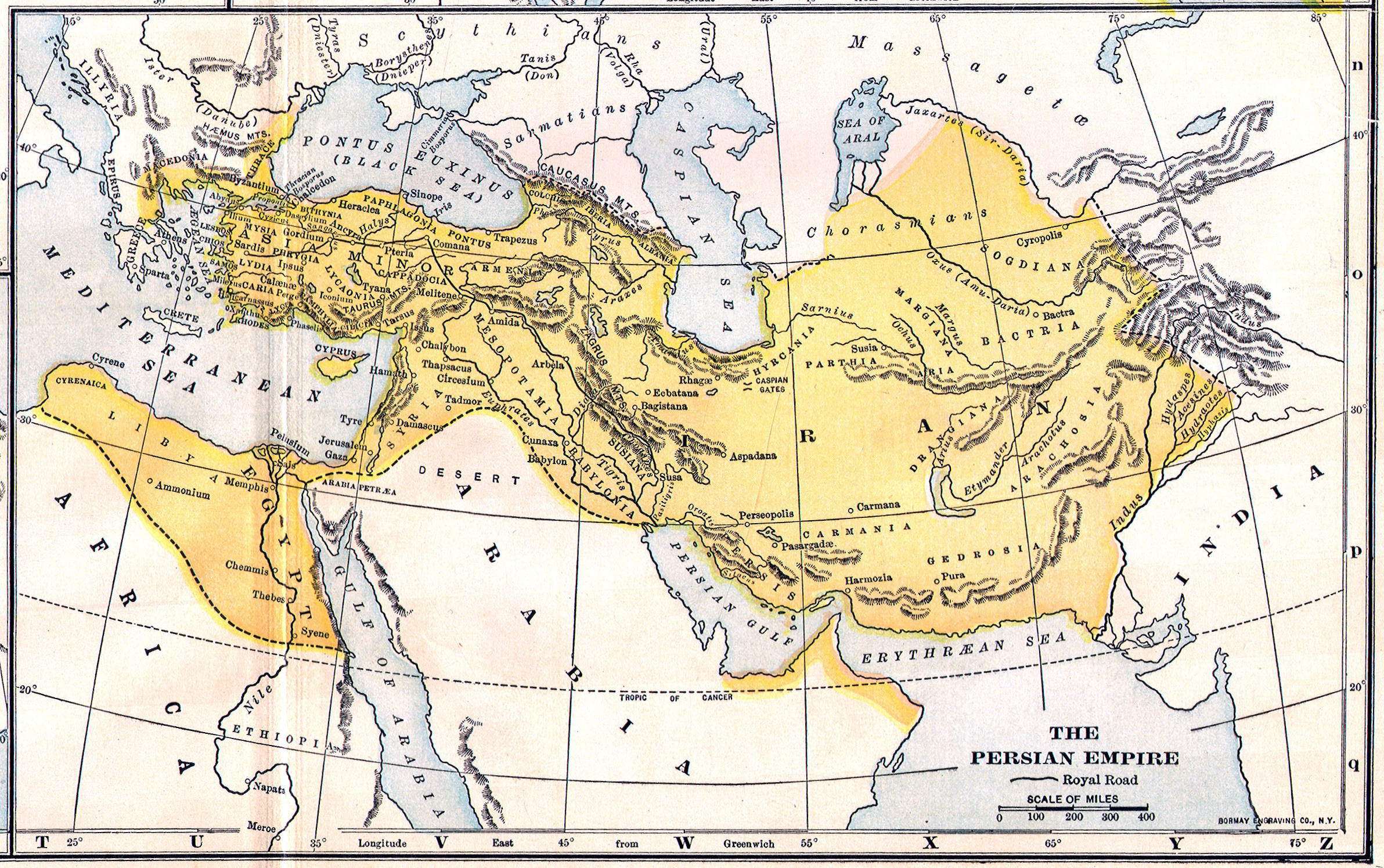
 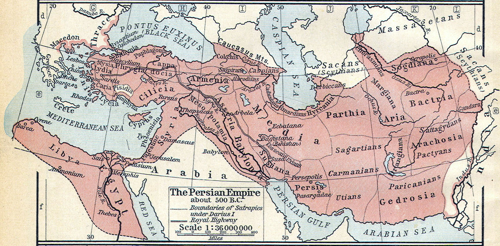 Persian Empire, 500 B. C.
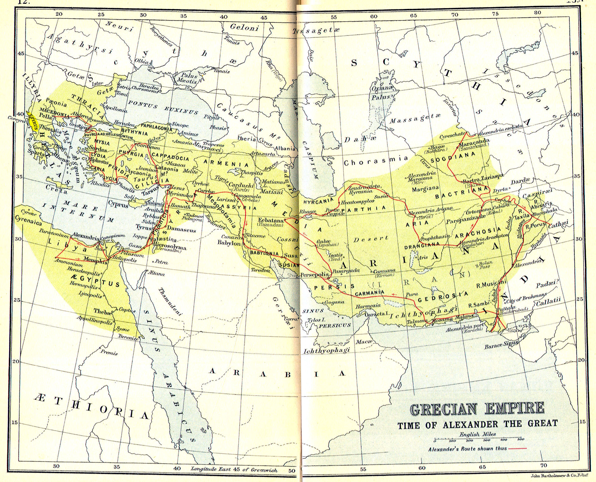
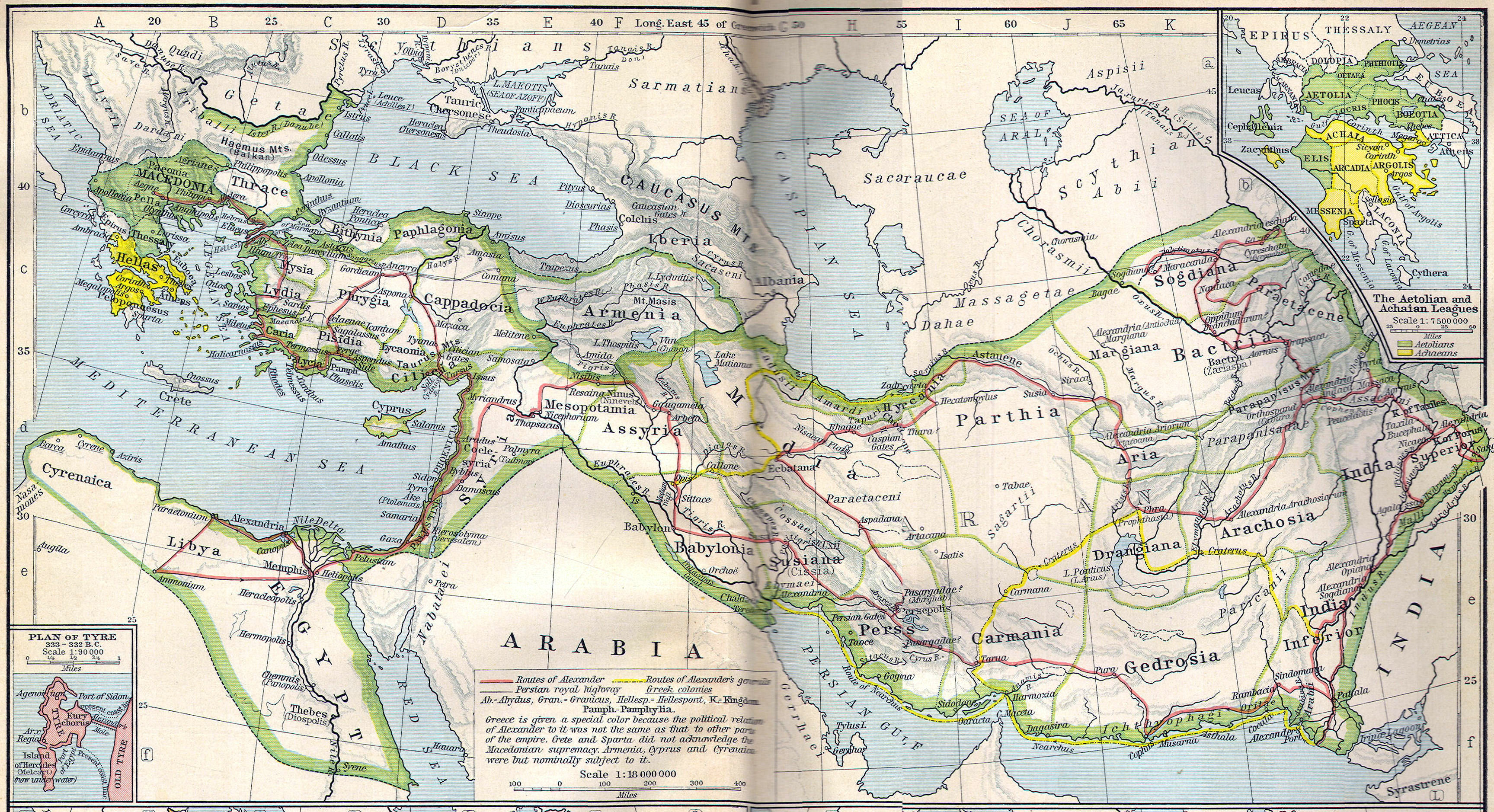
 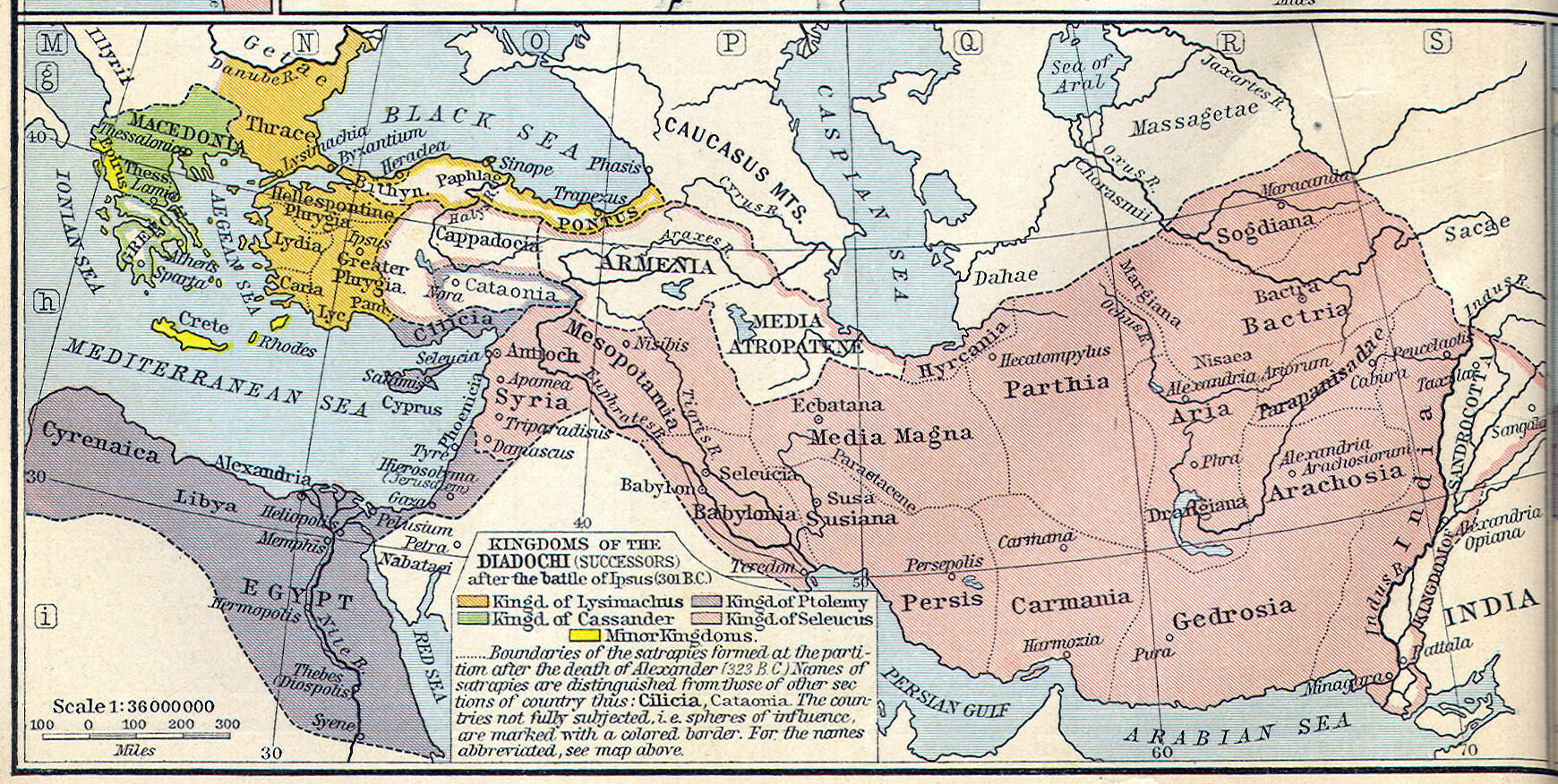 Hellenistic Empires, 300 B. C.
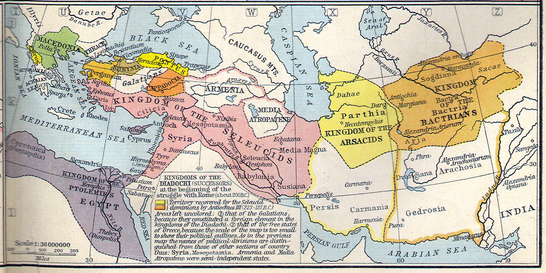
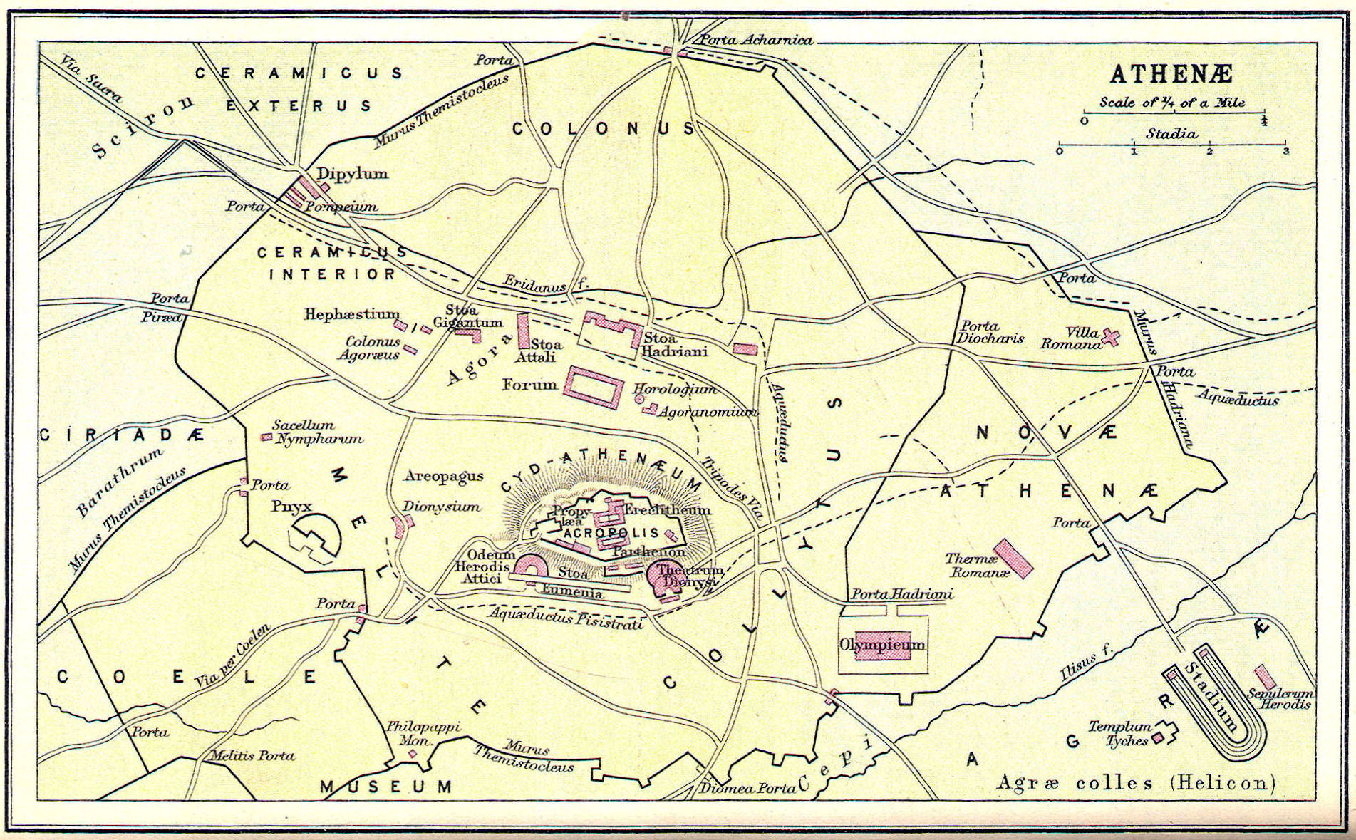
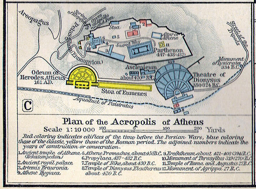
 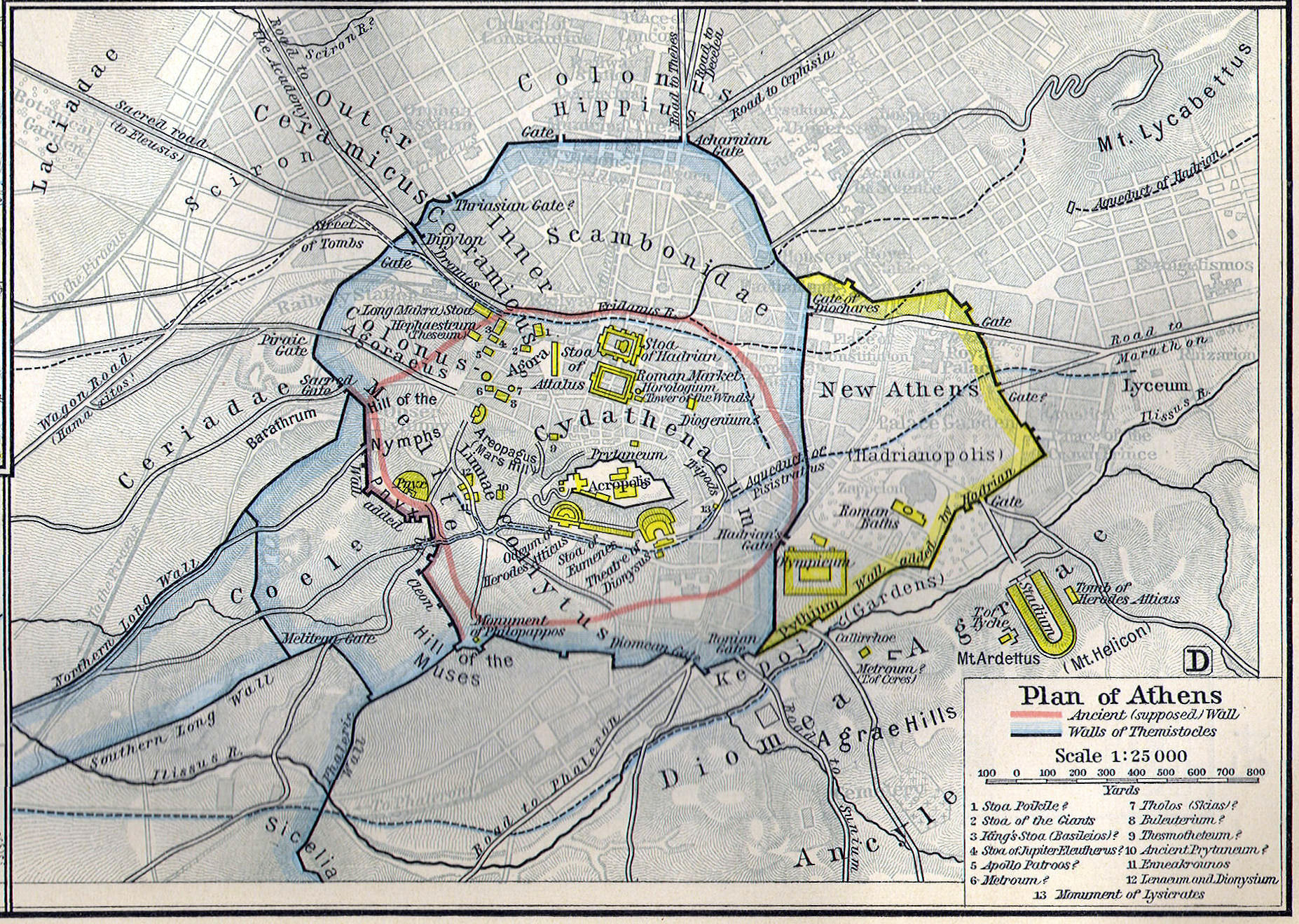 City of Athens, 450 B. C.
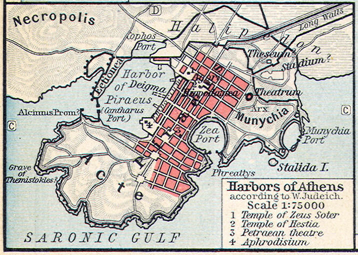
 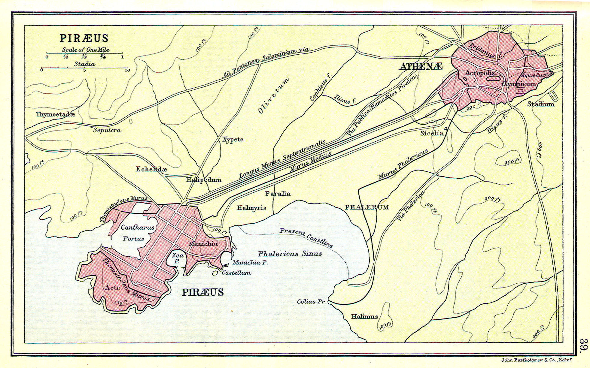 Athens and port of Piraeu, 450 B. C.
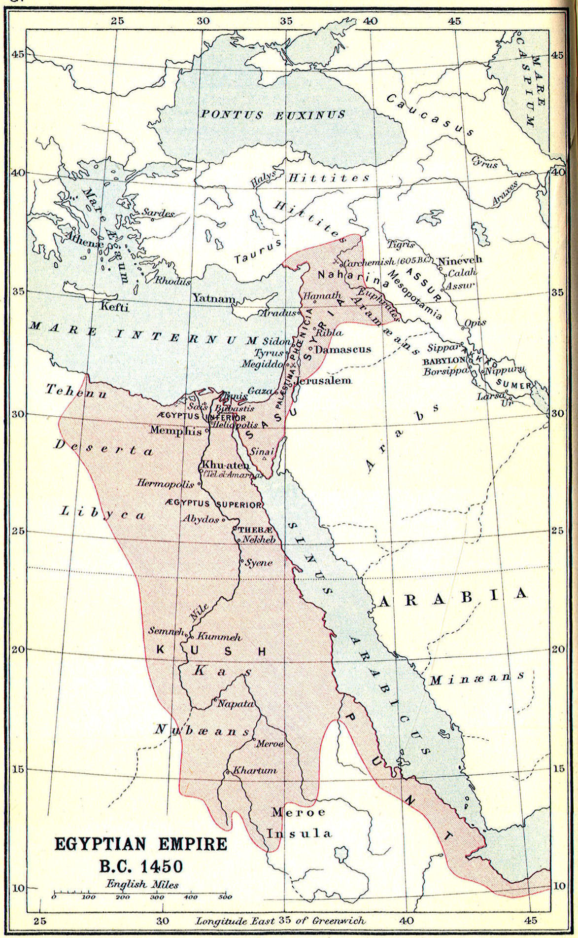